Pine Ridge, South Carolina
| Pine Ridge, South Carolina | |
|---|---|
| Town | |
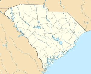 Pine Ridge, South Carolina Location within the state of South Carolina | |
| Coordinates: 33°54′39″N 81°6′27″W / 33.91083°N 81.10750°WCoordinates: 33°54′39″N 81°6′27″W / 33.91083°N 81.10750°W | |
| Country | United States |
| State | South Carolina |
| County | Lexington |
| Established | 1958 |
| Area | |
| • Total | 3.7 sq mi (9.7 km2) |
| • Land | 3.7 sq mi (9.6 km2) |
| • Water | 0.0 sq mi (0.0 km2) |
| Elevation | 262 ft (80 m) |
| Population (2000) | |
| • Total | 1,593 |
| • Density | 429.1/sq mi (165.7/km2) |
| Time zone | Eastern (EST) (UTC-5) |
| • Summer (DST) | EDT (UTC-4) |
| ZIP code | 29169 |
| Area code(s) | 803 |
| FIPS code | 45-56950[1] |
| GNIS feature ID | 1250127[2] |
| Website | www.townofpineridgesc.com |
Pine Ridge is a town in Lexington County, South Carolina, United States. The population was 1,593 at the 2000 census. It is part of the Columbia, South Carolina Metropolitan Statistical Area.
Geography
Pine Ridge is located at 33°54′39″N 81°6′27″W / 33.91083°N 81.10750°W (33.910857, -81.107635).[3]
According to the United States Census Bureau, the town has a total area of 3.7 square miles (9.7 km²), of which, 3.7 square miles (9.6 km²) of it is land and 0.27% is water.
Demographics
| Historical population | |||
|---|---|---|---|
| Census | Pop. | %± | |
| 1960 | 329 | — | |
| 1970 | 633 | 92.4% | |
| 1980 | 1,287 | 103.3% | |
| 1990 | 1,731 | 34.5% | |
| 2000 | 1,593 | −8.0% | |
| 2010 | 2,064 | 29.6% | |
| Est. 2015 | 2,230 | [4] | 8.0% |
As of the census[1] of 2000, there were 1,593 people, 606 households, and 458 families residing in the town. The population density was 429.1 people per square mile (165.8/km²). There were 626 housing units at an average density of 168.6 per square mile (65.1/km²). The racial makeup of the town was 92.78% White, 5.15% African American, 0.31% Native American, 0.88% Asian, 0.19% from other races, and 0.69% from two or more races. Hispanic or Latino of any race were 1.19% of the population.
There were 606 households out of which 37.5% had children under the age of 18 living with them, 61.7% were married couples living together, 10.4% had a female householder with no husband present, and 24.4% were non-families. 19.8% of all households were made up of individuals and 5.1% had someone living alone who was 65 years of age or older. The average household size was 2.63 and the average family size was 3.05.
In the town the population was spread out with 26.6% under the age of 18, 7.6% from 18 to 24, 29.8% from 25 to 44, 28.4% from 45 to 64, and 7.6% who were 65 years of age or older. The median age was 37 years. For every 100 females there were 95.0 males. For every 100 females age 18 and over, there were 92.9 males.
The median income for a household in the town was $48,750, and the median income for a family was $54,514. Males had a median income of $35,243 versus $28,846 for females. The per capita income for the town was $18,534. About 6.6% of families and 9.1% of the population were below the poverty line, including 12.2% of those under age 18 and 17.5% of those age 65 or over.
References
- 1 2 "American FactFinder". United States Census Bureau. Retrieved 2008-01-31.
- ↑ "US Board on Geographic Names". United States Geological Survey. 2007-10-25. Retrieved 2008-01-31.
- ↑ "US Gazetteer files: 2010, 2000, and 1990". United States Census Bureau. 2011-02-12. Retrieved 2011-04-23.
- ↑ "Annual Estimates of the Resident Population for Incorporated Places: April 1, 2010 to July 1, 2015". Retrieved July 2, 2016.
- ↑ "Census of Population and Housing". Census.gov. Archived from the original on May 11, 2015. Retrieved June 4, 2015.
External links
Municipalities and communities of Lexington County, South Carolina, United States | ||
|---|---|---|
| Cities | 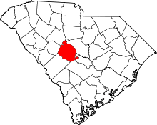 | |
| Towns | ||
| CDPs | ||
| Footnotes | ‡This populated place also has portions in an adjacent county or counties | |