R759 road (Ireland)

The R759 road is a regional road in Ireland that runs south-east to north-west through the Sally Gap in the Wicklow Mountains from the R755 near Roundwood in East Wicklow to the N81 in West Wicklow.
It is a route used by many people travelling between east County Wicklow and areas inland who wish to avoid the longer journey via the congested M50 in Dublin. It is one of two routes through the Wicklow Mountains from east to west, the other being the Wicklow Gap which is crossed by the R756.
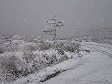
In winter it is often dangerous or impassable due to snow and ice as it is not treated by the Local Authority.
The highest point on the road is at the Sally Gap where it crosses the Military Road (R115), 503m (1,650 ft) (53°08′15″N 6°18′43″W / 53.1376°N 6.3120°W).
The road passes through some spectacular scenery, including the deep corrie lake Lough Tay below Luggala in the eastern hills, the moorlands of the Sally Gap plateau and the valley of the River Liffey for its descent from Sally Gap down to the N81 in west Wicklow.
The road is 27 km (17 mi) long.
See also
- Roads in Ireland
- National primary road
- National secondary road
- Rathfarnham and the Military Road
- Ireland's first ski rescue