R291 road (Ireland)
| ||||
|---|---|---|---|---|
|
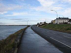
R291 entering Rosses Point | ||||
| Route information | ||||
| Length: | 7.6 km[1] (4.7 mi) | |||
| Major junctions | ||||
| From: |
| |||
| To: | local road L3309 at Rosses Point | |||
| Location | ||||
| Primary destinations: |
| |||
| Road network | ||||
| ||||

The R291 road is a regional road in Ireland linking Sligo and Rosses Point in County Sligo.[2] The road is part of the Wild Atlantic Way.[3]
The road travels along the southern coast of the Rosses Point peninsula via Ballincar. It is 7.6 km (4.7 mi) long.
See also
References
- ↑ Google (8 Feb 2016). "R291" (Map). Google Maps. Google. Retrieved 8 Feb 2016.
- ↑ "S.I. No. 54/2012 – Roads Act 1993 (Classification of Regional Roads) Order 2012". Government of Ireland. 28 Feb 2012. Retrieved 8 Feb 2016.
- ↑ "Wild Atlantic Way: Rosses Point Coastal Walk". Fáilte Ireland. Retrieved 5 Jun 2016.
This article is issued from Wikipedia - version of the 6/6/2016. The text is available under the Creative Commons Attribution/Share Alike but additional terms may apply for the media files.