Roundwood
| Roundwood An Tóchar | |
|---|---|
| Town | |
|
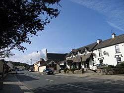
Roundwood's Main Street | |
 Roundwood Location in Ireland | |
| Coordinates: 53°04′N 6°14′W / 53.067°N 6.233°WCoordinates: 53°04′N 6°14′W / 53.067°N 6.233°W | |
| Country | Ireland |
| Province | Leinster |
| County | Wicklow |
| Elevation | 238 m (781 ft) |
| Population (2011)[1] | |
| • Urban | 833 |
| Time zone | WET (UTC+0) |
| • Summer (DST) | IST (WEST) (UTC-1) |
| Eircode (Routing Key) | A98 |
| Irish Grid Reference | O187029 |
Roundwood, historically known as Tóchar[2] (Irish: an Tóchar, meaning "the causeway"), is a village in County Wicklow, Ireland. It was listed as having a population of 833 in the 2011 census.
Geography
Roundwood is located where the R755 road joins the R764 and R765. The R755 is part of the main route from Dublin to Glendalough in the Wicklow Mountains. At 238 metres above sea level, Roundwood is one of the highest villages in Ireland.
Vartry Reservoir Lakes (reservoirs built in the 1860s) are close by.
History

Roundwood has a close association with two former Presidents of Ireland, Seán T. O'Kelly who lived locally and Erskine Childers who is buried in the Church of Ireland Derralossary churchyard near the village.
Twin towns — Sister cities

Roundwood is twinned with the village of Spézet, in Brittany, in the northwest of France.[3] The schools in both areas regularly communicate and engage with another. For many years, exchange programmes have been in place for the students.
See also
References
- ↑ "Roundwood Legal Town Results". Central Statistics Office. 2011.
- ↑ Placenames Database of Ireland
- ↑ Roundwood School News Roundwood.ie. Published in 02-04. Retrieved on 11-12-07.
External links
-
 Media related to Roundwood at Wikimedia Commons
 -
 Roundwood travel guide from Wikivoyage
 - Official website
Places in County Wicklow | ||
|---|---|---|
| Towns |  | |
| Villages |
| |
| ||