Preparis
 Preparis Location of Preparis Island in Myanmar | |
| Geography | |
|---|---|
| Location | Bay of Bengal |
| Coordinates | 14°52′30″N 93°37′48″E / 14.875°N 93.63°ECoordinates: 14°52′30″N 93°37′48″E / 14.875°N 93.63°E |
| Adjacent bodies of water | Andaman Sea |
| Total islands | 3 |
| Major islands |
|
| Area | 8.1 km2 (3.1 sq mi) |
| Length | 7.7 km (4.78 mi) |
| Width | 1.8 km (1.12 mi) |
| Highest elevation | 81 m (266 ft) |
| Administration | |
| Region | Yangon |
| District | South Yangon |
| Township | Cocokyun |
| Ward | Preparis Ward |
Largest settlement |
Preparis (population 50) |
| Demographics | |
| Demonym | Myanma |
| Population | 50 (2014) |
| Pop. density | 6.2 /km2 (16.1 /sq mi) |
| Ethnic groups | Bamar people |
| Additional information | |
| Time zone | |
| Official website |
www |
| ISO Code = MM-06 | |
Preparis Island is an island located between the Bay of Bengal and the Andaman Sea, 77 km (48 mi) to the NNE of the Coco Islands and 133 km (83 mi) to the SSW from Cape Negrais, the nearest point in the coast of Burma. It has a distance of 340 km (210 mi) south of the city of Yangon.
History
According to 19th century visitors, the island was uninhabited by humans, but many monkeys were observed. The island was host to the 78th Highlanders regiment when their transport ship Frances Charlotte hit an off-shore rock in 1817. Most crew survived as a freshwater supply was discovered and their stay remained short.[1]
Geography
Preparis island makes up the northern end of the Andaman Islands chain. The island is 7.7 km (5 mi) long and has a maximum width of 1.8 km (1.1 mi). It is covered with dense forest and has gentle slopes rising to a maximum height of 81 metres (266 feet).[2]
- Cow and Calf Islets
A group of 3 Flat-topped islets, 23 metres (75 feet), 3.4 km (2.1 mi) to the north.[3]
- West Reef Islets
A group of 3 islets, 1 metre (3 feet), 4.2 km (2.6 mi) to the west.[3]
- Preparis Pinncale
A rock, 12 metres (39 feet) high, 3 km (1.9 mi) to the south.[3]
Flora and Fauna
The island is covered with low trees and bush.[4]
Administration
The island is subject to the Cocokyun township of Myanmar, along the Coco Islands.
Demographics
The is a regular presence of 50 inhabitants on the island which are engaged in very small scale farming and fishing, mainly for the island consumption. These villagers are actually part of a military unit that inhabits remote border outposts.
Transportation
The island has a small helipad in the village.
See also
External links
Image gallery
 Map
Map
References
| Wikimedia Commons has media related to Preparis. |
Capital: Yangon | ||
| East Yangon District |  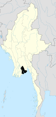 | |
| North Yangon District | ||
| South Yangon District | ||
| West Yangon District (Downtown) | ||
| Main cities and towns | ||