Prairie Township, Warren County, Indiana
| Prairie Township | |
|---|---|
| Township | |
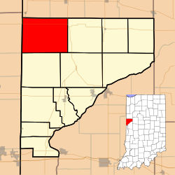 Location of Prairie Township in Warren County | |
 Location of Indiana in the United States | |
| Coordinates: 40°26′28″N 87°27′23″W / 40.44111°N 87.45639°WCoordinates: 40°26′28″N 87°27′23″W / 40.44111°N 87.45639°W | |
| Country | United States |
| State | Indiana |
| County | Warren |
| Established | 1864 |
| Government | |
| • Type | Indiana township |
| Area | |
| • Total | 47.66 sq mi (123.4 km2) |
| • Land | 47.66 sq mi (123.4 km2) |
| • Water | 0 sq mi (0 km2) 0% |
| Elevation | 732 ft (223 m) |
| Population (2010) | |
| • Total | 257 |
| • Density | 5.4/sq mi (2.1/km2) |
| GNIS feature ID | 453772 |
Prairie Township is one of twelve townships in Warren County, Indiana, United States. According to the 2010 census, its population was 257 and it contained 117 housing units; the population density is the lowest of any township in the county, at 6.1 inhabitants per square mile (2.4/km2).[1]
History
Prairie Township was formed in 1864 out of a portion of Pine Township.[2]
Geography
According to the 2010 census, the township has a total area of 47.66 square miles (123.4 km2), all land.[1] It is almost entirely agricultural and contains a single town, Tab. Two other small communities in the eastern part of the township, Locust Grove and Walnut Grove, dwindled away during the 20th century and are now extinct.


Transportation
U.S. Route 41 runs along a portion of the township's eastern border, starting at the northeastern corner and going south for about 1 mile (1.6 km) before veering to the east.[3] Indiana State Road 26 runs from the Illinois state line and across the northern part of the township, reaching U.S. Route 41 at the eastern border.[4] Indiana State Road 352 leaves State Road 26 at the western border and runs north for about 1 mile (1.6 km) before leaving the township (and the county) on its way through the small town of Ambia in Benton County.[5] The township contains Dalton Airport.
Education
Prairie Township is part of the Metropolitan School District of Warren County.[6]
Government
Prairie Township has a trustee who administers rural fire protection and ambulance service, provides relief to the poor, manages cemetery care, and performs farm assessment, among other duties. The trustee is assisted in these duties by a three-member township board. The trustees and board members are elected to four-year terms.[7]
Prairie Township is part of Indiana's 8th congressional district, Indiana House of Representatives District 42,[8] and Indiana State Senate District 38.[9]
References
- 1 2 "Population, Housing Units, Area, and Density: 2010 - County -- County Subdivision and Place -- 2010 Census Summary File 1". United States Census. Retrieved 2013-05-10.
- ↑ Warren County Historical Society 1966, p. 94.
- ↑ "U.S. Route 41". Highway Explorer. Retrieved 2010-09-21.
- ↑ "State Road 26". Highway Explorer. Retrieved 2010-09-21.
- ↑ "State Road 352". Highway Explorer. Retrieved 2010-09-21.
- ↑ "Corporation Snapshot, M S D Warren County #8115". Indiana Department of Education. Retrieved 2011-01-27.
- ↑ "Government". United Township Association of Indiana. Retrieved 2011-01-06.
- ↑ "Indiana Senate" (PDF). State of Indiana. Retrieved 2013-12-02.
- ↑ "Indiana House Districts" (PDF). State of Indiana. Retrieved 2013-12-02.
- "Prairie Township, Warren County, Indiana". Geographic Names Information System. United States Geological Survey. Retrieved 2009-09-24.
- United States Census Bureau TIGER/Line Shapefiles
Bibliography
- Goodspeed, Weston A. (1883). "Part II. History of Warren County". Counties of Warren, Benton, Jasper and Newton, Indiana. Chicago: F. A. Battey and Company. pp. 31–156. Retrieved 2010-09-19.
- Clifton, Thomas, ed. (1913). Past and Present of Fountain and Warren Counties Indiana. Indianapolis: B. F. Bowen and Company. pp. 201–335. Retrieved 2010-09-19.
- Warren County Historical Society (1966). A History of Warren County, Indiana. Williamsport, Indiana.
- Warren County Historical Society (2002). A History of Warren County, Indiana (175th Anniversary Edition). Williamsport, Indiana.
External links
 |
Hickory Grove Township, Benton County | Grant Township, Benton County | | |
| Grant Township, Vermilion County, Illinois | |
Pine Township | ||
| ||||
| | ||||
| Jordan Township | Liberty Township |
Municipalities and communities of Warren County, Indiana, United States | ||
|---|---|---|
| Towns | ||
| Townships | ||
| Unincorporated communities | ||
| Ghost towns | ||