Port Talbot
| Port Talbot | |
.jpg) The elevated section of the M4 above Port Talbot and the steelworks in the distance |
|
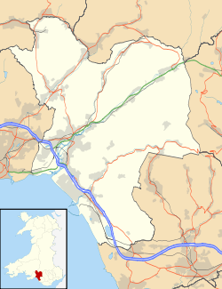 Port Talbot |
|
| Population | 37,276 [1] |
|---|---|
| OS grid reference | SS755895 |
| Principal area | Neath Port Talbot |
| Ceremonial county | West Glamorgan |
| Country | Wales |
| Sovereign state | United Kingdom |
| Post town | PORT TALBOT |
| Postcode district | SA12, SA13 |
| Dialling code | 01639 |
| Police | South Wales |
| Fire | Mid and West Wales |
| Ambulance | Welsh |
| EU Parliament | Wales |
| UK Parliament | Aberavon |
| Welsh Assembly | Aberavon |
|
|
Coordinates: 51°35′26″N 3°47′55″W / 51.59055°N 3.79859°W
Port Talbot (/pərˈtɔːlbət/ or /pərˈtælbət/[2]) is a town in the county borough of Neath Port Talbot, Wales. It had a population of 37,276 in 2011.[1] It is best known as the home of the Port Talbot Steelworks, one of biggest steelworks in the world, which currently employs an estimated 10% of the town's population. The steelworks has for many years been under threat of closure.[3]
History
Modern Port Talbot is a town formed from the merging of multiple villages, including Baglan and Margam, and centred on Aberafan on the west side of the river Afan. 'Port Talbot' first appears in 1837 as the name of the new docks built on the east side of the river by the Talbot family. The name became applied to the emerging conurbation.
The earliest evidence of humans in the Port Talbot area has been found on the side of Mynydd Margam where Bronze Age farming ditches can be found from 4,000 BC. There were Iron Age hill forts on Mynydd Dinas, Mynydd Margam, Mynydd Emroch and other nearby hills. Mynydd Hawdef contains remains of an ancient Iron Age village. The Margam deer herd was first introduced by the Romans.[4][5]
Aberafan was first established by Caradoc ap Iestyn (son of Iestyn ap Gwrgant), on the instructions of Robert Fitzhamon, after the Normans' conquest of south Wales by the end of the eleventh century. The town grew up with and around the castle which Fitzhamon ordered to be built (where Castle, Norman and Bailey streets are situated near to Saint Mary's Church in modern-day Port Talbot). The first recorded name of Aberafan was the French Norman 'Avene' which is likely to be an interpretation of the Welsh 'a-bhan' meaning 'from the heights' meaning the hills of the Afan Valley, from whence flowed the River Afan. 'Afan' is always pronounced 'Avan'. Margam Abbey was founded in 1147 as a daughter house of Clairvaux, a Cistercian foundation, by Robert, 1st Earl of Gloucester. Local landowner John Talbot, fought at the Battle of Crécy, and bred the Talbot dog, a breed of small white dog, an ancestor of the modern Beagle.
The English antiquarian John Leland made an extensive journey through Wales c.1536-39 of which he recorded an itinerary. He passed through Aberafan, which he describes as a "poor village" surrounded by barren ground, though he also describes the area as heavily wooded, not much of which remains today. He mentions the use of the river mouth as a port. His portrayal of Aberafan as a small, struggling village suggests that the port was not in great use, especially as traffic to and from Margam Abbey would have ceased following its dissolution in 1536.[6]
The area of the parish of Margam lying on the west bank of the lower Afan became industrialised following the establishment of a copperworks in 1770. The Afan was diverted and a dock was opened in 1839 named for the Talbot family,[7] local landowners who were related to the pioneer photographer, William Henry Fox Talbot. The Talbots were patrons of Margam Abbey, and also built Margam Castle. Christopher Rice Mansel Talbot (1803–1890) (Liberal Member of Parliament for Glamorgan from 1830 until his death) saw the potential of his property as a site for an extensive ironworks, which opened in early 1831.
CRM Talbot's daughter Emily Charlotte Talbot (1840–1918) inherited her father's fortune and became just as notable in the development of ports and railways. With assistance from engineers Charles Meik and Patrick Meik, she set about creating a port and railway system to attract business away from Cardiff and Swansea. The Port Talbot Railway and Docks Company opened a dock at Port Talbot and the Llyfni Railway in 1897, followed by the Ogmore Valley Extension and the South Wales Mineral Junction Railway (almost all these lines were closed as part of the Beeching Axe cuts in the mid-1960s, but some bridges and viaducts remain and many of these railway routes have re-emerged as recreational cycle tracks). By 1900, the dock was exporting over 500,000 tons of coal; it reached a peak of over three million tons in 1923.
In 1952 the completion of the Abbey Works by the Steel Company of Wales made Port Talbot the home of one of Europe's largest integrated steelworks and (with 18,000 employees) the largest employer in Wales. This was followed by the establishment of a chemical plant at Baglan Bay by British Petroleum (now BP) in the 1960s. In 1970 a new deep-water harbour was opened by Queen Elizabeth II and the Duke of Edinburgh. This harbour was capable of discharging iron ore vessels of 100,000 deadweight tonnage (DWT),[8] a tenfold improvement on the old dock. By the early 21st century, due to further modification and dredging, the harbour is capable of harbouring vessels of over 170,000 DWT.[9]
Governance
 [Full screen]
|
The borough of Port Talbot was created in November 1921, incorporating Margam, Cwmafan and Aberafan.[7] It was therefore 85 years after the phrase 'Port Talbot' was first used that it became officially recognised as the town's name.
Port Talbot was part of the historic county of Glamorgan. The 1974 county council re-organisation split Glamorgan into three new counties, and Port Talbot became one of the four districts of West Glamorgan.[10]
Following the demise of West Glamorgan County Council in 1996, Port Talbot borough council was merged with Neath and part of Lliw Valley Districts to create the new unitary authority of Neath Port Talbot County Borough.[11] The Civic Centre is located in Port Talbot, and the town is represented by three of the 64 councillors that make up the county council.[12]
The centre of the town is covered by the Port Talbot ward for local council elections.
Physical geography

The town is built along the eastern rim of Swansea Bay in a narrow strip of coastal plain surrounding the River Afan estuary. Swansea is visible on the opposite side of Swansea Bay. The local beach is known as Aberafan Sands and is situated along the edge of the bay between the River Afan and the River Neath. The other beach in Port Talbot is Margam Sands, popularly known as Morfa Beach. The north-eastern edge of the town is marked by the River Neath. A significant landmark in the town is the Port Talbot Steelworks.
Human geography
The town is still said to be the most polluted place in Wales and the most polluted in the United Kingdom outside London.[13] However, air quality in the Port Talbot area has improved.
63% of Port Talbot population in 2000 was between the ages of 15-64. Male unemployment in 2000 was around 9%, with female unemployment around 6% in 2000.[14][15][16][16]
Geology
Port Talbot has a variety of bedrock and drift types.[17][18]

Bedrock geology
South East of Port Talbot is dominated by Pennant sandstone which forms this high relief area including Mynydd Margam, Mynydd Dinas and the other mountains. The pennant sandstone is made up of two formations which are the Rhondda Member and Brithdir Member. The sandstone formed in Carboniferous swamps 300 million years ago. Pennant sandstone is a micacous sandstone which has a brown colouration with areas of red staining where iron from pyrite in coal has weathered creating a rust colouration.
Lower land areas are predominantly Pennant sandstone within the South Wales Middle Coal Measures Formation, South Wales Upper Coal Measures Formation and South Wales Lower Coal Measures Formation.
Drift geology
There is a variety of drift deposits in Port Talbot. Sandfields area of Port Talbot is built upon blown sand and tidal flat deposits. These were deposited by alluvial processes (wind) and fluvial processes (water). Velindre area of Port Talbot is built upon an alluvial fan deposit. This deposit formed during the last glacial period 14,000 years ago. Baglan Road in Port Talbot is built upon glacial till from the Devensian period. Till, also known as boulder clay, is a mix of unconsolidated sediment with a range of grain sizes (clay-boulder). This forms as the fronts of glaciers rapidly deposit material due to melting. Cwmafan in Port Talbot is built upon alluvial and glaciofluvial deposits, formed from glacial melt water. Baglan Moors, Fairfield and Port Talbot town centre are built upon tidal flat deposits (tides were higher 12,000 years ago allowing sandy deposits to accumulate).
Economic geology
Coal seams within the Pennant sandstone run North West-South East and East-West. The coal seams arise from the South Wales Middle Coal Measures Formation, South Wales Upper Coal Measures Formation, South Wales Lower Coal Measures Formation, Rhondda Member and Brithdir Member. Pennant sandstone is an excellent construction rock and road stone.
Structural geology
Faults have an orientation of North West-South East, Eas-West and North-South. All are normal faults which form extension processes. There are also many marine fossils bands.
Bio-stratigraphy/palaeontology
Marine fossils found in Port Talbot region include species of bivalves, gastropods and brachiopods. Terrestrial fossils include fern tree branches, trunks, leaves and roots. Traces of organism footprints can also be found.[19][20]
Engineering geology
Drift geology average thickness is between 3 metres to 20 metres. Several landslips occur in the highlands including many bole holes historically made for the construction of the M4 motorway, steelworks and coal mines.[20]
Hydro-geology
Rivers in the region are fault guided meaning that they flow is highly influenced by a structural weakness called a fault. Several natural springs occur in the highland regions with a neutral to slightly acidic ph values. Natural ground water levels varies from 10 metres below the Taibach area of Port Talbot to over 20 metres. Rivers in the region including the River Afan (Aberafan), River Neath (Baglan Bay), Ffrwd wyllt (Taibach), Arnallt Brook (Taibach), Baglan Brook (Baglan) and other rivers are fast flowing and are highly influenced by their mouths (end of the rivers, tidal region). A spout can be found in Baglan Park in the Baglan region of Port Talbot. Many open and uncovered reservoirs exist in the region. Water has been channelled into ditches in industrial areas of Port Talbot.[20][21]
Marine geo-science and oceanography
Port Talbot sea floor topography ranges from 0m to 15m within Swansea Bay. There are many patches within the bay including the North Kenfig patches, green grounds, outer green grounds, madjoe and stalheim. These patches are created from faults, hollows, general topography and other factors. Sea depth around Port Talbot is 10m-50m with increasing depth with increasing distance from the coast. There are two beaches within Port Talbot: Aberafan and Morfa. Sand at both beaches are yellow and semi-shell rich. Tide in the area has a harmonic prediction which means it can be predicted easy and has repeatable tide heights every year. The outer bay area and sea area near Port Talbot Pier has a tidal stream with no harmonic prediction. A tidal stream (or tidal current) is an alternating horizontal movement of water associated with the rise and fall of the tide caused by tide-producing forces. This means that the tide can not be accurately predicted due to additional factors like currents, rip current, river mouths and precipitation. There are also two major dumping grounds within the bay. These are areas were sand is collected for construction industry. Port Talbot docks is a deep water harbour which allows large cargo shape to dock into the area.
Sport
Sporting teams in Port Talbot include:
- Aberavon RFC, (founded in 1876) who play in the Rugby Union Welsh Premier Division
- Tata Steel Multi Sport Club, who organise swim, bike, run and triathlon events for employees and the local community in the Neath Port Talbot area.
- Port Talbot Town Cricket Club founded in 1963 and playing in the South Wales Premier Cricket League
- Aberavon Quins RFC, (founded in 1891) who play in the WRU Division 1 West Central
- Aberavon Green Stars RFC
- Corus (Port Talbot) RFC
- Taibach RFC
- Neath Port Talbot Steelers, club who play in the Rugby League Conference
- Afan Lido F.C.
- Port Talbot Town F.C., compete in the League of Wales, and also the First Division Welsh Champions
- Goytre United F.C.
- Margam United F.C, based at the Saltings football field in Knights Road, Margam.
- Corus F.C., who play at home at the SCOW fields in Abbots Close
- Port Talbot Wheelers cycling club
The town is part of the Ospreys rugby union region, by which it is represented at the top level of the sport.
Margam Forest to the northeast of the Port Talbot is used as a venue for a stage of the annual Wales Rally GB. In the past, the rally route has traversed Margam Country Park.
Afan Forest Park to the north of the town has a number of dedicated mountain biking trails including the 'Penhydd', 'Y Wâl', 'Skyline', 'White's Level' and 'W²'.[22]
Port Talbot has an array of higher level football teams. Welsh Football League Division One teams Port Talbot Town F.C. and Afan Lido F.C. are based in the town while Goytre United F.C. is based just outside Port Talbot. The town's nearest professionial clubs are Swansea City A.F.C., who play in the Premier League, and Cardiff City F.C. who play in the Championship.
Education
There are five comprehensive schools situated within the Port Talbot area:
- Cymmer Afan
- Dyffryn Comprehensive Lower (Taibach) and Upper (Margam)
- Glan Afan Comprehensive School
- Sandfields Comprehensive School
- St. Joseph’s Catholic School & Sixth Form Centre
A campus of Neath Port Talbot College is located in the Margam area. The Margam campus was previously called Afan College.
South Wales Miners' Museum
The South Wales Miners' Museum is located in Cynonville, Cymmer.
Margam Stones Museum
The nearby Margam Stones Museum has early Christian inscribed stones and Celtic crosses, including four from the area now under the Steelworks. A Roman milestone, an 8th-century pillar, and two Celtic crosses from the 10th century were all rescued from the steelworks site by the Talbot family and taken to Margam, where they are now in the museum, in the care of Cadw.[23]
Port Talbot Historical Society
Port Talbot Historical Society was founded in 1954 and is based in Carmel Chapel, in the town centre. The group is dedicated to the research and recording of local history and has published a number of books over the years. Their website is www.historicalporttalbot.com
Media
The area is served by several radio stations: The Wave (96.4FM), Swansea Sound (1170MW), Nation Hits (102.1FM), Real Radio (106.0FM) and Nation Radio (107.3FM), all of which are available on DAB. Radio Phoenix also operates a 24-hour hospital radio service for the patients & staff of Neath Port Talbot Hospital in Baglan Moors.
In 2005 the area was granted its first radio station when Afan FM, the inspiration of a group of local young people headed by 19-year-old Craig Williams, was awarded a five-year licence by Ofcom to serve Port Talbot and neighbouring Neath. Afan FM transmitted on 107.9FM and online via its website, broadcasting from the AquaDome leisure complex on Aberafan Seafront. Following a December 2009 fire at the AquaDome, Afan FM moved to Aberafan House, adjacent to the town's shopping centre. In late 2011 Afan FM was shut down after an unexpected tax bill; it ceased live broadcasting at 2pm on 13 December 2011.
The town is served by several newspapers. The Port Talbot Guardian was a weekly paper published by Media Wales, part of the Trinity Mirror group, but ceased publication in October 2009. The Swansea-based daily South Wales Evening Post and the weekly Courier and Tribune are also distributed in the town and are published by South West Wales Publications, part of the Northcliffe Media group.
Neath Port Talbot Council publish a quarterly newsletter entitled Pride - which is delivered to every home in the Neath Port Talbot area.
The Port Talbot Magnet is a hyperlocal online website that publishes local news and events from the Neath and Port Talbot area. Port Talbot Magnet started as a free printed issue in September 2013 distributed to Port Talbot postcodes SA12 and SA13.[24]
Cân i Gymru is usually filmed in Port Talbot. TV programmes such as Doctor Who and The Sarah Jane Adventures have filmed in this town.
The Passion in Port Talbot
In April 2011, actor Michael Sheen led a 72-hour National Theatre Wales production of a modern retelling of The Passion. The play began at 0530 BST on Good Friday with a seafront scene, inspired by John the Baptist's baptism of Jesus, which was watched by hundreds who had heard about it by word of mouth.
By the time the first main part of the play was performed on Aberafan Beach at 1500 BST, organisers estimated up to 6,000 people had gathered to watch.
On Saturday, there were sequences in Llewellyn Street, the Castle Street underpass, Aberafan Shopping Centre, the Seaside Social and Labour Club Seaside Social and labour Club[25] in Sandfields and nearby Abbeyville Court.
On Easter Sunday, the production returned to Aberafan Beach as part of the finale. A trial was performed on Civic Square before a procession from Station Road, with the final scene, "the cross", at Aberafan seafront. By the time the procession had reached the seafront close to where it had begun 72 hours earlier, organisers estimate over 13,000 people had come to watch on the small roundabout.
In April 2012, Michael Sheen returned to attend the world premiere of a two-hour feature-length film The Gospel of Us based on The Passion. The premiere was held at the Apollo Cinema (now the Reel Cinema) on the Aberafan seafront close to where The Passion took place. Tickets for the premiere sold out weeks before the showing; all six screens showed the film simultaneously. The film was also shown daily from Easter Sunday to the following Thursday prior to its UK-wide release the next day, 13 April 2012.
Transport
Railways
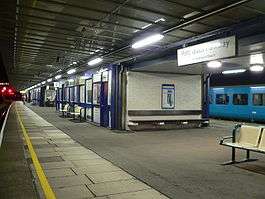
Port Talbot is served by the South Wales Main Line at Port Talbot Parkway railway station. First Great Western and Arriva Trains Wales serve the station with services westbound to Neath and Swansea and West Wales Line and eastbound to Bridgend, Cardiff Central, Newport, Bristol Parkway, Swindon, Didcot Parkway, Reading and London Paddington. Trains also run via Hereford and Shrewsbury to Crewe and Manchester Piccadilly.
Other
Port Talbot bus station, located adjacent to the Aberafan Centre in the centre of the town is the main bus transport hub, it is a National Express stop. Local bus services are provided by First Cymru, South Wales Transport & Veolia Transport Cymru. The bus station's layout is very distinctive for the fact that buses always have to perform a 270° clockwise turn to exit the station. A Sustrans cycle route has recently been constructed at this bus station as part of the connect2 scheme connecting the Afan Valley with Aberafan beach.
The M4 motorway cuts through the town from southeast to northwest, crossing a central area on a concrete viaduct, junctions 38 to 41 serve Port Talbot, with junctions 40 and 41 being in the commercial heart of the town. This busy urban stretch of the M4, with tight bends, 2-lane carriageways, short narrow slip roads and concrete walls on both sides, was the first length of motorway in Wales when it opened to traffic in 1966.[26] The road has a speed limit of 50 mph (80 km/h) enforced with a speed camera in the eastbound direction. The stretch through Port Talbot town centre is a particular traffic congestion blackspot and there have been calls to close the slip roads at junctions 40 and 41 to improve traffic flow.[27] However some commuters oppose this plan since it would add more time to their journey. A new dual carriageway relief road, the Port Talbot Peripheral Distribution Road (PDR),[28] was completed in 2013. It serves as a distributor road through Port Talbot to the southwest of the M4, beginning at M4 Junction 38 and ending near Junction 41.
The Port Talbot Docks complex consist of an inner set of floating docks and an outer tidal basin. Construction of the tidal basin began in 1964 and the whole basin covers about 500 acres (2.0 km2).[29] The tidal basin is capable of handling ships of up to 170,000 DWT and is used mostly for the import of iron ore and coal for use by nearby Port Talbot Steelworks. The inner floating docks were constructed in 1898[30] and were closed in 1959. They were re-opened in 1998 for commercial shipping and in March 2007 for the import of some steel products[31] and are capable of handling ships of up to 8,000 dwt.[32] There have been proposals for the development of an intermodal freight terminal at the port.
Economy


Heavy industry is a visible feature of Port Talbot's economy. The coastal strip of the town features Port Talbot Steelworks, a large BOC Industrial Gases plant, a biomass power station and a gas-fired power station. Further power plants are being planned or commissioned: at Margam adjacent to the BOC plant, at Aberafan Beach sea front and a recently announced £60m project within Corus to utilise by-product gases.
On 20 November 2007, the Department for Business, Enterprise and Regulatory Reform (BERR) granted consent for the world's largest biomass power station to be built at Port Talbot.[33] This is expected to provide enough electricity (from wood from environmentally-managed forests, mostly in North America) to supply half the homes in Wales with electricity.
Potential future development currently centres around the peripheral distributor road to the south (the dual carriageway road in the Margam and Tiabach areas was finished in 2013), Baglan Industrial Park and Baglan Energy Park to the west, Port Talbot Docks to the southwest, Margam Country Park to the east and the Afan Valley to the north. In March 2009 Neath Port Talbot County Borough Council announced a regeneration project for Port Talbot town centre and docks, with a masterplan for new homes, offices, light industry, retail developments and improvements to the railway station.[34]
Economic factors
A recent local council research project into industry revealed that 37.4% of Port Talbot's workforce belong in the public sector, notably Health and Social Care. Port Talbot is also the site for Neath Port Talbot General Hospital, which houses a psychiatric ward and drug rehabilitation centre, including a Juvenile wing which provides temporary emergency care for 15-18 year olds lasting up to seven days before being placed in a secure psychiatric unit. According to the office of national statics between April 2012 to March 2013 25,400 (7.8%) between the ages of 16-64 were economically inactive, 60,100 (70.3%) between the ages of 16-64 were economically active. The unemployment rate was 7.8% and the employment rate was 64.9%.[35]
Youth organisations
Port Talbot is home to a number of youth organisations. They are operated by Neath Port Talbot County Borough Council, the Ministry of Defence and a range of other charitable organisations.
Council youth groups
Neath Port Talbot County Borough Council operates youth clubs in Blaengwynfi, Bryn, Bryncoch, Cimla, Croeserw, Crynant, Cwmafan, Cwmllynfell, Cymmer, Glyncorrwg, Glynneath, Hengwrt, Neath, Sandfields, Seven Sisters, Taibach and Ystalyfera.[36]
Cadet organisations
The 499 (Port Talbot) Squadron Air Training Corps, Sea Cadets, Port Talbot Detachment and Dyfed and Glamorgan Army Cadet Force operate in Port Talbot.
Future major developments
- A deep coal mine is planned to be built in the Margam area to sustain a supply of coal to the steelworks for 15 years.
- The world's first tidal lagoon is planned with the aim to complete by 2017 in Baglan Bay area.
- A 'super school' equivalent to 4-5 comprehensive schools is planned for the Baglan Moors area.[37]
- Port Talbot Parkway train station will be demolished and replaced by a new station. The development includes a new enclosed footbridge with lifts providing step-free access to the platform.[38]
- A £13.5m Aberavon Fitness and Leisure Centre is on track to be completed by the end of 2016.[39]
Notable people
- See Category:People from Port Talbot
- William Abraham (1842–1922, b. Cwmafan), trade unionist and politician
- Martyn Ashton, British mountain bike trials former world champion and multiple British champion, lives in Port Talbot.
- Keith Barnes, Australian rugby league great was born in Port Talbot before emigrating aged 13. As of 2014 Barnes still has his Welsh accent
- Captain Beany, celebrity charity fundraiser, and celebrity lookalike.
- Robert Blythe, Welsh actor, was brought up in Tan y Groes Street. Played Fagin Hepplewhite in the BBC comedy High Hopes.
- Di Botcher, Welsh comedy actress.[40]
- Rob Brydon, actor and comedian was brought up in Baglan, Port Talbot.
- Richard Burton was born in Pontrhydyfen, Port Talbot as Richard Jenkins and had his early education in Port Talbot where he met his mentor, Philip Burton.
- Thomas Owen David (Owain ap Japheth), poet, member of the Gorsedd
- Leondre Devries, part of the singing duo Bars and Melody who came third on Britain's Got Talent in 2014.
- Alan Durban, footballer, born 7 July 1941
- Peg Entwistle, successful Broadway theatre actress whose 1932 suicide from atop the Hollywood sign in Los Angeles forever tagged her as "The Hollywood Sign Girl" was born at 5 Broad Street, Port Talbot on 5 February 1908.[41]
- Professor Sir Christopher Evans, businessman, originally from Port Talbot
- William Evans (1883–1968), writer
- Bernard Fox, actor, born Bernard Lawson
- Rhod Gilbert, comedian, lives in Port Talbot
- Lateysha Grace, cast member on reality show The Valleys
- Richard Hibbard, rugby union player (Wales and Lions international)
- James Hook, rugby union player, current Perpignan and Wales fly-half
- Sir Anthony Hopkins, actor, was born and raised in Margam, Port Talbot.
- Geoffrey Howe was born in Port Talbot and spent his early years there. When he was made a life peer in 1992 he chose the title Baron Howe of Aberavon.
- Chris Jenkins, European and World Powerlifting champion
- Clive Jenkins (1926–1999), trade unionist
- Gareth Jones, conductor
- Martyn Lloyd-Jones (1899–1981, b. Cardiff), Calvinistic Methodist minister who ministered Bethlehem Calvinistic Methodist Chapel, Sandfields, Aberafan from 1926 to 1938 prior to teaching at Westminster Chapel in London
- Michael Locke, aka 'Pancho' of TV series Dirty Sanchez, was born and brought up in Baglan, Port Talbot
- Allan Martin, rugby union player (Wales and Lions international)
- Caroline Painter (1932-1992), journalist, writer
- Christopher Painter, composer, born in 1962
- Colin Pascoe, former Swansea City, Sunderland and Wales international.
- Dic Penderyn, was born as Richard Lewis in Aberafan in 1803, in the centre of what is now Port Talbot but before the town was named as such in 1840. He is buried at St. Mary's Church in the centre of the town. He was convicted of assault on an army soldier and executed
- Paul Potts, an opera singer and the winner of Britain's Got Talent in 2007, lives in Port Talbot
- Anna Risi (Anne Rees), mezzo soprano
- Linda Sharp, champion surfer from Aberafan, won the European surfing championships twice, the British surfing championships ten times and the Welsh surfing championships 19 times[42]
- Michael Sheen, Welsh actor was born in Newport but he was brought up in Port Talbot
- Rhys Taylor, footballer born in Neath on 7 April 1990.
- David John Thomas (known as 'Afan' Thomas), composer, b Llan Baglan, nr Cwmavon, W Glamorgan 1881, d S Wales 1928
- George Thomas, 1st Viscount Tonypandy was born in Tydraw Street, Port Talbot and was speaker in the House of Commons.
- Andrew Vicari, painter was born in Port Talbot.
- Freddie Williams, from Margam, was the 1950 and 1953 Speedway World Champion. As of 2013, Williams is the only Welshman to win the championship.
- Richard Winpenny, Professor of Inorganic Chemistry, The University of Manchester[43] and director of The Photon Science Institute at the University of Manchester[44]
Sea rescue
Port Talbot coastguard celebrated its centenary in 2008 with a history of rescues in the last 100 years. The crew are now the mud rescue team for the Swansea Bay area. Port Talbot Coastguard are one of the seven rescue teams that make up the Gower Sector.
Port Talbot also has an Inshore Lifeboat, which is part of the Royal National Lifeboat Institution (RNLI). Set about making sure the Inwater docks, Aberafan Beach and rivers along the route are safe.
Both sea rescue organisations, are opposite each other, and are used to working in partnership for effective beach and sea safety. [45]
See also
References
- 1 2 "2011 Census". Nomisweb.co.uk. 27 March 2011. Retrieved 25 November 2013.
- ↑ (1999) Collins Concise Dictionary, HarperCollins, Glasgow, ISBN 0-00-472257-4
- ↑ "New BBC television series will recall the fight to save Port Talbot steelworks in the 1980s", South Wales Evening Post, 10 November 2015. Accessed 3 April 2016
- ↑ Margam Deer Herd (accessed: 18 June 2013)
- ↑ Ordnance Survey Map, Swansea and Neath Port Talbot Area, 2012
- ↑ "Full text of "The itinerary of John Leland in or about the years 1535-1543. parts I to [XI]". Archive.org. Retrieved 6 September 2013.
- 1 2 John Davies; Nigel Jenkins; Menna Baines; Peredur I. Lynch, eds. (2008). The Welsh Academy Encyclopedia of Wales. Cardiff: University of Wales Press. p. 697.
- ↑ www.oceannavigator.com article link not accessible.
- ↑ "AB Ports web page for Port Talbot". Abports.co.uk. Retrieved 25 November 2013.
- ↑ "Archive Network Wales: West Glamorgan Archive Service - Context". Anws.llgc.org.uk. Retrieved 25 November 2013.
- ↑ "Local Government (Wales) Act 1994, County Boroughs". Legislation.gov.uk. Retrieved 25 November 2013.
- ↑ "council details for Neath Port Talbot". www.southwalesguardian.co.uk. Retrieved 25 November 2013.
- ↑ Port Talbot tops pollution chart. BBC News Monday, 28 February 2005 "Across the UK, only Marylebone Road and Camden in London had higher levels, with readings of 43 and 35. The national average was 23.3." http://news.bbc.co.uk/1/hi/wales/4303811.stm
- ↑ Information on air quality in Port Talbot can be found on the air quality section of the www.npt.gov.uk/airquality NPT council website]
- ↑
- 1 2
- ↑ The BGS Lexicon of Named Rock Units — Result Details (Retrieved: 18 June 2013)
- ↑ National Minerals Map of Wales (Retrieved: 18 June 2013)
- ↑ "Information about fossils: Glossary". Fossiel.net. Retrieved 6 September 2013.
- 1 2 3 British Geological Society Map, Swansea and Port Talbot region
- ↑ Ordnance Survey Map, Port Talbot Region,2011
- ↑ Mountain Biking in Afan Forest Park (Retrieved: 3 May 2014)
- ↑ Sign boards at the Margam Stones Museum, undated, viewed in the Museum in June 2012
- ↑ Port Talbot Magnet
- ↑ Seaside Social and labour Club
- ↑ "The Motorway Archive. M4 in Wales - Coryton to Baglan". Iht.org. 22 July 1966. Retrieved 25 November 2013.
- ↑ "'End road chaos by closing M4 slip road' - icWales". Icwales.icnetwork.co.uk. 22 November 2007. Retrieved 25 November 2013.
- ↑ "Top award for new Port Talbot road (2008)". walesonline.co.uk. 10 July 2008. Retrieved 25 November 2013.
- ↑ www.coastguard.ukf.net: Port Talbot Coastguard Search and Rescue Emergency Team History
- ↑ www.neath-porttalbot.gov.uk: complete_lowquality.pdf Archived 21 August 2008 at the Wayback Machine.
- ↑ "Associated British Ports News: Port Talbot Docks Handles First Steel Cargo For Nearly Four Decades". Abports.co.uk. Retrieved 25 November 2013.
- ↑ "Associated British Ports: Port Facilities". Abport.co.uk. Retrieved 25 November 2013.
- ↑ "£400M Wood Chip Plant Approved". BBC News. 21 November 2007. Retrieved 22 May 2010.
- ↑ "NPT CBC - Port Talbot Consultation". Npt.gov.uk. 15 August 2013. Retrieved 25 November 2013.
- ↑ "Neath Port Talbot". Retrieved 22 May 2010.
- ↑ Neath Port Talbot Youth Service (Retrieved: 3 May 2014)
- ↑ Neath Port Talbot Local Development Plan (Retrieved: 18 June 2013)
- ↑ Wales station improvements programme (Retrieved: 01 August 2015)
- ↑ Aberavon Seafront on course for another attraction (Retrieved: 01 August 2015)
- ↑ "(Di Botcher at the IMDB database)".
- ↑ "(Peg Entwistle)". www.thehollywoodsigngirl.com. Retrieved 25 November 2013.
- ↑ Steve England (July 2004). "Carve Greatest British Surfer poll". Surfers Village. Retrieved 15 February 2010.
- ↑ "(Richard Winpenny)". www.manchester.ac.uk. Retrieved 25 November 2013.
- ↑ "(Richard Winpenny)". www.psi.manchester.ac.uk. Retrieved 25 November 2013.
- ↑ "Port Talbot Lifeboat Station". Rnli.org. 28 August 2013. Retrieved 6 September 2013.
External links
| Wikivoyage has a travel guide for Port Talbot. |
| Wikimedia Commons has media related to Port Talbot. |
- Port Talbot Historical Society. A collection of historical photos, videos and documents of Aberafan / Port Talbot and districts
- Large online collection of historical photos of Aberafan / Port Talbot
- BBC South West Wales: Port Talbot slide show tour
- Aerial photograph of Port Talbot town and docks
- www.geograph.co.uk : photos of Port Talbot and surrounding area
- Port Talbot 2006 (photographs of Port Talbot)
- Neath Port Talbot Council Web Site
| Communities |
|  |
|---|---|---|
| Towns and villages |
| |
| Castles | ||
| Rivers | ||
| Topics | ||