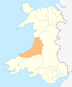
Ceredigion
| Ceredigion Sir Ceredigion | ||
|---|---|---|
| County | ||
|
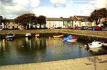
Clockwise from top: Aberystwyth Castle, Dolau Inn, Aberystwyth shore, beach at Mwynt, Water buffalo in river ceridwen, Aberaeron harbour | ||
| ||
 | ||
| Admin HQ | Aberaeron and Aberystwyth | |
| Government | ||
| • Type | Ceredigion County Council | |
| Area | ||
| • Total | 1,783 km2 (688 sq mi) | |
| Area rank | Ranked 4th | |
| Population (2011) | ||
| • Total | 75,900 | |
| • Rank | Ranked 19th | |
| • Density | 43/km2 (110/sq mi) | |
| • Density rank | Ranked 21st | |
| • Ethnicity | 99.5% White | |
| Welsh language | ||
| • Rank | Ranked 4th | |
| • Any skills | 61.2% | |
| Geocode |
00NQ (ONS) W06000008 (GSS) | |
| ISO 3166 code | GB-CGN | |
| Website |
www | |


Ceredigion (Welsh pronunciation: [kɛrɛˈdɪɡjɔn]) is a county in Mid Wales. In the Middle Ages, it was a minor kingdom also known for a time as Seisyllwg.[1] Following its Norman conquest, the name was anglicised to Cardigan[2] and then Cardiganshire[3] (Welsh: Sir Aberteifi) and it began to be administered as a county in 1282. This historic county was abolished in 1974 before being reconstituted in 1996 under the Welsh name Ceredigion. The county had a population of 75,900 at the 2011 UK census. Its largest town, Aberystwyth, is one of the two administrative centres; the other being Aberaeron. Aberystwyth houses Aberystwyth University, Bronglais Hospital and the National Library of Wales. The inland town of Lampeter houses part of the University of Wales Trinity Saint David.
The county is mainly rural with a low coastal strip along the margins of Cardigan Bay surrounded by a mountainous hinterland. There are a number of sandy beaches popular with visitors here, linked by the long-distance Ceredigion Coast Path. More than half the population speak the Welsh language and the county is considered a centre of Welsh culture.
At one time, Ceredigion had more industry than it does today. Lead, silver and zinc were mined here, and its former seat at Cardigan was the principal port of southern Wales prior to the silting of its harbour. The economy became highly dependent on dairy farming and the rearing of livestock for the English market. During the last century, livestock farming has become less profitable, and the population of Cardiganshire has been in decline as people moved to the more prosperous parts of Wales or emigrated to other countries. More recently, the population has started rising again as elderly people move into the county for retirement, and various government and European Union initiatives have encouraged tourism and other alternative sources of income.
History
Ceredigion has been inhabited since prehistoric times: 170 hill forts and enclosures have been identified across the county and there are many standing stones dating back to the Bronze Age.[4] Around the time of the Roman invasion of Britain, the area was between the realms of the Demetae and Ordovices. The Sarn Helen road ran through the territory, with forts at Bremia and Loventium protecting gold mines near present-day Llelio. Following the Roman withdrawal, Irish raids and invasions were repulsed, supposedly by the forces under a northerner named Cunedda. The 9th-century History of the Britons attributed to Nennius records that Cunedda's son Ceredig settled the area around the Teifi in the 5th century.[5] The territory supposedly remained a minor kingdom under his dynasty until its extinction upon the drowning of Gwgon ap Meurig c. 871, after which it was administered by Rhodri Mawr of Gwynedd before passing to his son Cadell, whose son Hywel Dda inherited its neighbouring kingdom Dyfed and established the realm of Deheubarth. The era—whose Viking invasions destroyed many monastic records—is highly obscure; some historians believe the Dyfed ruler Hyfaidd ap Bledrig may have annexed Ceredigion before his heirs lost it to Hywel through war.
Many pilgrims passed through Cardiganshire on their way to St Davids. Some came by sea and made use of the churches at Mwnt and Penbryn, while others came by land seeking hospitality at such places as Strata Florida Abbey. Both the abbey and Llanbadarn Fawr were important monastic sites of scholarship and education. Place names including ysbyty denote their association with pilgrims.[6]
In 1282, Edward I of England conquered the principality of Wales and divided the area into counties. One of thirteen traditional counties in Wales, Cardiganshire was also a vice-county. Cardiganshire was split into the five hundreds of Genau'r-Glyn, Ilar, Moyddyn, Penarth and Troedyraur.[7][8] In the 18th century there was an evangelical revival of Christianity, and non-conformism became established in the county as charismatic preachers like Daniel Rowland of Llangeitho attracted large congregations. Every community built its own chapel or meeting house, and Cardiganshire became one of the centres of Methodism in Wales with the Aeron Valley being at the centre of the revival.[9]
Cardigan was one of the major ports of southern Wales, but its harbour silted in the mid-19th century and the Industrial Revolution largely passed the area by. In the uplands, wheeled vehicles were rare in the 18th century, and horses and sleds were still being used for transport. On the coast, trade in herrings and corn took place across the Irish Sea. In the 19th century, many of the rural poor emigrated to the New World from Cardigan, between five and six thousand leaving the town between 1790 and 1860. Aberystwyth became the main centre for the export of lead and Aberaeron and Newquay did brisk coastal trade. The building of the railway from Shrewsbury in the 1860s encouraged visitors and hotels sprang up in the town to accommodate them.[10]
This area of the county of Dyfed became a district of Wales under the name Ceredigion in 1974 under the Local Government Act 1972,[11] and since 1996, has formed the county of Ceredigion.[12] According to the 2001 census, Ceredigion has the fourth highest proportion of Welsh speakers in the population at 61%; only Gwynedd, the Isle of Anglesey and Carmarthenshire have a higher proportion.[13]
Geography


Ceredigion is a coastal county, bordered by Cardigan Bay to the west, Gwynedd to the north, Powys to the east, Carmarthenshire to the south and Pembrokeshire to the south-west. Its area is 1,795 square kilometres (693 sq mi).[14] In 2010 the population was 76,938, making it the second most sparsely populated county in Wales.[14]
The main settlements are Aberaeron, Aberporth, Aberystwyth, Borth, Cardigan, Lampeter, Llanarth, Llanddewi Brefi, Llandysul, Llanilar, Llanrhystud, Llanon, New Quay, and Tregaron. The largest of these are Aberystwyth and Cardigan.[15]
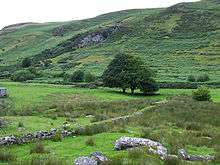
The Cambrian Mountains cover much of the east of the county; this large area forms part of the desert of Wales. In the south and west, the surface is less elevated. The highest point is Pumlumon at 2,467 feet (752 m), other Marilyns include Pen y Garn and Llan Ddu Fawr. On the slopes of Pumlumon five rivers have their sources: the Severn, the Wye, the Dulas, the Llyfnant and the Rheidol, the last of which meets the Afon Mynach in a 300 feet (91 m) plunge at the Devil's Bridge chasm. The largest river is the River Teifi which forms the border with Carmarthenshire and Pembrokeshire for part of its length. The towns of Lampeter, Llandysul, Newcastle Emlyn and Cardigan are all in the Teifi Valley, and each has communities on each side of the river, in different counties. Other significant rivers include the River Aeron which has its estuary at Aberaeron, and the River Ystwyth and the River Rheidol both of which reach the sea in Aberystwyth harbour.[15]
Ceredigion's 50 miles (80 km) of coastline has sandy beaches. In 2011 Ceredigion's beaches were awarded five Blue Flag Awards, four Green Coast Awards, and fourteen Seaside Awards.[16] Ceredigion is one of only two places in the United Kingdom with a permanent presence of bottlenose dolphins.[17] Another member of the fauna is the red kite; these may be seen in various localities in the county, but at the Red Kite Feeding Centre near Tregaron, they are fed each day, and large numbers congregate along with hungry crows and other birds.[18]
Ceredigion had the largest population growth of any county in Wales, with a 19.5% increase from 1991 to 2003.[13] Tourism and agriculture, chiefly hill farming, are the most important industries. In addition, two universities are within the county boundaries: Aberystwyth University and the Lampeter campus of the University of Wales, Trinity Saint David. The Welsh Plant Breeding Station is near Aberystwyth and linked to the University. The National Library of Wales, founded in 1907, is also in Aberystwyth. Ceredigion is an extremely rural county; the largest town, Aberystwyth, has fewer than 15,000 permanent residents and the remainder of the population of the county is scattered over 150 small towns, villages and hamlets.[19]
The county has no large commercial areas. The nearest substantial settlements are located at least 1 hour 45 minutes drive away. Approximate road distances from Ceredigion's largest town, Aberystwyth, are: Swansea, 75 miles (121 km) to the south; Shrewsbury, 76 miles (122 km) to the east, in the English county of Shropshire; and Wrexham, 82 miles (132 km) to the northeast. The capital, Cardiff, is over 100 miles (160 km) from most parts of the county. Although Ceredigion and Gwynedd share a boundary, it is not possible to travel directly between the two by land as all road and rail links avoid the Dyfi estuary and pass through Dyfi Junction or Machynlleth in Powys.[15]
Dylan Thomas lived in New Quay and Talsarn and frequented Aberaeron and Lampeter. The Dylan Thomas Trail runs through part of the county, linking the places associated with the poet.[20] The Ceredigion Coast Path is a long-distance footpath following the coastline from Cardigan to Ynyslas, a distance of about 60 miles (97 km). It can conveniently be divided into seven sections and has some spectacular scenery.[21]
Local government
Between 1888 and 1974, the county was governed by Cardiganshire County Council, which took over the functions of county administration from the Quarter Sessions court in 1889.[12] The county was abolished in 1974 by the Local Government Act 1972 — and it was succeeded by the district of Ceredigion in the new county of Dyfed.[22] This district became a unitary authority on 1 April 1996 under the name of Cardiganshire; to change its name back to Ceredigion the following day. It has, apart from minor realignments, identical borders to the former county.[11]
A referendum was held on 20 May 2004 on whether to have a directly elected mayor for the county, the first in Wales. The Llais Ceredigion political initiative had been formed with this aim[23] but the proposal was rejected.[24]
Economy
Farming has traditionally been the basis of Cardiganshire's economy, with dairying and stock-rearing being the main occupations. Before the first railway was built in 1866, the stock used to be herded over the mountains to England, where Rugby, Northampton and London were important destinations. At one time there was a sizeable mining industry in Cardiganshire, but the reserves of lead, silver and zinc became unprofitable to mine by the early part of the twentieth century. Shipping was also important in the county, with coal and lime being imported in coastal vessels, and mineral ores and oak bark for tanning being exported. Shipbuilding was an important industry with most of Wales' sailing vessels being built in Cardiganshire.[14]
Cardiganshire had a substantial population in the early modern period but this declined during the nineteenth century as wider social and economic developments affected all aspects of Cardiganshire life. Traditional industries were in decline, agriculture was in decline and it was becoming increasingly difficult for a still-rising population to earn a living within their native parishes and communities. By the first half of the twentieth century, falling livestock prices and greater world competition made farming unprofitable and many residents of Cardiganshire moved to other parts of South Wales, where there were better employment opportunities, and many more emigrated to the United States, Canada, Patagonia and Australia.[14] Another factor was that the owners of the great landed estates, who had for so long dominated the politics of the county, were in many cases heavily in debt. This second factor contributed to the loss of landowner influence in the running of the county, a trend that became very apparent at the first elections to the Cardiganshire County Council in 1889.[25]

By the second half of the twentieth century, the declining population trend had gone into reverse. Increasing numbers of retired people were arriving to make their home in the tranquil surroundings, and after the Beacham Commission in the 1960s, the British government realised that the rural way of life in parts of Wales was in crisis, and started to react. Through government initiatives and local actions, opportunities in tourism, rural crafts, specialist food shops, farmers' markets and added-value food products began to emerge.[14] However, in 2011, at 3.1%, Ceredigion still had one of the highest proportions of its population working in agriculture, forestry and fishing, close behind such other places as Orkney and Shetland.[26] Another use for marginal land in exposed positions is the provision of renewable wind energy; Cefn Croes Wind Farm near Devil's Bridge has 39 turbines and a nominal capacity of 58,500 kW.[27]
Farm incomes have been in decline over the years and, as well as being a European Objective I area, in 2001 Ceredigion was designated a regional "Tourist growth area" by the Wales Tourist Board.[19] There is little industry other than farming, so tourism plays an important part in the county's economy. Visitors stay in hotels, guest houses and homes offering bed-and-breakfast, self-catering cottages, caravans and camp sites, spending money in local shops, dine in local establishments and visit the county's many attractions. Ceredigion prides itself on offering an unspoilt natural landscape, and Aberystwyth lays claim to being the capital of Welsh culture.[28]
Sport and leisure
The main football team in the county is Aberystwyth Town F.C. which plays in the Welsh Premier League, its home matches being at the Park Avenue ground in the town. It has yet to come higher than third in the League but won the Welsh Cup in 1899/1900 and the Welsh Amateur Cup in 1930/31, 1932/33 and 1969/70.[29] Cardigan Town Football Club, also known as the "Magpies", play in Division 1 of the Ceredigion League which they won in 1968/69, 1995/96, 1999/2000, 2000/01 and 2002/03.[30]
Leisure activities available in the county include beach activities, rambling, cycling, sea fishing, canoeing, sailing and horse riding. Many of the towns and villages along the coast have small harbours and facilities for sailing, dolphin watching and other maritime activities. The River Teifi is a renowned salmon fishing river and also has a series of rapids near Llandysul where canoeing, kayaking and white water rafting take place.[31]

The county is rich in archaeological remains such as forts, earthworks and standing stones. Historic sites that can be accessed include Aberystwyth Castle[32] and Cardigan Castle,[33] as well as Strata Florida Abbey.[34]
Other visitor attractions include the Cwmystwyth Mines, Devil's Bridge,[32] the Bwlch Nant yr Arian Forest Visitor Centre,[32][35] Elvis Rock, Cors Caron (Tregaron bog), the Vale of Rheidol Railway,[32] Aberystwyth Cliff Railway.[32]
The National Library of Wales[32] is at Aberystwyth and there is information on local history at the Ceredigion Museum,[32] also in Aberystwyth. There is also the technical museum Internal Fire – Museum of Power, which is at Tan-y-groes near the coast road.[36] Stately homes in the county open to the public include the Hafod Estate[37] and Llanerchaeron.[32]
Transport

The Cambrian Line provides mainline railway services between Aberystwyth and Shrewsbury, where passengers can join services for London and elsewhere. Passengers can change at Dovey Junction railway station for trains to Pwllheli.[38] There are no motorways in Ceredigion. The A487 coast road links Cardigan with Aberystwyth, passing close to Newquay and through Aberaeron, and the A44 goes eastwards from Aberystwyth to Rhayader, Leominster and Worcester.[39] There are local bus services between the main centres of population,[40] and long distance services between Aberystwyth and Cardiff. A bus service known as "Bwcabus" operates in the south of the county offering customised transport for rural dwellers.[41]
There are no commercial airports but the West Wales Airport near the village of Aberporth is licensed for the deployment of civil and military unmanned aerial vehicles (UAV)s and is used for flying and testing these drones.[42] There are no ports or ferry termini in the county but several of the coastal towns have facilities for yachts and small craft.[40]
See also
- List of Lord Lieutenants of Cardiganshire
- List of Custodes Rotulorum of Cardiganshire
- List of High Sheriffs of Cardiganshire
- List of schools in Ceredigion
- List of MPs for the Ceredigion (formerly Cardiganshire) constituency
- Centre points of the United Kingdom
References
Citations
- ↑ EB (1878), p. 95.
- ↑ EB (1878), p. 94.
- ↑ EB (1911), p. 319.
- ↑ "Discover Ceredigion: Hillforts and Heroes". Ceredigion County Council. Retrieved 14 April 2016.
- ↑ Davies, John, A History of Wales
- ↑ "Discover Ceredigion: Pilgrims and Princes". Ceredigion County Council. Retrieved 14 April 2016.
- ↑ Margaret Escott (2009). "Cardiganshire; The History of Parliament: the House of Commons 1820-1832, ed. D.R. Fisher". historyofparliamentonline.org. Cambridge University Press. Retrieved 26 April 2012.
- ↑ Society for the Difussion of Useful Knowledge (1836). The Penny Cyclopaedia of the Society for the Difussion of Useful Knowledge. Charles Knight. p. 287. Retrieved 26 April 2012.
- ↑ "Discover Ceredigion: Peace and Religion". Ceredigion County Council. Retrieved 14 April 2016.
- ↑ Lloyd, Thomas; Orbach, Julian; Scourfield, Robert (2006). Carmarthenshire and Ceredigion. Yale University Press. pp. 2–3. ISBN 0-300-10179-1.
- 1 2 Schaefer, Christina K. (1999). Instant Information on the Internet!: A Genealogist's No-frills Guide to the British Isles. Genealogical Publishing Com. p. 51. ISBN 978-0-8063-1614-7.
- 1 2 "County Council". Cyngor Sir Ceredigion County Council. Retrieved 14 April 2016.
- 1 2 "Census shows Welsh language rise Friday, 14 February, 2003 extracted 12-04-07". Retrieved 20 September 2014.
- 1 2 3 4 5 Nienaber, Birte (2016). Globalization and Europe's Rural Regions. Routledge. pp. 76–83. ISBN 978-1-317-12709-3.
- 1 2 3 Philip's (1994). Atlas of the World. Reed International. pp. 16–17. ISBN 0-540-05831-9.
- ↑ "Ceredigion tourism - Beaches". Retrieved 20 September 2014.
- ↑ "Cardiganshire Coast & Country". Retrieved 20 September 2014.
- ↑ "Red Kite Feeding". Gigrin. Retrieved 11 April 2016.
- 1 2 Hall, Derek R.; Kirkpatrick, Irene (2005). Rural Tourism and Sustainable Business. Channel View Publications. pp. 236–237. ISBN 978-1-84541-335-4.
- ↑ The Dylan Thomas Trail by D. N. Thomas, Y Lolfa 2002
- ↑ "Ceredigion Coast Path". Ceredigion County Council. Retrieved 14 April 2016.
- ↑ Wade, William; Forsyth, Christopher (2014). Administrative Law. Oxford University Press. pp. 91–92. ISBN 978-0-19-968370-3.
- ↑ "New party reveals election targets". BBC News. 6 January 2004. Retrieved 12 April 2016.
- ↑ "Gains for Plaid in Ceredigion". BBC News. 11 June 2004. Retrieved 12 April 2016.
- ↑ Morgan. "Cardiganshire Politics": 314–18; 319–20.
- ↑ Dorling, Danny; Thomas, Bethan (2016). People and Places: A 21st-century Atlas of the UK. Policy Press. p. 160. ISBN 978-1-4473-1136-2.
- ↑ "Cefn Croes, United-Kingdom". Wind Energy Market Intelligence. The Wind Power. Retrieved 11 April 2016.
- ↑ Cloke, Paul; Crang, Philip; Goodwin, Mark (2013). Introducing Human Geographies, Second Edition. Routledge. p. 522. ISBN 978-1-4441-6980-5.
- ↑ "Club honours". Aberystwyth Town Football Club. Retrieved 16 April 2016.
- ↑ "Cardigan Town Football Club: History". Cardigan Town Football Club. Retrieved 16 April 2016.
- ↑ "Llandysul Paddlers". Retrieved 16 April 2016.
- 1 2 3 4 5 6 7 8 "Things to do in Ceredigion". TripAdvisor. Retrieved 18 April 2016.
- ↑ "Cardigan Castle". Retrieved 18 April 2016.
- ↑ "Strata Florida Project". University of Wales Trinity Saint David. Retrieved 18 April 2016.
- ↑ "Bwlch Nant yr Arian Forest Visitor Centre". Visit Mid Wales. Retrieved 18 April 2016.
- ↑ "Internal Fire: Museum of Power". Retrieved 18 April 2016.
- ↑ "The Hafod Estate". Natural Resource Wales. Retrieved 18 April 2016.
- ↑ Jenkins, Stanley C.; Loader, Martin (2015). The Great Western Railway: Shrewsbury to Pwllheli Vol. 5. Amberley Publishing Limited. pp. 15–16. ISBN 978-1-4456-4299-4.
- ↑ Concise Road Atlas: Britain. AA Publishing. 2015. pp. 36–39. ISBN 978-0-7495-7743-8.
- 1 2 Le Nevez, Catherine; Whitfield, Paul (2012). The Rough Guide to Wales. Rough Guides Limited. pp. 257–267. ISBN 978-1-4093-5902-9.
- ↑ "Bwcabus". Bwcabus. 2012. Retrieved 11 April 2016.
- ↑ "West Wales Airport". Retrieved 11 April 2016.
Bibliography
- "County of Cardigan", Encyclopædia Britannica, 9th ed., Vol. V, New York: Charles Scribner's Sons, 1878, pp. 94–5.
- "Cardiganshire", Encyclopædia Britannica, 11th ed., Vol. V, Cambridge: Cambridge University Press, 1911, pp. 319–21.
- Morgan, Kenneth O. (1967). "Cardiganshire Politics: The Liberal Ascendancy 1885–1923". Ceredigion. 5 (4): 311–346.
External links
| Wikimedia Commons has media related to Ceredigion. |
Coordinates: 52°15′10″N 4°00′01″W / 52.25278°N 4.00028°W