Port Matilda, Pennsylvania
| Port Matilda, Pennsylvania | |
|---|---|
| Borough | |
|
The center of Port Matilda | |
 Map showing Port Matilda in Centre County | |
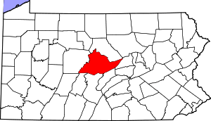 Map showing Centre County in Pennsylvania | |
 Port Matilda Map showing Port Matilda in Centre County | |
| Coordinates: 40°48′00″N 78°03′04″W / 40.80000°N 78.05111°WCoordinates: 40°48′00″N 78°03′04″W / 40.80000°N 78.05111°W | |
| Country | United States |
| State | Pennsylvania |
| County | Centre |
| Settled | 1836 |
| Incorporated (borough) | 1926 |
| Government | |
| • Mayor | Ida Lively |
| • Borough Council President | Chris Prospero |
| Area | |
| • Total | 0.6 sq mi (1.4 km2) |
| Elevation | 1,053 ft (321 m) |
| Population (2010) | |
| • Total | 606 |
| • Density | 1,110.7/sq mi (428.9/km2) |
| Time zone | Eastern (EST) |
| • Summer (DST) | EDT (UTC) |
| Zip code | 16870 |
| Area code(s) | 814 |

Port Matilda is a borough in Centre County, Pennsylvania, United States. It is part of the State College, Pennsylvania Metropolitan Statistical Area. The population was 606 at the 2010 census.
Geography
Port Matilda is located at 40°48′0″N 78°3′4″W / 40.80000°N 78.05111°W (40.800056, -78.051119).[1]
According to the United States Census Bureau, the borough has a total area of 0.6 square miles (1.6 km2), all of it land.
Demographics
| Historical population | |||
|---|---|---|---|
| Census | Pop. | %± | |
| 1880 | 310 | — | |
| 1930 | 508 | — | |
| 1940 | 646 | 27.2% | |
| 1950 | 685 | 6.0% | |
| 1960 | 697 | 1.8% | |
| 1970 | 680 | −2.4% | |
| 1980 | 647 | −4.9% | |
| 1990 | 669 | 3.4% | |
| 2000 | 638 | −4.6% | |
| 2010 | 606 | −5.0% | |
| Est. 2015 | 598 | [2] | −1.3% |
| Sources:[3][4][5] | |||
As of the census[4] of 2010, there were 606 people, 262 households, and 165 families residing in the borough. The population density was 1,110.7 people per square mile (428.9/km²). There were 289 housing units at an average density of 529.7 per square mile (204.5/km²). The racial makeup of the borough was 98.0% White, 0.1% Black or African American, 0.1% Native American, 0.1% Asian, 0.8% from other races, and 0.8% from two or more races. Hispanic or Latino of any race were 1.2% of the population.
There were 262 households, out of which 26.3% had children under the age of 18 living with them, 47.3% were married couples living together, 4.6% had male householder with no wife present, 11.1% had a female householder with no husband present, and 37.0% were non-families. 30.2% of all households were made up of individuals, and 10.7% had someone living alone who was 65 years of age or older. The average household size was 2.31 and the average family size was 2.88.
In the borough the population was spread out, with 19.5% under the age of 18, 10.1% from 18 to 24, 29.2% from 25 to 44, 28.8% from 45 to 64, and 12.4% who were 65 years of age or older. The median age was 40 years. For every 100 females there were 103.4 males. For every 100 females age 18 and over, there were 101.7 males.
The median income for a household in the borough was $32,054, and the median income for a family was $53,750. The per capita income for the borough was $19,418. About 14.5% of families and 20.2% of the population were below the poverty line, including 54.9% of those under age 18 and 3.2% of those age 65 or over.
History
Squire Clement Beckwith laid out the town in 1850 and named it to honor his daughter, Matilda. Why he chose to call it Port Matilda is not clear, but the name may have reflected his hope that the town would eventually be connected to the Bald Eagle and Spring Creek Branch of the Pennsylvania canal. While the canal did not reach Port Matilda, the Bald Eagle Railroad did, and the community became a market center in the Bald Eagle Valley for agricultural and lumber products.[6]
Industrial History
Port Matilda was home to McFeely Brick Co., located on Brick St. at the northeast end of the town adjacent to the railroad. The company was based at Latrobe, Pennsylvania and founded by Fred McFeely, the grandfather of children's television personality Fred Rogers. The company was later owned by General Refractories, which closed the Port Matilda plant in 1959. Its primary product was silica fire brick made from ganister rock, using beehive kilns. Its bricks were typically stamped "Vulcan".[7][8]
References
- ↑ "US Gazetteer files: 2010, 2000, and 1990". United States Census Bureau. 2011-02-12. Retrieved 2011-04-23.
- ↑ "Annual Estimates of the Resident Population for Incorporated Places: April 1, 2010 to July 1, 2015". Retrieved July 2, 2016.
- ↑ "Census of Population and Housing". U.S. Census Bureau. Retrieved 11 December 2013.
- 1 2 "American FactFinder". United States Census Bureau. Retrieved 2008-01-31.
- ↑ "Incorporated Places and Minor Civil Divisions Datasets: Subcounty Resident Population Estimates: April 1, 2010 to July 1, 2012". Population Estimates. U.S. Census Bureau. Retrieved 11 December 2013.
- ↑ Centre County History
- ↑ Pennsylvania Historical & Museum Commission data; National Park Service HAER Survey; personal inspection
- ↑ Fred Rogers Biography