Philipsburg, Centre County, Pennsylvania
| Philipsburg, Pennsylvania | |
|---|---|
| Borough | |
|
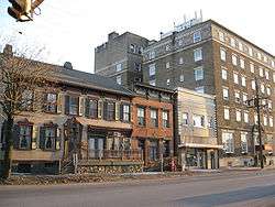
200 block of Presqueisle Street, Philipsburg | |
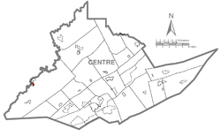 Map showing Philipsburg in Centre County | |
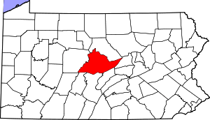 Map showing Centre County in Pennsylvania | |
 Philipsburg Map showing Philipsburg in Centre County | |
| Coordinates: 40°53′42″N 78°13′09″W / 40.89500°N 78.21917°W | |
| Country | United States |
| State | Pennsylvania |
| County | Clearfield and Centre |
| Settled | 1797 |
| Incorporated (borough) | 1864 |
| Area | |
| • Total | 0.8 sq mi (2.1 km2) |
| Elevation | 1,437 ft (438 m) |
| Population (2010)[1] | |
| • Total | 2,770 |
| • Estimate (2013)[2] | 2,708 |
| • Density | 3,462.5/sq mi (1,319.0/km2) |
| Time zone | Eastern (EST) |
| • Summer (DST) | EDT (UTC) |
| Zip code | 16866 |
| Area code(s) | 814 |
| Website |
www |
Philipsburg is a borough in Centre County, Pennsylvania, United States. It is located at 40°53′42″N 78°13′09″W / 40.89500°N 78.21917°WCoordinates: 40°53′42″N 78°13′09″W / 40.89500°N 78.21917°W (40.895, -78.2193).[3] It is part of the State College, Pennsylvania Metropolitan Statistical Area. The borough's population was 2,770 at the 2010 census.
Geography
According to the United States Census Bureau, the borough has a total area of 0.8 square miles (2.1 km²), all of it land. Major roads through the area are US Route 322 and State Routes 350, 504, and 53.
Historical landmarks
Philipsburg is home to a number of sites of renovated historical interest, including the Rowland Theater (located on Front Street), the Union Church and Burial Ground (also known as the "Mud" Church, on Presqueisle Street), the Hardman Philips House, the Simler House (on North Second St), and Halehurst (located off Presqueisle Street near Ninth Street), thought to be a stop on the Underground Railroad, although no evidence to support this has been published. The Rowland Mansion, former home of U.S. Congressman Charles Hedding Rowland, suffered damage from a recent fire. It has since been repaired and reopened as a bed and breakfast. The Philipsburg commercial district underwent a series of renovations including a $1 million street project to revitalize the main shopping district.[4]
The Philipsburg Historic District was added to the National Register of Historic Places in 1999.[5]
Demographics
| Historical population | |||
|---|---|---|---|
| Census | Pop. | %± | |
| 1870 | 1,086 | — | |
| 1880 | 1,779 | 63.8% | |
| 1890 | 3,245 | 82.4% | |
| 1900 | 3,266 | 0.6% | |
| 1910 | 3,585 | 9.8% | |
| 1920 | 3,900 | 8.8% | |
| 1930 | 3,600 | −7.7% | |
| 1940 | 3,963 | 10.1% | |
| 1950 | 3,988 | 0.6% | |
| 1960 | 3,872 | −2.9% | |
| 1970 | 3,700 | −4.4% | |
| 1980 | 3,533 | −4.5% | |
| 1990 | 3,048 | −13.7% | |
| 2000 | 3,056 | 0.3% | |
| 2010 | 2,770 | −9.4% | |
| Est. 2015 | 2,715 | [6] | −2.0% |
| Sources:[2][7][8] | |||
As of the census of 2010, there were 2,770 people, 1,317 households, and 686 families residing in the borough. The population density was 3,462.5 people per square mile (1,319.0/km²). There were 1,512 housing units at an average density of 1,890/sq mi (720/km²). The racial makeup of the borough was 94.5% White,1.6% Black or African American, 0.2% Native American, 2.8% Asian, 0.3% from other races, and 1.0% from two or more races. Hispanic or Latino of any race were 1.1% of the population.
There were 1,317 households, out of which 23.2% had children under the age of 18 living with them, 38.0% were married couples living together, 3.6% had a male householder with no wife present, 10.5% had a female householder with no husband present, and 47.9% were non-families. 40.4% of all households were made up of individuals, and 18.7% had someone living alone who was 65 years of age or older. The average household size was 2.10 and the average family size was 2.86.
In the borough the population was spread out, with 19.3% under the age of 18, 9.6% from 18 to 24, 25.8% from 25 to 44, 24.8% from 45 to 64, and 20.5% who were 65 years of age or older. The median age was 42 years. For every 100 females there were 89.2 males. For every 100 females age 18 and over, there were 87.7 males.
The median income for a household in the borough was $31,903, and the median income for a family was $42,433. The per capita income for the borough was $23,675. 16.8% of the population and 11.0% of families were below the poverty line. Out of the total people living in poverty, 14.8% are under the age of 18 and 8.6% are 65 or older.
Schools
The Philipsburg-Osceola School District is the school district that serves the Philipsburg and Osceola area:
- Philipsburg Elementary
- Philipsburg-Osceola Area Middle School
- Philipsburg-Osceola Area Senior High School
- Osceola Mills Elementary
Notable people
- Matt Adams, professional baseball player - St. Louis Cardinals
- Jon Condo, professional football player - Oakland Raiders
- Ty Tyson, sportscaster
- Jackson Verbeck-Myers, Real Life Homeward Bound & Internet Celebrity
References
- ↑ "American FactFinder". United States Census Bureau. Retrieved 2014-08-06.
- 1 2 "Population Estimates". United States Census Bureau. Retrieved 2014-08-06.
- ↑ "US Gazetteer files: 2010, 2000, and 1990". United States Census Bureau. 2011-02-12. Retrieved 2011-04-23.
- ↑ http://visitclearfieldcounty.org/fileadmin/Clearfield_County/Pdfs/PHILIPSBURG.pdf
- ↑ National Park Service (2010-07-09). "National Register Information System". National Register of Historic Places. National Park Service.
- ↑ "Annual Estimates of the Resident Population for Incorporated Places: April 1, 2010 to July 1, 2015". Retrieved July 2, 2016.
- ↑ "Census of Population and Housing". U.S. Census Bureau. Retrieved 11 December 2013.
- ↑ "American FactFinder". United States Census Bureau. Retrieved 2008-01-31.
External links
| Wikimedia Commons has media related to Philipsburg, Centre County, Pennsylvania. |
- Borough of Philipsburg official website
- Philipsburg Online, area business directory