Platinum, Alaska
| Platinum Arviq | |
|---|---|
| City | |
 Platinum Location in Alaska | |
| Coordinates: 59°0′25″N 161°48′55″W / 59.00694°N 161.81528°W | |
| Country | United States |
| State | Alaska |
| Census Area | Bethel |
| Incorporated | February 13, 1975[1] |
| Government | |
| • Mayor | Mark Moyle[2] |
| • State senator | Lyman Hoffman (D) |
| • State rep. | Bob Herron (D) |
| Area | |
| • Total | 44.7 sq mi (115.8 km2) |
| • Land | 44.6 sq mi (115.6 km2) |
| • Water | 0.1 sq mi (0.2 km2) |
| Elevation | 13 ft (4 m) |
| Population (2010) | |
| • Total | 61 |
| • Density | 1.4/sq mi (0.53/km2) |
| Time zone | Alaska (AKST) (UTC-9) |
| • Summer (DST) | AKDT (UTC-8) |
| ZIP codes | 99651 |
| Area code | 907 |
| FIPS code | 02-61080 |
Platinum (Arviiq in Central Alaskan Yup'ik) is a city in Bethel Census Area, Alaska, United States. The population was 61 at the 2010 census.
Geography
Platinum is located at 59°0′25″N 161°48′55″W / 59.00694°N 161.81528°W (59.006890, −161.815290).[3]
History
During World War II, the Alaska Territorial Guard served to safeguard it against Japanese attack as only source of the strategic metal platinum in the Western Hemisphere.[4] See The History of Platinum.
According to the United States Census Bureau, the city has a total area of 44.7 square miles (116 km2), of which, 44.6 square miles (116 km2) of it is land and 0.1 square miles (0.26 km2) of it (0.16%) is water.
Demographics
| Historical population | |||
|---|---|---|---|
| Census | Pop. | %± | |
| 1940 | 45 | — | |
| 1950 | 72 | 60.0% | |
| 1960 | 43 | −40.3% | |
| 1970 | 55 | 27.9% | |
| 1980 | 55 | 0.0% | |
| 1990 | 64 | 16.4% | |
| 2000 | 41 | −35.9% | |
| 2010 | 61 | 48.8% | |
| Est. 2015 | 64 | [5] | 4.9% |
As of the census[7] of 2000, there were 41 people, 17 households, and 9 families residing in the city. The population density was 0.9 people per square mile (0.4/km²). There were 26 housing units at an average density of 0.6 per square mile (0.2/km²). The racial makeup of the city was 7.32% White, 90.24% Native American, and 2.44% from two or more races.
There were 17 households out of which 47.1% had children under the age of 18 living with them, 29.4% were married couples living together, 11.8% had a female householder with no husband present, and 41.2% were non-families. 41.2% of all households were made up of individuals and none had someone living alone who was 65 years of age or older. The average household size was 2.41 and the average family size was 2.90.
In the city the age distribution of the population shows 26.8% under the age of 18, 2.4% from 18 to 24, 43.9% from 25 to 44, 17.1% from 45 to 64, and 9.8% who were 65 years of age or older. The median age was 32 years. For every 100 females there were 105.0 males. For every 100 females age 18 and over, there were 130.8 males.
The median income for a household in the city was $21,250, and the median income for a family was $22,500. The per capita income for the city was $7,632. There are 33.3% of families living below the poverty line and 22.0% of the population, including 33.3% of under eighteens and none of those over 64
References
- ↑ 1996 Alaska Municipal Officials Directory. Juneau: Alaska Municipal League/Alaska Department of Community and Regional Affairs. January 1996. p. 120.
- ↑ 2015 Alaska Municipal Officials Directory. Juneau: Alaska Municipal League. 2015. p. 126.
- ↑ "US Gazetteer files: 2010, 2000, and 1990". United States Census Bureau. 2011-02-12. Retrieved 2011-04-23.
- ↑ Marston, Marvin R. (1969). Men of the Tundra: Alaska Eskimos at War. October House. pp. 51, 54–57.
- ↑ "Annual Estimates of the Resident Population for Incorporated Places: April 1, 2010 to July 1, 2015". Retrieved July 2, 2016.
- ↑ "Census of Population and Housing". Census.gov. Retrieved June 4, 2015.
- ↑ "American FactFinder". United States Census Bureau. Retrieved 2008-01-31.
Coordinates: 59°00′25″N 161°48′55″W / 59.00689°N 161.81529°W
Municipalities and communities of Bethel Census Area, Alaska, United States | ||
|---|---|---|
| Cities | 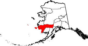 | |
| CDPs | ||
| Unincorporated communities | ||
| Ghost towns | ||
| Neighborhoods | ||