Quinhagak, Alaska
| Quinhagak Kuinerraq | |
|---|---|
| City | |
 Quinhagak Location within the state of Alaska | |
| Coordinates: 59°45′12″N 161°54′10″W / 59.75333°N 161.90278°WCoordinates: 59°45′12″N 161°54′10″W / 59.75333°N 161.90278°W | |
| Country | United States |
| State | Alaska |
| Census Area | Bethel |
| Incorporated | February 13, 1975[1] |
| Government | |
| • Mayor | Jerilyn Kelly |
| • State senator | Lyman Hoffman (D) |
| • State rep. | Bob Herron (D) |
| Area | |
| • Total | 5.3 sq mi (13.6 km2) |
| • Land | 4.7 sq mi (12.1 km2) |
| • Water | 0.6 sq mi (1.5 km2) |
| Elevation | 16 ft (5 m) |
| Population (2010) | |
| • Total | 669 |
| • Density | 130/sq mi (49/km2) |
| Time zone | Alaska (AKST) (UTC-9) |
| • Summer (DST) | AKDT (UTC-8) |
| ZIP code | 99655 |
| Area code | 907 |
| FIPS code | 02-64600 |
Quinhagak (/ˈkwɪnəhɑːk/;[2] also spelled Kwinhagak) (Kuinerraq in Central Alaskan Yup'ik) is a city in Bethel Census Area, Alaska, United States. As of the 2010 census, the population of the city is 669.[3]
The Yupik name for the village is Kuinerraq, meaning "new river channel." It has been dated to at least 1000 AD.[4]
Quinhagak is near the Nunalleq archaeological site, which has the "easily the largest collection of pre-contact Yup'ik material anywhere," according to anthropologist Rick Knecht. Thousands of items dating from 1350 to 1670 have been uncovered. These include many organic artifacts preserved in permafrost. The site is located along eroding coastline and up to 75% of the original site is thought to have washed away, As of 2013, including the original excavation site.[5][6]
Geography
Quinhagak is located at 59°45′12″N 161°54′10″W / 59.753374°N 161.902701°W.[7] It is situated on the Kanektok River and near the Arolik River, approximately a mile from the Kuskokwim Bay of the Bering Sea.
According to the United States Census Bureau, the city has a total area of 5.2 square miles (13 km2), of which, 4.7 square miles (12 km2) of it is land and 0.6 square miles (1.6 km2) of it (10.86%) is water.
Demographics
| Historical population | |||
|---|---|---|---|
| Census | Pop. | %± | |
| 1890 | 109 | — | |
| 1900 | 201 | 84.4% | |
| 1910 | 111 | −44.8% | |
| 1920 | 193 | 73.9% | |
| 1930 | 230 | 19.2% | |
| 1980 | 412 | — | |
| 1990 | 501 | 21.6% | |
| 2000 | 555 | 10.8% | |
| 2010 | 669 | 20.5% | |
| Est. 2015 | 706 | [8] | 5.5% |
As of the census[10] of 2000, there were 555 people, 137 households, and 113 families residing in the city. The population density was 118.5 people per square mile (45.8/km²). There were 153 housing units at an average density of 32.7 per square mile (12.6/km²). The racial makeup of the city was 2.70% White, 96.04% Native American, and 1.26% from two or more races. 0.72% of the population were Hispanic or Latino of any race.
There were 137 households out of which 50.4% had children under the age of 18 living with them, 56.2% were married couples living together, 12.4% had a female householder with no husband present, and 16.8% were non-families. 12.4% of all households were made up of individuals and 1.5% had someone living alone who was 65 years of age or older. The average household size was 4.05 and the average family size was 4.52.
In the city the population was spread out with 37.1% under the age of 18, 9.5% from 18 to 24, 29.5% from 25 to 44, 16.0% from 45 to 64, and 7.7% who were 65 years of age or older. The median age was 27 years. For every 100 females there were 109.4 males. For every 100 females age 18 and over, there were 115.4 males.
The median income for a household in the city was $25,156, and the median income for a family was $25,313. Males had a median income of $23,750 versus $36,250 for females. The per capita income for the city was $8,127. About 27.2% of families and 26.1% of the population were below the poverty line, including 34.0% of those under age 18 and 25.0% of those age 65 or over.
Economy
The village hosts a commercial fishing industry and cannery, and the population during the summer salmon season increases as workers from other area villages migrate to Quinhagak to work.
Most Quinhagak households practice subsistence hunting and gathering in addition to any wage work they are able to find, utilizing the village's excellent location for salmon and trout fishing, bird, caribou, and moose hunting, and berry picking. Much of the work available is government-funded (through the Lower Kuskokwim School District, which runs the local school, or through the Native Village of Kwinhagak) or seasonal (commercial fishing and/or canning).
References
- ↑ 1996 Alaska Municipal Officials Directory. Juneau: Alaska Municipal League/Alaska Department of Community and Regional Affairs. January 1996. p. 125.
- ↑ "Quinhagak". Alaska Community Information Summaries (CIS). Retrieved 2010-11-30.
- ↑ "Profile of General Population and Housing Characteristics: 2010 Demographic Profile Data". US Census Bureau, American FactFinder. Retrieved 2012-11-11.
- ↑ Administration, United States Economic Development; Commerce, United States Dept of (1996-01-01). American Indian reservations and trust areas. Economic Development Administration, U.S. Dept. of Commerce.
- ↑ Dunham, Mike (17 August 2013). "Excavation reveals largest trove of Yup'ik artifacts". Anchorage Daily News. Retrieved 19 August 2013.
- ↑ "Nunalleq 2013 official project website". Retrieved 19 August 2013.
- ↑ "US Gazetteer files: 2010, 2000, and 1990". United States Census Bureau. 2011-02-12. Retrieved 2011-04-23.
- ↑ "Annual Estimates of the Resident Population for Incorporated Places: April 1, 2010 to July 1, 2015". Retrieved July 2, 2016.
- ↑ "Census of Population and Housing". Census.gov. Archived from the original on May 11, 2015. Retrieved June 4, 2015.
- ↑ "American FactFinder". United States Census Bureau. Archived from the original on September 11, 2013. Retrieved 2008-01-31.
Municipalities and communities of Bethel Census Area, Alaska, United States | ||
|---|---|---|
| Cities | 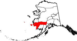 | |
| CDPs | ||
| Unincorporated communities | ||
| Ghost towns | ||
| Neighborhoods | ||