Napaimute, Alaska
| Napaimute | |
|---|---|
| Unincorporated community | |
 Napaimute Location within the state of Alaska | |
| Coordinates: 61°27′43″N 158°38′21″W / 61.46194°N 158.63917°WCoordinates: 61°27′43″N 158°38′21″W / 61.46194°N 158.63917°W | |
| Country | United States |
| State | Alaska |
| Census area | Bethel |
| Government | |
| • State senator | Lyman Hoffman (D) |
| • State rep. | Bob Herron (D) |
| Time zone | Alaska (AKST) (UTC-9) |
| • Summer (DST) | AKDT (UTC-8) |
| GNIS feature ID | 2418727[1] |
Napaimute (Napamiut in Yup'ik) is an unincorporated Alaska Native village located in the Bethel Census Area of the U.S. state of Alaska.
History
Englishman George Hoffman established a trading post at the location of present-day Napaimute in 1906. The village that formed around the trading post was called Hoffman's. The middle Kuskokwim Valley was seeing and influx of gold prospectors at that time and Hoffman's became an important supply and trade center. George Hoffman would soon relocated to Georgetown, and the name of the village was changed to Napaimute. In Yup'ik, the word Napaimute translates to "forest people". The first territorial school along the Kuskokwim River was built in 1920 at Napaimute. By 1930, the US census was reporting a Napaimute population of 111, however, the population then began to decline, and by 1969, the village's last permanent resident had left the village. With the passage of the Alaska Native Claims Settlement Act in 1971, a village corporation called Napaimute Limited was formed and in 1975, one of its members established permanent residency at the village. the village council was able to receive federal recognition as an Alaska Native Tribe in 1994, which enabled it to start receiving funding from the Bureau of Indian Affairs. Current efforts to revitalize the community are evident by the set up of a sawmill in 2001, tribal operations in 2002, and an airport feasibility study launched in 2004.
Geography
Georgetown is located at 61°32′N 158°40′W / 61.533°N 158.667°W on the north bank of the upper Kuskokwim River 28 miles east of Aniak in the Kilbuck-Kuskokwim mountains. Napaimute is accessible by boat, or snowmobile (winter). There are several gravel bars nearby in the Kuskokwim river that are sometimes used by small aircraft as makeshift landing strips, and there is currently a feasibility study being conducted to develop an airstrip capable of providing safe year-round air-access
References
Municipalities and communities of Bethel Census Area, Alaska, United States | ||
|---|---|---|
| Cities | 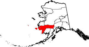 | |
| CDPs | ||
| Unincorporated communities | ||
| Ghost towns | ||
| Neighborhoods | ||