Nunapitchuk, Alaska
| Nunapitchuk | |
|---|---|
| City | |
 Nunapitchuk Location in Alaska | |
| Coordinates: 60°53′47″N 162°27′16″W / 60.89639°N 162.45444°W | |
| Country | United States |
| State | Alaska |
| Census Area | Bethel |
| Incorporated | August 26, 1969[1] |
| Government | |
| • Mayor | James Berlin, Sr.[2] |
| • State senator | Lyman Hoffman (D) |
| • State rep. | Bob Herron (D) |
| Area | |
| • Total | 8.5 sq mi (22.1 km2) |
| • Land | 7.9 sq mi (20.3 km2) |
| • Water | 0.7 sq mi (1.8 km2) |
| Elevation | 10 ft (3 m) |
| Population (2010) | |
| • Total | 496 |
| • Density | 58/sq mi (22/km2) |
| Time zone | Alaska (AKST) (UTC-9) |
| • Summer (DST) | AKDT (UTC-8) |
| ZIP codes | 99641 |
| Area code | 907 |
| FIPS code | 02-56680 |
Nunapitchuk /nuːnəˈpɪtʃək/ (Central Alaskan Yup'ik: Nunapicuar) is a city in Bethel Census Area, Alaska, United States. At the 2010 census the population was 496.
Geography
Nunapitchuk is located at 60°53′47″N 162°27′16″W / 60.89639°N 162.45444°W (60.896352, -162.454383).[3]
According to the United States Census Bureau, the city has a total area of 8.6 square miles (22 km2), of which, 7.9 square miles (20 km2) of it is land and 0.7 square miles (1.8 km2) of it (8.07%) is water.
Demographics
| Historical population | |||
|---|---|---|---|
| Census | Pop. | %± | |
| 1940 | 121 | — | |
| 1950 | 125 | 3.3% | |
| 1960 | 327 | 161.6% | |
| 1990 | 378 | — | |
| 2000 | 466 | 23.3% | |
| 2010 | 496 | 6.4% | |
| Est. 2015 | 523 | [4] | 5.4% |
As of the census[6] of 2000, there were 466 people, 105 households, and 91 families residing in the city. The population density was 59.3 people per square mile (22.9/km²). There were 120 housing units at an average density of 15.3 per square mile (5.9/km²). The racial makeup of the city was 3.43% White, 95.49% Native American, 0.43% Asian, 0.21% from other races, and 0.43% from two or more races.
There were 105 households out of which 67.6% had children under the age of 18 living with them, 67.6% were married couples living together, 11.4% had a female householder with no husband present, and 12.4% were non-families. 10.5% of all households were made up of individuals and 1.9% had someone living alone who was 65 years of age or older. The average household size was 4.44 and the average family size was 4.88.
In the city the age distribution of the population shows 41.8% under the age of 18, 10.3% from 18 to 24, 27.7% from 25 to 44, 15.7% from 45 to 64, and 4.5% who were 65 years of age or older. The median age was 23 years. For every 100 females there were 109.9 males. For every 100 females age 18 and over, there were 115.1 males.
The median income for a household in the city was $29,286, and the median income for a family was $30,313. Males had a median income of $16,250 versus $36,250 for females. The per capita income for the city was $8,364. About 14.6% of families and 20.7% of the population were below the poverty line, including 29.9% of those under age 18 and none of those age 65 or over.
Life in Nunapitchuk
Nunapitchuk is part of the Yukon-Kuskokwim Delta, and as such sits on swampy tundra. There are no roads to or within Nunapitchuk; buildings are connected by a network of boardwalks. The village is accessible by small aircraft, boats, and hovercraft , as weather permits.
The village's grocery and fuel needs are served by a single general store, owned and operated by the local Alaska Native Corporation, Nunapitchuk, Limited. Many locals also practice subsistence fishing and hunting .
References
- ↑ 1996 Alaska Municipal Officials Directory. Juneau: Alaska Municipal League/Alaska Department of Community and Regional Affairs. January 1996. p. 112.
- ↑ 2015 Alaska Municipal Officials Directory. Juneau: Alaska Municipal League. 2015. p. 119.
- ↑ "US Gazetteer files: 2010, 2000, and 1990". United States Census Bureau. 2011-02-12. Retrieved 2011-04-23.
- ↑ "Annual Estimates of the Resident Population for Incorporated Places: April 1, 2010 to July 1, 2015". Retrieved July 2, 2016.
- ↑ "Census of Population and Housing". Census.gov. Retrieved June 4, 2015.
- ↑ "American FactFinder". United States Census Bureau. Retrieved 2008-01-31.
External links
- Nunapitchuk Public School (photos and first-hand discussion of the village.)
Coordinates: 60°53′47″N 162°27′16″W / 60.896352°N 162.454383°W
Municipalities and communities of Bethel Census Area, Alaska, United States | ||
|---|---|---|
| Cities | 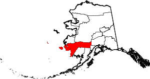 | |
| CDPs | ||
| Unincorporated communities | ||
| Ghost towns | ||
| Neighborhoods | ||