Pitchcott
Coordinates: 51°52′40″N 0°52′24″W / 51.8777°N 0.8733°W
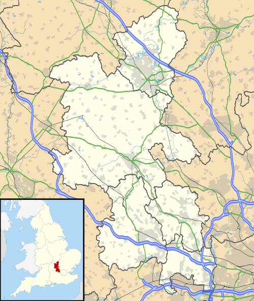
Pitchcott is a village and civil parish in the Aylesbury Vale district of Buckinghamshire, England. It is about 3 miles (5 km) northeast of Waddesdon, slightly less than 4 miles (6.4 km) south of Winslow and slightly more than 4 miles (6.4 km) north of Aylesbury. At the 2011 Census the population was included in the civil parish of Oving.
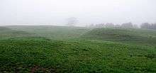
The parish is small, covering 925 acres (374 ha).[2] The highest point is Pitchcott Hill, about 510 feet (160 m) above sea level. The village is on the eastern brow of the hill, between about 445 feet (136 m) and 475 feet (145 m) above sea level.
Archaeology

A Roman road called Carter's Lane forms part of the parish's western boundary with Quainton.[3] There is some evidence of Roman occupation south of the village.[4]
Pitchcott is a shrunken village: around the surviving settlement, to the southeast and in other directions, are medieval house platforms and traces of tracks.[5] Southwest of the former parish church is a mound that may have been the base of a medieval windmill.[6] The parish also has good examples of ridge and furrow,[4] showing that in the Middle Ages some of the land now farmed as pasture used to be arable.
In 1927 only about 32 acres (13 ha) were arable and 887 acres (359 ha) was grassland.[2] A transition from arable farming to sheep pasture in previous centuries, aided by enclosure, may explain why Pitchcott village shrank.
Manor
The toponym is derived from the Old English for "cottage where pitch is stored". Pitchcott is not named in the Domesday Book of 1086 or in 12th-century records.[2] In 1225 the manor was one fee of the Honour of Wallingford.[2] In 1540 this was merged with the Honour of Ewelme in Oxfordshire, and the last mention of Pitchcott's overlordship dates from 1550.[2]
In 1225 Pitchcott's mesne lord was Roger Pipard and in 1284 it was held by Robert Pipard.[2] In the 14th century it passed to the Earls of Hereford and in 1377, four years after the death of Humphrey de Bohun, 7th Earl of Hereford it was held by his heirs in attachment to the manor of Great Haseley in Oxfordshire.[2] The 7th Earl died with no male heir, so Pitchcott passed via his elder daughter Eleanor de Bohun to his granddaughter Anne of Gloucester, who became married to Edmund Stafford, 5th Earl of Stafford.[2] The last known record of the mesne lordship is from 1400,[2] three years before Edmund Stafford died.
In 1225 Roger Pipard's tenant was Richard Vernon of Haddon, Derbyshire.[2] Both Haddon and Pitchcott remained in the Vernon family until Sir George Vernon died in 1566, leaving them to his daughter, Margaret Stanley.[2] In 1588 her son Edward mortgaged Pitchcott to Edward Saunders.[2] In the 17th century his granddaughter Elizabeth became married to Sir Walter Pye, and subsequently Pitchcott was held in moieties by the Pye and Saunders families until Thomas Saunders bought out the Pye moiety in 1773.[2] In 1831 a later Thomas Saunders died with no male heir and Pitchcott was divided between his two surviving sisters and two nieces.[2] In 1852 their representatives sold Pitchcott to Mayer Amschel de Rothschild, but in 1853 he exchanged it with Christ Church, Oxford for property at Mentmore. Christ Church still held Pitchcott in the 1920s.[2]
Pitchcott held a manorial court in the 15th and 16th centuries.[2]
Parish church
The 12th-century Church of England parish church of Saint Giles has been deconsecrated and converted to a private house, but the churchyard remains in use. Pitchcott is now part of the ecclesiastical parish of Oving with Pitchcott, for which the parish church is All Saints' in Oving, 1 mile (1.6 km) northeast of Pitchcott.
The oldest part of St Giles' is the nave, which is probably 12th-century.[7] The chancel was built in the first half of the 13th century, and its south wall retains its two original lancet windows.[2] The more easterly of the two windows has a low sill forming a sedile.[2] In the east jamb[8] of the westerly window was a 13th-century stone book-rest.[2] The priest's door on its south side of the chancel was inserted in about 1340.[2]
In the nave the present north doorway and the two south windows were inserted in the 15th century.[2] The north doorway is now blocked.[2] The west tower was added in the 15th century, and its upper stage was added or rebuilt in the 16th century.[2] A datestone states that the south porch was built or rebuilt in 1662.[2] The church was over-restored[8] in 1864.[2] The work included inserting two north windows in the nave to match the 15th-century south ones, and building a new chancel arch.[2] The chancel east window has 19th-century stained glass.
St Giles' has three bells in the tower and a sanctus bell.[2] The second bell is inscribed "Sent Luke Apostel, 1590" and may have been cast by Robert III Newcombe and Bartholomew Atton of Buckingham.[2] The other two bells were cast by the Chandler family of bell-founders of Drayton Parslow: the treble in 1686 by an unknown member of the family and the tenor by George Chandler in 1717.[2] St Giles' had two silver communion services: a paten and small chalice dating from 1569,[8] and an 1871 chalice with an 1884 paten.[2]
The ecclesiastical parish of St Giles was united with that of All Saints, Oving in 1902.[2] By the end of 1967 St Giles' had been deconsecrated and its fittings sold and dispersed.[9] The stone book-rest in the chancel was removed to All Saints', Oving. St Giles' was then converted into a private house. It is a Grade II* listed building.[9]
Economic history
A datestone records that Manor Farmhouse was built in 1657.[10] The house has been altered in the 18th century and subsequently, and now has an irregular L-shaped plan.[10] Lower Farmhouse is a symmetrical building dating from about 1830.[11]
A few barn conversions were made in 2007.
References
- ↑ "Area selected: Aylesbury Vale (Non-Metropolitan District)". Neighbourhood Statistics: Full Dataset View. Office for National Statistics. Retrieved 28 October 2013.
- 1 2 3 4 5 6 7 8 9 10 11 12 13 14 15 16 17 18 19 20 21 22 23 24 25 26 27 28 29 30 31 Page 1927, pp. 89–91
- ↑ Reed 1979, p. 46.
- 1 2 Pitchcott-Whitchurch Ridge 2008, p. 3.
- ↑ "Shrunken Village". Unlocking Buckinghamshire's Past. Buckinghamshire County Council. Retrieved 28 October 2013.
- ↑ "Windmill Mound". Unlocking Buckinghamshire's Past. Buckinghamshire County Council. Retrieved 28 October 2013.
- ↑ RCHME 1913, pp. 235–236.
- 1 2 3 Pevsner 1960, p. 224.
- 1 2 "Church of St Giles". National Heritage List for England. English Heritage. 21 December 1967. Retrieved 28 October 2013.
- 1 2 "Manor Farmhouse". National Heritage List for England. English Heritage. 29 January 1985. Retrieved 28 October 2013.
- ↑ "Lower Farmhouse". National Heritage List for England. English Heritage. 29 January 1985. Retrieved 28 October 2013.
Sources and further reading
- Bailey, K.A. (2001). "The Smallest Estates in Domesday Buckinghamshire". Records of Buckinghamshire. Aylesbury: Buckinghamshire Archaeological Society. 41: 233. ISSN 0967-2885.
- Chalkley, Barbara (1985). Three Deserted Villages in the Vale of Aylesbury: Burston, Moreton, Pitchcott. (unpublished document).
- Page, W.H., ed. (1927). A History of the County of Buckingham. Victoria County History. 4. pp. 89–91.
- Pevsner, Nikolaus (1960). Buckinghamshire. The Buildings of England. Harmondsworth: Penguin Books. p. 224. ISBN 0-14-071019-1.
- Pitchcott-Whitchurch Ridge (pdf). Landscape Character Type: LCT 9 Low Hills and Ridges. LCA 9.3. Aylesbury Vale District Council & Buckinghamshire County Council. 2008.
- Reed, Michael (1979). Hoskins, W.G.; Millward, Roy, eds. The Buckinghamshire Landscape. The Making of the English Landscape. London: Hodder & Stoughton. p. 46. ISBN 0-340-19044-2.
- RCHME (1913). An Inventory of the Historical Monuments in Buckinghamshire. 2 – North. London: Royal Commission on the Historical Monuments of England. pp. 235–236.
- Viney, E. (1991). "Buckinghamshire Churches in the Eighteen Forties". Records of Buckinghamshire. Aylesbury: Buckinghamshire Archaeological Society. 33: 81. ISSN 0967-2885.
| Wikimedia Commons has media related to Pitchcott. |
