Poundon
| Poundon | |
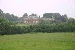 Poundon House |
|
 Poundon |
|
| Population | 114 (2011 Census)[1] |
|---|---|
| OS grid reference | SP645255 |
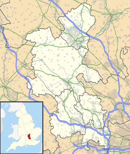
| District | Aylesbury Vale |
| Shire county | Buckinghamshire |
| Region | South East |
| Country | England |
| Sovereign state | United Kingdom |
| Post town | BICESTER |
| Postcode district | OX27 |
| Dialling code | 01869 |
| Police | Thames Valley |
| Fire | Buckinghamshire |
| Ambulance | South Central |
| EU Parliament | South East England |
| UK Parliament | Buckingham |
|
|
Coordinates: 51°55′29″N 1°03′34″W / 51.9246°N 1.0594°W
Poundon is a hamlet and a civil parish in Aylesbury Vale district in Buckinghamshire, England. It is located near the Oxfordshire border, about four miles northeast of Bicester, three miles southwest of Steeple Claydon.
The village name is Anglo Saxon in origin, though its meaning is uncertain. In manorial rolls of 1255 it was recorded as Paundon.
During the Second World War Poundon was the site of stations 53b and 53c of the Special Operations Executive (SOE). Just outside the village is Tower Hill Business Park. This used to be Poundon Hill Wireless Station, a FCO/MI6 signals intelligence station. [2] [3]
References
- ↑ Neighbourhood Statistics 2011 Census, Accessed 3 February 2013
- ↑ Turnbull, Alan (24 August 2006). ""Secret Bases" Part 1". Pagliacci Productions Limited. Retrieved 2006-08-30.
- ↑ "Get-a-map - Poundon Hill". Ordnance Survey. Retrieved 2006-08-30.

This article is issued from Wikipedia - version of the 11/26/2016. The text is available under the Creative Commons Attribution/Share Alike but additional terms may apply for the media files.