East Claydon
| East Claydon | |
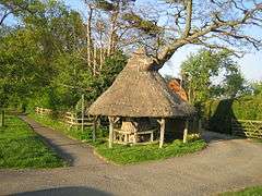 Thatched tree shelter in East Claydon |
|
 East Claydon |
|
| Population | 345 (2011 Census)[1] |
|---|---|
| OS grid reference | SP735255 |
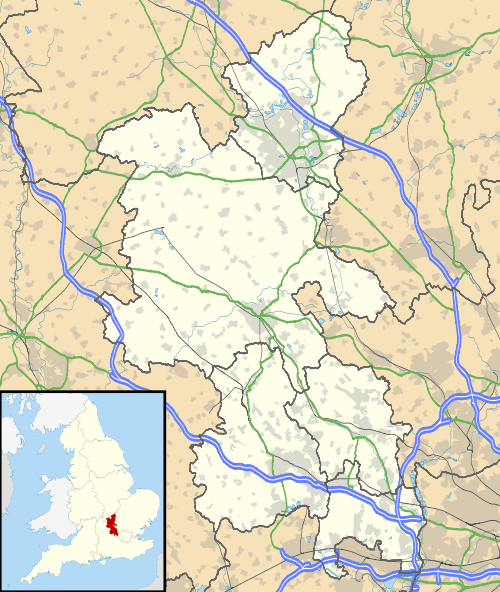
| District | Aylesbury Vale |
| Shire county | Buckinghamshire |
| Region | South East |
| Country | England |
| Sovereign state | United Kingdom |
| Post town | BUCKINGHAM |
| Postcode district | MK18 |
| Dialling code | 01296 |
| Police | Thames Valley |
| Fire | Buckinghamshire |
| Ambulance | South Central |
| EU Parliament | South East England |
| UK Parliament | Buckingham |
|
|
Coordinates: 51°55′27″N 0°55′44″W / 51.9241°N 0.9290°W
East Claydon is a village and is also a civil parish in the Aylesbury Vale district of Buckinghamshire, England. It is about 2 1⁄2 miles (4 km) miles south west of Winslow.
The village name 'Claydon' is Anglo Saxon in origin, and derives from the Old English: clægig + dun meaning 'clay hill'. The affix 'East' is used to differentiate the village from nearby Steeple Claydon and Middle Claydon, and from the hamlet of Botolph Claydon that lies within the parish of East Claydon.
The rural village of around 75 houses currently includes a primary school and a volunteer-run pub and also features a distinctive thatched tree with seating around the base. The village hall has a bell tower, the bell of which is known as 'the mushroom', in reference to its shape. This is also reflected in the name of the pub 'The Mushroom Club'.
The parish church dedicated to St Mary was demolished during the English Civil War by Cornelius Holland,[2][3] one of King Charles's judges, but was rebuilt after the restoration. The current structure is largely of 18th century design, but comprises components from various centuries, the earliest of which is the 13th century.
East Claydon School is a mixed, community, infant school, which takes children from the age of four through to the age of seven, when they generally move to a school in Steeple Claydon or Winslow. The school is quite small, with approximately thirty pupils.
References
- ↑ Neighbourhood Statistics 2011 Census, Accessed 3 February 2013
- ↑ "A Topographical Dictionary of England – Claydon, East (St. Mary)". British History Online. Retrieved 2012-08-16.
- ↑ "East Claydon – History & Descriptions". GENUKI. Retrieved 2007-08-10.
External links
![]() Media related to East Claydon at Wikimedia Commons
Media related to East Claydon at Wikimedia Commons
