Pind Kargu Khan
| Pind Kargo Khan | |
|---|---|
| Union council | |
|
Pind Kargo Khan is located in Abbottabad District | |
| Country |
|
| Province | Khyber-Pakhtunkhwa |
| District | Abbottabad |
| Tehsil | Abbottabad |
| Government | |
| • Nazim | Pir Khan Tanoli |
| • Naib Nazim | Sultan Muhammad Khan Tanoli |
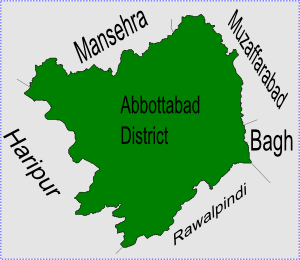
Pind Kargo Khan is one of the 51 union councils of Abbottabad District in Khyber-Pakhtunkhwa province of Pakistan[1] it is located 30 km from Abbottabad city.
People, culture and economy
The population of Pind Kargu Khan is over 20,000. The local language is Hindko. The main ethnic groups or tribes of this area are Tanolis and among them are also scattered some Awans and Syeds families. The local dress of the people is Shalwar/Qameez.
Pind Kargu Khan is an historical town, the huge forest of pine tree named Kohe-e-Balehana is located on the peak of Sando Gali, most of the residents are engaged with agriculture where the main crops are maze and wheat. A beautiful valley with the flower of Rose, Chamblali, Sunflower, Bunnaksha is covered by full greenery around it. The main streamlines of water supply goes from PK Khan to around all the Union Council and as well as to the Union Council of Sherwan. The main fruits are apricot, pomegranate, locate, peach, apple, and strawberry. The people of PK Khan are mostly engaged in transportation, farming, mining business and 55% of the population are related with the job outside PK Khan.
Upper and Lower Khalora village has a distinguished position in this union council because it is a beautiful valley surrounded by lash green mountains, beautiful landscape and is the gateway to neighbouring Union Council of Sherwan. The majority of the people of Khalora Upper and lower migrated to Karachi due to the better opportunities of employment which the government has been able to solve in Pind Kargu Khan and neighbouring areas.
Subdivisions
The Union Council is subdivided into the following areas: Bacha Kalan, Bacha Khurd, Bandi Nikra, Bareela, Barkot, Gandah, Haall Baloch, Pind, Habibabad,Hall Lakhala, Kanger Bala, Kangrora, Khalora Kalan, Khalora Khurd, Khanda Khoo, Lakhala, Pind Kargu Khan Shehar,Manna, Darrah, Karari, Besala,Charat,Maheerh, Sando Gali, Bagarian, Dakhain, rakran,Phohar, Ratta, Sari Sher Shah and Tandhara
- Jarral Shareef
- Jahanabad (Marora)
- Bacha Sani
- Bhajwal
- Gul Bandi
- Jabbi
- Kuthiala
- Kotnali
- Nakhey
References
External links
- on google maps
Coordinates: 34°00′00″N 73°00′00″E / 34.0000°N 73.0000°E