Abbottabad
| Abbottabad (Urdu: ایبٹ آباد) | |
|---|---|
| Abbottabad | |
|
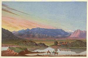
View of Abbottabad from Shimla Hill | |
 Abbottabad | |
| Coordinates: 34°9′21″N 73°13′10″E / 34.15583°N 73.21944°ECoordinates: 34°9′21″N 73°13′10″E / 34.15583°N 73.21944°E | |
| Country |
|
| Province |
|
| District | Abbottabad |
| Founded | 1863 |
| Elevation | 1,256 m (4,121 ft) |
| Population | |
| • Total | 1,430,238 |
| Time zone | PST (UTC+5) |
| Calling code | 0992 |
| Number of Union Councils | 6[1] |
| Website | http://www.abottabad.gov.pk |
| Abbottabad District Government | |

Abbottabad (/ˈæbətəbæd/ or /ˈɑːbtəbæd/) (Urdu, Hindko: ایبٹ آباد Aibṭ ābād [ɛːbʈaːˈbaːd̪]) is a city located in the Hazara region of Khyber Pakhtunkhwa province, in northeastern Pakistan. The city is situated in 110 kilometres (68 mi) north of the capital Islamabad, 130 kilometres (81 mi) from Rawalpindi and 150 kilometres (93 mi) northeast of Peshawar at an altitude of 1,260 metres (4,134 ft) and is the capital of the Abbottabad District. Kashmir lies to the east of the city.
The city is well known throughout Pakistan for its pleasant weather, high-standard educational institutions and for hosting the Pakistan Military Academy in Kakul. It remains a popular hill station attracting hundreds of thousands of tourists every year.
History
Abbottabad, was the headquarters of the Hazara District during British rule of the Indian Subcontinent. It was named after Major James Abbott who founded the town and district in January 1853[2] after the annexation of Punjab. He remained the first Deputy Commissioner of the Hazara district from 1849 until April 1853. Major Abbott is noted for having written a poem titled "Abbottabad", before he went back to Britain, in which he wrote of his fondness for the town and his sadness at having to leave it. In the early 20th century, Abbottabad became an important military cantonment and sanatorium, serving as the headquarters of a brigade in the Second Division of the Northern Army Corps.[3] The garrison consisted of four battalions of native infantry, of the Frontier Force (including the 5th Gurkha Rifles) and two native mountain batteries.[4]
In 1901, the population of the town and cantonment was 7,764[3] and the income averaged around Rs. 14,900. This increased to Rs. 22,300 in 1903, chiefly derived from octroi. During this time chief public institutions were built such as the Albert Victor unaided Anglo-Vernacular High School, the Municipal Anglo-Vernacular High School and the Government dispensary.[4] In 1911, the population had risen to 11,506 and the town also contained four battalions of Gurkhas.[5] In June 1948, the British Red Cross opened a hospital in Abbottabad to deal with thousands of patients who were being brought in from the Kashmir fighting areas.[6]

Recent history
In October 2005 Abbottabad was devastated by the Kashmir earthquake. Although most of Abbottabad survived, many older buildings were destroyed or severely damaged.[7] On 25 January 2011, Indonesian JI terrorist Umar Patek who was wanted in 2002 Bali bombings as well as a series of 2000 church bombings was arrested in Abbottabad.[8][9]
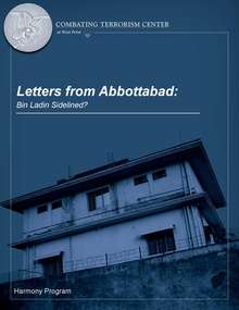
In May 2011, Abbottabad gained worldwide attention when U.S. President Barack Obama announced that Osama bin Laden had been killed in his compound in the city.[10][11] In February 2012, nine months after bin Laden was killed, Pakistani authorities demolished the compound where Osama bin Laden had lived for years.[12][13]
Geography

The city is bounded at all four sides by the Sarban hills, from which residents and tourists can see breathtaking views of the region and city. The location of the city and the hills allows Abbottabad to experience pleasant weather in the summer and cold winters. The Dor river flows south of Abbottabad through the town of Harnol, eventually reaching Tarbela Dam, situated west of Abbottabad. Neighbouring districts are Mansehra to the north, Muzaffarabad to the east, Haripur to the west and Islamabad Capital Territory to the south.
Topography
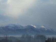
Abbottabad is situated in the Orash Valley lying between 34°92′N latitude and 73°13′E longitude at an altitude of 4,120 feet (1,260 m). To the north is the picturesque Kaghan Valley.[2]
Climate
Abbottabad has a humid subtropical climate, with mild to warm temperatures during the spring and autumn months, hot temperatures during June and July, and cool to mild temperatures during the winter. The temperature can rise as high as 38 °C (100 °F) during the mid-summer months and drop below −5 °C (23 °F) during the extreme cold waves. Snowfall occurs occasionally in December and January, though it is sparse, while the heavy rainfall events occurs during the monsoon season stretching from July to September that frequently cause flooding in lower lying parts of the city.
| Climate data for Abbottabad, Pakistan | |||||||||||||
|---|---|---|---|---|---|---|---|---|---|---|---|---|---|
| Month | Jan | Feb | Mar | Apr | May | Jun | Jul | Aug | Sep | Oct | Nov | Dec | Year |
| Average high °C (°F) | 12 (54) |
14 (57) |
18 (64) |
23 (73) |
28 (82) |
33 (91) |
30 (86) |
28 (82) |
28 (82) |
25 (77) |
20 (68) |
15 (59) |
22 (72) |
| Average low °C (°F) | 2 (36) |
4 (39) |
8 (46) |
12 (54) |
16 (61) |
20 (68) |
20 (68) |
18 (64) |
17 (63) |
13 (55) |
8 (46) |
4 (39) |
11 (52) |
| Average precipitation mm (inches) | 73 (2.87) |
103 (4.06) |
123 (4.84) |
104 (4.09) |
73 (2.87) |
77 (3.03) |
247 (9.72) |
244 (9.61) |
96 (3.78) |
51 (2.01) |
31 (1.22) |
47 (1.85) |
1,269 (49.95) |
| Source: Weatherbase[14] | |||||||||||||
Language
According to the 1998 Census of the 881,000 who resided in the Abbottabad District, Hindko, a dialect of Punjabi, was spoken by 94.26% of the population, followed by other Punjabi dialects at 2.30%, Pashto at 2.22% and Urdu at 1.05%.[15] Urdu is understood and spoken fluently by majority of the residents and used in markets, offices and formal functions as the official language. English is widely used in business and education.
| Rank | Language | Dialect | 1998 census[15] |
|---|---|---|---|
| 1 | Punjabi | Hindko dialect | 94.26% |
| 2 | Other Punjabi dialects | 2.30% | |
| 3 | Pashto | — | 2.22% |
| 4 | Urdu | — | 1.05% |
| 5 | Others | — | ~0.17%[16] |
Government
Abbottabad is the headquarters of Hazara Division and Abbottabad District. The District Nazim, Commissioner, Deputy Inspector General of police and Forest Conservator, all reside in Abbottabad. The city is divided into localities, towns, colonies and neighbourhoods. In addition to the civil administration, the town is also the regimental headquarters for the Frontier Force Regiment, the Baloch Regiment and Pakistan Army Medical Corps and Kakul Military Academy is also located in Abbottabad.
Economy
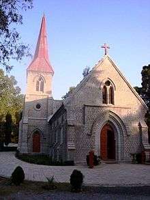
Abbottabad's economy is largely based on tourism. It is known for its shady gardens, church bells and wide streets in the Old Cantonment which evoke the British colonial era.
Tourism


Abbottabad has been attracting tourists to the city since the colonial era, as it is a major transit point to all major tourist regions of Pakistan such as Nathiagali, Ayubia and Naran. According to the Imperial Gazetteer of India, "the town is picturesquely situated at the southern corner of the Rash (Orash) plain, 4,120 feet (1,260 m) above the sea".[4]
Like much of the mountainous Northern Areas, tourism is an important source of income in Abbottabad. In the summer when temperatures rise to around 45 degrees Celsius in Punjab and Khyber Pakhtunkhwa, a large number of tourists travel to Abbottabad. The Karakoram Highway, which traces one of the paths of the ancient Silk Road, starts from Hasan Abdal on the N5 and heads north passing through the city, eventually reaching Khunjerab Pass. The Karakorum Highway is a major attraction itself for its views. The Karakoram, Himalayas and the Hindu Kush ranges can be approached from Abbottabad and it continues to be a transit city for tourists, serving as a base for visiting numerous nearby places, such as Hunza, Gilgit, Skardu and Indus Kohistan, of the Karakoram Range.[18]
Abbottabad is popular not just with visitors but with those looking to relocate. Its weather, peaceful reputation and the perceived security of a garrison have drawn many from other cities to work or educate their children. There was an influx of migrants from Azad Kashmir after the 2005 Kashmir Earthquake, another from the Swat District during military operations against militants in 2009 and 2010, and also from Waziristan after the army launched major operations against the Taliban in 2009.[19] There is an under construction £19m amusement park in the city located on a 50-acre site is includes a zoo, adventure sports facilities, restaurants and artificial waterfalls.[20]
Some popular tourist destinations in and around Abbottabad include:
- Ayubia National Park
- Bara Gali
- Dor River Valley (at Harnoi/Harnol)
- Dunga Gali
- Harnoi
- Ilyasi Mosque
- Khaira Gali
- Nathia Gali
- Shimla Hill
- Thandiani
- Kukmang
- Raees Khana Bazar
- Sangimaira/Tharyati
- Barra Hottar
- Boi-Marhes
- Kunhar River Spot-Boi
- Boi Bazar-Kashmir-Point
Mandian
Mandian is the northern part of Abbottabad city. The population of this area is 100,000. The word Mandian means fruit or vegetable markets: it is a center of commerce with markets and businesses. Today Mandian is a busy hub of the city.
Mandian is also known as Missile Chowk, because a Ghori Missile is installed there.
Many renowned schools and colleges are in Mandian like Brook Montessori and School System, Government Postgraduate College Mandian, Army Burn Hall College, Wisdom House Public School,Pakistan International Public School and College (PIPS) and Khyber Pakhtunkhwa University of Engineering & Technology Abbottabad Campus. Ayub Medical College and COMSAT Institute of Information Technology Abbottabad campus is situated 1 km away in the north from Mandian on main Karakoram Highway in Mirpur and Abbottabad Public School,Abbottabad International Medical College and Frontier Medical College is 5 km away on the same karakoram highway from Mandian,in the northern end of Abbottabad city.
Mandian has a small industrial estate, which promotes medium- and small-scale industries and provides employment to hundreds of people.
Education

Abbottabad has one of the country's highest literacy rates with 67% in 2007, and 87% in 2011 ranking first in Khyber Pakhtunkhwa and second overall in Pakistan(proof). The city also has a young demographic (ages 15–30) due to a large number of students who have come from across the country to study in its schools, for example PIPS, Army Burn Hall College, Army Public College and Abbottabad Public School. The city has a wide variety of post-secondary institutions, such as Ayub Medical College, Frontier Medical College, COMSATS University of Science and Technology, and the University of Engineering & Technology.
Abbottabad is also home to the Pakistan Military Academy, a four-year coeducational federal service military academy that provides training to the officers of the Pakistan Army.[21] The academy has three training battalions, and 12 companies. Another 2,000 guests each year, from over 34 countries, receive some training at PMA.
According to the Alif Ailaan Pakistan District Education Rankings 2014, Abbottabad is ranked 37 out of 146 districts in Pakistan in terms of the quality of education. For facilities and infrastructure, the district is ranked 67 out of 146. [22] A detailed picture of the district’s education performance is also available online. [23]
Media
Electronic and Print media is actively playing its role in Abbottabad. Cable Net Hazara is the largest cable operators of the region providing Pakistani channels to the masses. Kay 2 TV is the Hindko channel of the area.
There are different daily newspapers published in Abbottabad. Some of the newspapers are Roznama AAJ, Roznama Shamal, Kay 2 Times, Roznama Pine, Weekly Manzar and the Hindko newspaper Chaita. The Daily Mahasib, published since 1997, is a local newspaper of the city.[24]
With the boom of social media websites like HCP[25] are also active in providing news to people of the region and is the first online portal of the Hazara Division.
Sports
The Abbottabad Falcons are the professional cricket team of Abbottabad plays in the national Twenty 20 and List A cricket tournaments. Apart from cricket, field hockey and taekwondo are the other popular sports here. Sports facilities in the city include:
- Abbottabad Cricket Stadium
- Abbottabad Hockey Stadium
- Jalal Baba Cricket Stadium Malik Pura.
- Abasin Karate & Martial Arts Training Center
- Jansher Khan Squash Complex.
- AMC-PCB Ground.
- Kunj Football Stadium.
- Nawanshehr Football Ground.
- Dhamtour Football Ground.
- Banda Lamba Football Ground.
- Kakul Ground.
- Barrahottar Cricket Stadium.
Transportation
Abbottabad's main public transport consists of modified Taxis, Carry pick-up vans Suzukis, which can accommodate anywhere from 1 to 14 people at one time. Taxis are also available as well as wagons that connect Abbottabad to the surrounding cities and towns (ex. Nawanshahr, Nathiagali, Sherwan, Dhamtour, Haripur, Mansehra) in the region. Abbottabad is also served by Daewoo Express and Niazi Express, the NATCO, Skyways and many other bus services. Pakistan Railways does not serve Abbottabad, however a PR Reservation Office is located in Fawara Chowk in the city centre. The nearest railway station is located in Havelian, which is the last and most northern station on the Pakistan Railway network. The station is approximately thirty minutes drive south from Abbottabad city centre.
See also
- 5th Royal Gurkha Rifles
- Abbottabad, poem
- Army Burn Hall College
- Army Public College PMA Kakul
- Ayub Medical College
- Frontier Medical College
- Old Christian Cemetery, Abbottabad
- St. Luke's Church, Abbottabad
- Pakistan International Public School and College (PIPS)
References
- ↑ "URL accessed 5 April 2006". Nrb.gov.pk. 28 October 2005. Retrieved 28 January 2012.
- 1 2 "Abbottabad". Encyclopedia Britannica. I: A-Ak - Bayes (15th ed.). Chicago, IL: Encyclopedia Britannica, Inc. 2010. p. 13. ISBN 978-1-59339-837-8.
- 1 2 Abbottabad – Encyclopædia Britannica Eleventh Edition
- 1 2 3 "Abbottabad Town – Imperial Gazetteer of India, v. 5, p. 1". Dsal.uchicago.edu. Archived from the original on 7 June 2011. Retrieved 2 May 2011.
- ↑ "The Project Gutenberg eBook, The Panjab, North-West Frontier Province, and Kashmir, by Sir James McCrone Douie". Gutenberg.org. Retrieved 2 May 2011.
- ↑ "Partition of India and Pakistan 1947 – British Red Cross". Redcross.org.uk. Retrieved 2 May 2011.
- ↑ "Doctor's diary". BBC News. 14 October 2005. Retrieved 2 May 2011.
- ↑ "Bali bombing suspect Umar Patek 'arrested in Pakistan'". BBC News online. 30 September 2011. Retrieved 30 September 2011.
- ↑ "Militant's road ends in Pakistan". Dawn. 15 April 2011. Retrieved 4 May 2011.
- ↑ L. Meckler, A. Entous and Z. Hussain (1 May 2011). "U.S. Forces Kill Osama bin Laden Obama Says Sept. 11 Attacks Avenged in Commando Assault on Pakistani Compound; Body of Terror Mastermind Captured". The Wall Street Journal.
- ↑ Adams, Richard; Walsh, Declan; MacAskill, Ewen (2 May 2011). "Osama bin Laden is dead, Obama announces". The Guardian. UK. Archived from the original on 2 May 2011. Retrieved 2 May 2011.
- ↑ Gordts, Eline (27 February 2012). "Osama Bin Laden's House In Abbottabad Destroyed". Huffington Post. Retrieved 27 February 2012.
- ↑ Meredith Melnick (4 May 2011). "Abbottabad, a Hotspot for Medical Care". Time.
- ↑ "Weatherbase: Historical Weather for Abbottabad, Pakistan". Weatherbase. 2009.
- 1 2 "People Of District Abbottabad – Language". Replay.web.archive.org. 21 February 2008. Archived from the original on 21 February 2008. Retrieved 28 January 2012.
- ↑ Calculated by subtracting the other percentages.
- ↑ "Harnoi — gateway to Galyat". The Express Tribune. Muhammad Sadaqat. Retrieved 7 June 2015.
- ↑ "sdnpk.org". sdnpk.org. Archived from the original on 21 January 2009.
- ↑ "Hopes for bumper tourist season in Abbottabad". Dawn.Com. AFP. 15 May 2011. Retrieved 28 January 2012.
- ↑ "Bin Laden Town Abbottabad Plans Theme Park". Sky News.
- ↑ "Pakistan Military Academy – Cadets Training". Pakistanarmy.gov.pk. 25 January 1948. Retrieved 3 May 2011.
- ↑ "Alif Ailaan Pakistan District Education Rankings, 2014" (PDF). Alif Ailaan. Retrieved 2014-05-06.
- ↑ "Individual district profile link, 2014" (PDF). Alif Ailaan. Retrieved 2014-05-06.
- ↑ "Daily Mahasib Edition Online E-Paper". mahasib.com.pk.
- ↑ Hazara.com.pk
External links
| Wikisource has the text of the 1911 Encyclopædia Britannica article Abbottabad. |
| Wikimedia Commons has media related to Abbottabad. |
| Wikivoyage has a travel guide for Abbottabad. |