Pence (CDP), Wisconsin
| Pence, Wisconsin | |
|---|---|
| Census-designated place | |
|
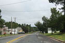
Looking east in downtown Pence | |
_highlighted.svg.png) Location in Iron County and the state of Wisconsin. | |
| Coordinates: 46°24′55″N 90°16′18″W / 46.41528°N 90.27167°WCoordinates: 46°24′55″N 90°16′18″W / 46.41528°N 90.27167°W | |
| Country | United States |
| State | Wisconsin |
| County | Iron |
| Area | |
| • Total | 1.068 sq mi (2.77 km2) |
| • Land | 1.068 sq mi (2.77 km2) |
| • Water | 0 sq mi (0 km2) |
| Elevation | 1,631 ft (497 m) |
| Population (2010) | |
| • Total | 131 |
| • Density | 120/sq mi (47/km2) |
| Time zone | Central (CST) (UTC-6) |
| • Summer (DST) | CDT (UTC-5) |
| Area code(s) | 715 & 534 |
| GNIS feature ID | 1571168[1] |
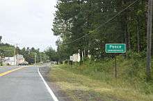
Sign for Pence on WIS77
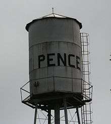
Water tower
Pence is an unincorporated census-designated place located in the town of Pence, Iron County, Wisconsin, United States. Pence is located on Wisconsin Highway 77 1.5 miles (2.4 km) southwest of Montreal. As of the 2010 census, its population is 131.[2]
References
| Wikimedia Commons has media related to Pence, Wisconsin. |
Municipalities and communities of Iron County, Wisconsin, United States | ||
|---|---|---|
| Cities | 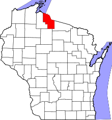 | |
| Towns | ||
| CDPs | ||
| Unincorporated communities | ||
| Indian reservations | ||
| Footnotes | ‡This populated place also has portions in an adjacent county or counties | |
This article is issued from Wikipedia - version of the 9/4/2016. The text is available under the Creative Commons Attribution/Share Alike but additional terms may apply for the media files.