Iron Belt, Wisconsin
| Iron Belt, Wisconsin | |
|---|---|
| Census-designated place | |
|
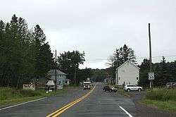
Looking east at downtown Iron Belt on WIS77 | |
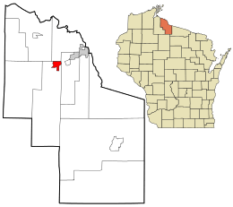 Location in Iron County and the state of Wisconsin. | |
| Coordinates: 46°24′02″N 90°19′28″W / 46.40056°N 90.32444°WCoordinates: 46°24′02″N 90°19′28″W / 46.40056°N 90.32444°W | |
| Country | United States |
| State | Wisconsin |
| County | Iron |
| Area | |
| • Total | 2.451 sq mi (6.35 km2) |
| • Land | 2.451 sq mi (6.35 km2) |
| • Water | 0 sq mi (0 km2) |
| Elevation | 1,555 ft (474 m) |
| Population (2010) | |
| • Total | 173 |
| • Density | 71/sq mi (27/km2) |
| Time zone | Central (CST) (UTC-6) |
| • Summer (DST) | CDT (UTC-5) |
| ZIP code | 54536 |
| Area code(s) | 715 & 534 |
| GNIS feature ID | 1566963[1] |

Sign on WIS77
Iron Belt is an unincorporated census-designated place located in Iron County, Wisconsin, United States. Iron Belt is located on Wisconsin Highway 77 southwest of Montreal, in the town of Knight. Iron Belt has a post office with ZIP code 54536.[2] As of the 2010 census, its population was 173.[3]
References
Municipalities and communities of Iron County, Wisconsin, United States | ||
|---|---|---|
| Cities | 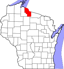 | |
| Towns | ||
| CDPs | ||
| Unincorporated communities | ||
| Indian reservations | ||
| Footnotes | ‡This populated place also has portions in an adjacent county or counties | |
This article is issued from Wikipedia - version of the 9/4/2016. The text is available under the Creative Commons Attribution/Share Alike but additional terms may apply for the media files.