Park Site (36LA96)
|
Park Site 36La96 | |
|
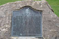
Plaque in Central Park | |
  | |
| Location | On a knoll in Central Park, midway between the Conestoga River and Mill Creek, West Lampeter Township, Pennsylvania |
|---|---|
| Coordinates | 40°01′7.07″N 76°17′3.67″W / 40.0186306°N 76.2843528°WCoordinates: 40°01′7.07″N 76°17′3.67″W / 40.0186306°N 76.2843528°W |
| Area | 4.4 acres (1.8 ha) |
| NRHP Reference # | 85000698[1] |
| Added to NRHP | April 4, 1985 |
The Park Site, designated 36LA96, is a historic archaeological site located in West Lampeter Township, Lancaster County, Pennsylvania, just south of the city of Lancaster. The site was excavated and assessed in 1979. The site features a Susquehannock burial site dated to the early 18th century and European-made artifacts.[2]
In 1985, it was listed on the National Register of Historic Places as "Park Site 36La96".[1] A plaque is posted on the site, and several artifacts are displayed at the park's Environmental Center.[3]
References
- 1 2 National Park Service (2010-07-09). "National Register Information System". National Register of Historic Places. National Park Service.
- ↑ "National Historic Landmarks & National Register of Historic Places in Pennsylvania" (Searchable database). CRGIS: Cultural Resources Geographic Information System. Note: This includes W. Fred Kinsey (July 1982). "National Register of Historic Places Inventory Nomination Form: Park Site 36La96" (PDF). Retrieved 2012-02-18.
- ↑ "Central Park". Lancaster county Department of Parks and Recreation. Retrieved November 15, 2012.
| Topics |   | |
|---|---|---|
| Lists by county |
| |
| Lists by city | ||
| Other lists | ||
| ||
This article is issued from Wikipedia - version of the 11/29/2016. The text is available under the Creative Commons Attribution/Share Alike but additional terms may apply for the media files.