| [3] |
Name on the Register |
Image |
Date listed[4] |
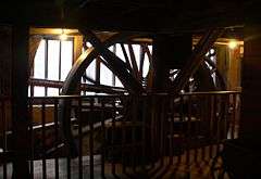
Location |
City or town |
Description |
|---|
| 1 |
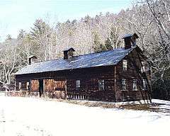
Brodhead Farm |
|
000000001979-07-23-0000July 23, 1979
(#79000242) |
Northeast of Bushkill on U.S. Route 209
41°08′59″N 74°55′12″W / 41.149722°N 74.92°W / 41.149722; -74.92 (Brodhead Farm) |
Lehman Township |
|
| 2 |
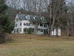
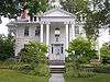
Callahan House |
|
000000001979-07-23-0000July 23, 1979
(#79000244) |
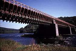
U.S. Route 209, south of Milford
41°19′00″N 74°48′01″W / 41.316667°N 74.800278°W / 41.316667; -74.800278 (Callahan House) |
Dingman Township |
|
| 3 |
D & H Canal Co. Office |
|
000000001993-08-09-0000August 9, 1993
(#93000715) |
Northwestern side of Scenic Drive in Lackawaxen
41°29′01″N 74°59′13″W / 41.483611°N 74.986944°W / 41.483611; -74.986944 (D & H Canal Co. Office) |
Lackawaxen Township |
Intact 1855 house built as local office for canal; now used as bed and breakfast
|
| 4 |
Delaware and Hudson Canal |
|
000000001968-11-24-0000November 24, 1968
(#68000051) |
Delaware and Hudson Canal
41°28′56″N 74°59′09″W / 41.482222°N 74.985833°W / 41.482222; -74.985833 (Delaware and Hudson Canal) |
Lackawaxen Township |
Extends into Wayne County
|
| 5 |
Delaware Aqueduct |
|
000000001968-11-24-0000November 24, 1968
(#68000055) |
Between Minisink Ford, New York and Lackawaxen
41°28′57″N 74°59′06″W / 41.482500°N 74.985000°W / 41.482500; -74.985000 (Delaware Aqueduct) |
Lackawaxen Township |
|
| 6 |
Dingman's Ferry Dutch Reformed Church |
|
000000001979-07-23-0000July 23, 1979
(#79000241) |
U.S. Route 209 in Dingman's Ferry
41°13′32″N 74°52′10″W / 41.225556°N 74.869444°W / 41.225556; -74.869444 (Dingman's Ferry Dutch Reformed Church) |
Delaware Township |
|
| 7 |
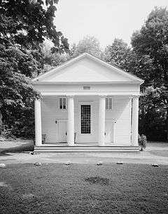
Forester's Hall |
|
000000001983-07-14-0000July 14, 1983
(#83002282) |
Broad and Hartford Streets
41°19′21″N 74°48′14″W / 41.3225°N 74.803889°W / 41.3225; -74.803889 (Forester's Hall) |
Milford |
|
| 8 |
Jervis Gordon Grist Mill Historic District |
|
000000001985-12-26-0000December 26, 1985
(#85003163) |
Water, Mill, and Seventh Streets
41°19′26″N 74°48′40″W / 41.323889°N 74.811111°W / 41.323889; -74.811111 (Jervis Gordon Grist Mill Historic District) |
Milford |
|
| 9 |
Zane Grey House |
|
000000001983-05-06-0000May 6, 1983
(#83002283) |
Roebling Road in Lackawaxen; also 135 Lackawaxen Scenic Dr.
41°29′08″N 74°59′16″W / 41.485556°N 74.987778°W / 41.485556; -74.987778 (Zane Grey House) |
Lackawaxen Township |
Self-designed 1905–18 home of the novelist; wrote Riders of the Purple Sage here. Now museum run by the National Park Service. Scenic Drive represents a boundaries increase of 000000002011-04-29-0000April 29, 2011
|
| 10 |
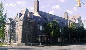
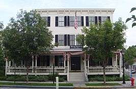
Hotel Fauchere and Annex |
|
000000001980-08-29-0000August 29, 1980
(#80003626) |
401 and 403 Broad Street
41°19′25″N 74°48′05″W / 41.323611°N 74.801389°W / 41.323611; -74.801389 (Hotel Fauchere and Annex) |
Milford |
|
| 11 |
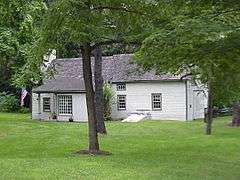
Lord House |
|
000000001980-06-30-0000June 30, 1980
(#80003625) |
Pennsylvania Route 739 at Lords Valley
41°22′04″N 75°03′49″W / 41.367778°N 75.063611°W / 41.367778; -75.063611 (Lord House) |
Blooming Grove Township |
|
| 12 |
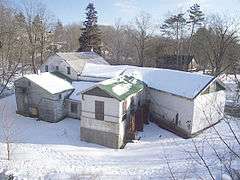
Metz Ice Plant |
|
000000002007-11-19-0000November 19, 2007
(#07001206) |
Harford Street
41°19′02″N 74°47′59″W / 41.317222°N 74.799722°W / 41.317222; -74.799722 (Metz Ice Plant) |
Milford |
|
| 13 |
Milford Historic District |
|
000000001998-07-23-0000July 23, 1998
(#98000898) |
Roughly along Broad, Harford, Ann, Catharine, High, and Fourth Streets
41°19′23″N 74°48′08″W / 41.323056°N 74.802222°W / 41.323056; -74.802222 (Milford Historic District) |
Milford |
|
| 14 |
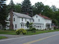
Mill Rift Hall |
|
000000001993-08-09-0000August 9, 1993
(#93000714) |
Bluestone Boulevard
41°24′42″N 74°44′45″W / 41.411667°N 74.745833°W / 41.411667; -74.745833 (Mill Rift Hall) |
Westfall Township |
|
| 15 |
Minisink Archeological Site |
|
000000001993-04-19-0000April 19, 1993
(#93000608) |
In the vicinity of Minisink Island[5]
41°17′26″N 74°49′44″W / 41.2906°N 74.829°W / 41.2906; -74.829 (Minisink Archeological Site) |
Dingman Township |
Extends into Sussex County, New Jersey
|
| 16 |
Nearpass House |
|
000000001993-08-19-0000August 19, 1993
(#93000849) |
Cemetery Road
41°25′07″N 74°44′30″W / 41.418611°N 74.741667°W / 41.418611; -74.741667 (Nearpass House) |
Westfall Township |
|
| 17 |
Nyce Farm |
|
000000001979-07-23-0000July 23, 1979
(#79000240) |
Northwest of Bushkill on U.S. Route 209
41°08′24″N 74°55′50″W / 41.14°N 74.930556°W / 41.14; -74.930556 (Nyce Farm) |
Lehman Township |
|
| 18 |
Paupack School |
Upload image |
000000002016-08-29-0000August 29, 2016
(#16000573) |
545 PA 507
41°24′28″N 75°13′38″W / 41.407639°N 75.227322°W / 41.407639; -75.227322 (Paupack School) |
Palmyra Township |
|
| 19 |
Peters House |
|
000000001979-08-24-0000August 24, 1979
(#79000239) |
U.S. Route 209 in Bushkill
41°05′36″N 75°00′08″W / 41.093333°N 75.002222°W / 41.093333; -75.002222 (Peters House) |
Lehman Township |
|
| 20 |
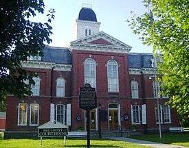
Pike County Courthouse |
|
000000001979-07-23-0000July 23, 1979
(#79002340) |
Broad and High Streets
41°19′28″N 74°48′04″W / 41.324444°N 74.801111°W / 41.324444; -74.801111 (Pike County Courthouse) |
Milford |
|
| 21 |
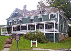
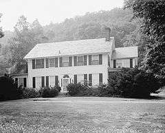
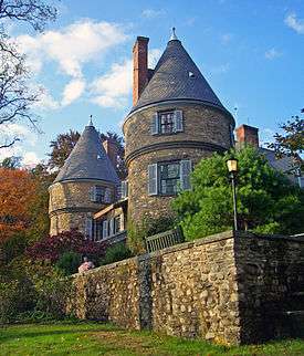
Gifford Pinchot House |
|
000000001966-10-15-0000October 15, 1966
(#66000694) |
Western edge of Milford
41°19′46″N 74°49′10″W / 41.329444°N 74.819444°W / 41.329444; -74.819444 (Gifford Pinchot House) |
Dingman Township |
Family home of Gifford Pinchot, founder of U.S. Forest Service, is only National Historic Site run by that agency. Also home to Pinchot Institute
|
| 22 |
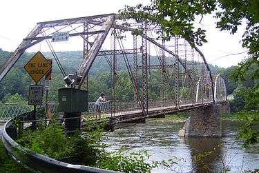
Pond Eddy Bridge |
|
000000001988-11-14-0000November 14, 1988
(#88002170) |
Quadrant Route 1011 over the Delaware River at Pond Eddy
41°26′21″N 74°49′13″W / 41.439167°N 74.820278°W / 41.439167; -74.820278 (Pond Eddy Bridge) |
Shohola Township |
Extends into Sullivan County, New York
|
| 23 |
Promised Land State Park-Bear Wallow Cabins |
|
000000001987-02-11-0000February 11, 1987
(#87000048) |
10 miles (16 km) north of Canadensis on Pennsylvania Route 390
41°19′10″N 75°12′46″W / 41.319444°N 75.212778°W / 41.319444; -75.212778 (Promised Land State Park-Bear Wallow Cabins) |
Palmyra Township |
|
| 24 |
Promised Land State Park-Whittaker Lodge District |
|
000000001987-02-11-0000February 11, 1987
(#87000047) |
10 miles (16 km) north of Canadensis on Pennsylvania Route 390
41°18′44″N 75°11′29″W / 41.312222°N 75.191389°W / 41.312222; -75.191389 (Promised Land State Park-Whittaker Lodge District) |
Palmyra Township |
|
| 25 |
Shohola Glen Hotel |
|
000000001997-03-28-0000March 28, 1997
(#97000288) |
100 Rohman Road
41°28′29″N 74°54′55″W / 41.474722°N 74.915278°W / 41.474722; -74.915278 (Shohola Glen Hotel) |
Shohola Township |
|
| 26 |
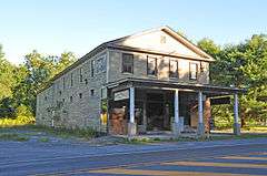
Turn Store and the Tinsmith's Shop |
|
000000001978-09-18-0000September 18, 1978
(#78000260) |
U.S. Route 209 in Bushkill
41°05′32″N 75°00′11″W / 41.092222°N 75.003056°W / 41.092222; -75.003056 (Turn Store and the Tinsmith's Shop) |
Lehman Township |
|
| 27 |
Marie Zimmermann Farm |
|
000000001979-11-01-0000November 1, 1979
(#79000243) |
Southwest of Milford on U.S. Route 209
41°15′07″N 74°51′30″W / 41.251944°N 74.858333°W / 41.251944; -74.858333 (Marie Zimmermann Farm) |
Delaware Township |
|


.JPG)
.JPG)
.JPG)
.JPG)
.JPG)
.JPG)