Oshrat
"Asherat" redirects here. For the place in Chitral District, Pakistan, see Ashret.
| Oshrat אָשְׁרַת | |
|---|---|
| Hebrew transcription(s) | |
| • official | Asherat |
 Oshrat | |
| Coordinates: 32°58′17.76″N 35°9′19.44″E / 32.9716000°N 35.1554000°ECoordinates: 32°58′17.76″N 35°9′19.44″E / 32.9716000°N 35.1554000°E | |
| Council | Mateh Asher |
| Affiliation | HaMerkaz HaHakla'i |
| Founded | 1983 |
| Population (2015)[1] | 512 |
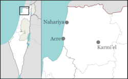
Oshrat (Hebrew: אָשְׁרַת) is a communal settlement in northern Israel. Located to the south-east of Nahariya and just north of Kafr Yasif, it falls under the jurisdiction of Mateh Asher Regional Council. In 2015 it had a population of 512.
The village was established in 1983 as an expansion of moshav Amka.
Etymology
Oshrat is a variation of the word Asher, the tribe on the lands of which the village stands. The founders used the word construction of Biblical names like Osnat, Tzafnat, etc.[2]
References
- ↑ "List of localities, in Alphabetical order" (PDF). Israel Central Bureau of Statistics. Retrieved 16 October 2016.
- ↑ HaReuveni, Immanuel (1999). Lexicon of the Land of Israel (in Hebrew). Miskal - Yedioth Ahronoth Books and Chemed Books. p. 71. ISBN 965-448-413-7.
This article is issued from Wikipedia - version of the 11/18/2015. The text is available under the Creative Commons Attribution/Share Alike but additional terms may apply for the media files.