Kfar Masaryk
| Kfar Masaryk כְּפַר מַסָּרִיק | |
|---|---|
|
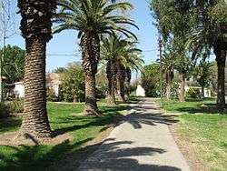
Kfar Masaryk in February, 2008. | |
 Kfar Masaryk | |
| Coordinates: 32°53′26.87″N 35°5′58.91″E / 32.8907972°N 35.0996972°ECoordinates: 32°53′26.87″N 35°5′58.91″E / 32.8907972°N 35.0996972°E | |
| District | Northern |
| Council | Mateh Asher |
| Affiliation | Kibbutz Movement |
| Founded | 29 November 1938 |
| Founded by | Eastern European Jews |
| Population (2015)[1] | 780 |
| Name meaning | Masaryk Village |
| Website | www.kfar-masaryk.org.il |
Kfar Masaryk (Hebrew: כְּפַר מַסָּרִיק, lit. Masaryk Village) is a kibbutz in northern Israel.[2][3] Located in the western Galilee near the Belus River and south of Acre, it falls under the jurisdiction of Mateh Asher Regional Council. In 2015 it had a population of 780.
History

The founders were immigrants from Czechoslovakia and Lithuania who settled in Petah Tikva in 1932. The following year they formed Kibbutz Czecho-Lita and moved to Bat Galim in Haifa. In 1934 they moved to an area of sand dunes near Kiryat Haim and changed the name of the group to "Mishmar Zevulun" (Guard of the Zevulun).[4] In 1937 they were joined by a group of Polish immigrants who were members of Hayotzer.
Despite opposition from the Jewish Agency, who reasoned that the sandy soil could not support agriculture, Mishmar Zevulun was established on 29 November 1938 as the 29th tower and stockade settlement. In 1940 the kibbutz moved to its present site and was renamed Kfar Masaryk after Tomáš Garrigue Masaryk, the first President of Czechoslovakia.[5]
Economy
The kibbutz grows cotton, tomatoes and avocados; breeds cattle, poultry and carp; and operates paper and cardboard box factories. It also manufacturers electronic devices.[6]
See also
References
- ↑ "List of localities, in Alphabetical order" (PDF). Israel Central Bureau of Statistics. Retrieved 16 October 2016.
- ↑ "Kfar Masaryk". Kibbutzimofisrael.netzah.org.
- ↑ "Kefar Masaryk Map — Satellite Images of Kefar Masaryk". Maplandia.com.
- ↑ Naaman factory: Settlement's building blocks
- ↑ A History of Czechs and Jews: A Slavic Jerusalem, Martin Wein
- ↑ Intensifying of the cooperation with kibbutz Kfar Masaryk