Netiv HaShayara
| Netiv HaShayara נְתִיב הַשַּׁיָּרָה | |
|---|---|
| Hebrew transcription(s) | |
| • unofficial | Nativ HaShayara |
 Netiv HaShayara | |
| Coordinates: 32°59′40.92″N 35°8′12.48″E / 32.9947000°N 35.1368000°ECoordinates: 32°59′40.92″N 35°8′12.48″E / 32.9947000°N 35.1368000°E | |
| District | Northern |
| Council | Mateh Asher |
| Affiliation | Moshavim Movement |
| Founded | 1950 |
| Founded by | Iraqi and Persian Jews |
| Population (2015)[1] | 488 |
| Name meaning | Path of the Convoy |
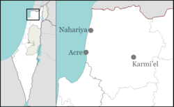
Netiv HaShayara (Hebrew: נְתִיב הַשַּׁיָּרָה, lit. Path of the Convoy) is a moshav in northern Israel. Located near Nahariya, it falls under the jurisdiction of Mateh Asher Regional Council. In 2015 it had a population of 488.
History
The village was established in 1950 by immigrants from Iran and Iraq, on lands of the depopulated Arab village of al-Ghabisiyya. It was originally named "Doveh" ("plenty"), and later named after the Yehiam convoy (Shayeret Yehiam), which tried to break into the besieged Yehiam during the 1948 Arab-Israeli War.[2]
References
- ↑ "List of localities, in Alphabetical order" (PDF). Israel Central Bureau of Statistics. Retrieved 16 October 2016.
- ↑ Mapa's concise gazetteer of Israel (in Hebrew). Yuval El'azari (ed.). Tel-Aviv: Mapa Publishing. 2005. p. 381. ISBN 965-7184-34-7.
This article is issued from Wikipedia - version of the 9/25/2016. The text is available under the Creative Commons Attribution/Share Alike but additional terms may apply for the media files.