List of secondary highways in Sudbury District
This is a list of secondary highways in Sudbury District, most of which serve as logging roads or provide access to provincial parks and isolated areas in the Sudbury District of northeastern Ontario.
Highway 528
Highway 528A
Highway 535
Highway 539
Highway 553
| ||||
|---|---|---|---|---|
| Imperial Street, Massey Tote Road | ||||
| Route information | ||||
| Length: | 33 km (21 mi) | |||
| Major junctions | ||||
| South end: |
| |||
| North end: |
| |||
| Location | ||||
| Municipalities: | Sables-Spanish Rivers | |||
| Highway system | ||||
| ||||

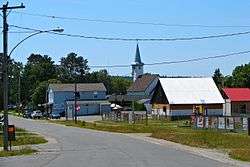
Secondary Highway 553, commonly referred to as Highway 553, is a provincially maintained highway in the Canadian province of Ontario. The highway is short, and spans only 33 kilometers. Its only purpose is to connect the Highway 17, the Trans Canada Highway, in the community of Massey (township of Sables-Spanish Rivers) to logging areas and provincial parks north of the community.
At Highway 553's northern terminus at Bull Lake, the roadway continues as tertiary Highway 810. The route of Highway 810 was part of Highway 553 prior to 1976, but was downgraded to tertiary highway status in that year because of its more limited traffic usage.
Highway 607
| ||||
|---|---|---|---|---|
| Route information | ||||
| Length: | 9.3 km (5.8 mi) | |||
| Major junctions | ||||
| South end: |
| |||
| North end: |
| |||
| Location | ||||
| Municipalities: | French River | |||
| Highway system | ||||
| ||||

Secondary Highway 607, commonly referred to as Highway 607, is a provincially maintained highway in the Canadian province of Ontario, near French River Provincial Park. It links Highway 64 to Highway 69, and mainly serves as a bypass of the intersection of Highways 64 and 69. Its total length is approximately 9.3 kilometres (5.8 mi). Its northern terminus is Highway 64, and its southern terminus is at Highway 69, near Bigwood.
Highway 607A
| ||||
|---|---|---|---|---|
| Route information | ||||
| Auxiliary route of [[Ontario Highway 607 |]] | ||||
| Length: | 3.2 km (2.0 mi) | |||
| Major junctions | ||||
| South end: | French River Provincial Park | |||
| North end: | Highway 607 | |||
| Location | ||||
| Municipalities: | French River | |||
| Towns: | Bon Air | |||
| Highway system | ||||
| ||||

Secondary Highway 607A, commonly referred to as Highway 607A, is a provincially maintained highway in the Canadian province of Ontario, in French River Provincial Park. The route connects Highway 607 to Bon Air and French River Provincial Park. Its total length is approximately 3.2 kilometres (2.0 mi). The northern terminus of the highway is Highway 607, while the southern terminus is in French River Provincial Park, 0.5 kilometers past Bon Air.
Highway 637
Highway 661
| ||||
|---|---|---|---|---|
| Route information | ||||
| Maintained by the Ministry of Transportation of Ontario | ||||
| Length: | 4.6 km (2.9 mi) | |||
| Major junctions | ||||
| North end: |
| |||
| South end: | Gogama | |||
| Location | ||||
| Counties: | Sudbury District | |||
| Highway system | ||||
| ||||

Secondary Highway 661 commonly referred to as Highway 661, is a provincially maintained secondary highway in the Sudbury District of the Canadian province of Ontario. It is a highway spur that measures 4.6 kilometres (2.9 mi) in length and connects the town of Gogama with Highway 144. It is the only provincial highway of any class that intersects Highway 144 apart from its termini and the route of Highway 560.
