Oneida, New York
| Oneida, New York | |
|---|---|
| City | |
|
Oneida Main Street in a 1907 postcard | |
 Oneida, New York Location within the state of New York | |
| Coordinates: 43°5′6″N 75°39′12″W / 43.08500°N 75.65333°WCoordinates: 43°5′6″N 75°39′12″W / 43.08500°N 75.65333°W | |
| Country | United States |
| State | New York |
| County | Madison |
| Chartered | 1901 |
| Government | |
| • Type | Mayor-Council |
| • Mayor | Leo Matzke (D) |
| • Common Council |
Members' List
|
| Area | |
| • Total | 22.1 sq mi (57.2 km2) |
| • Land | 22.0 sq mi (57.1 km2) |
| • Water | 0.0 sq mi (0.1 km2) |
| Elevation | 430 ft (131 m) |
| Population (2013) | |
| • Total | 11,262 |
| Time zone | Eastern (EST) (UTC-5) |
| • Summer (DST) | EDT (UTC-4) |
| ZIP code | 13421 |
| Area code(s) | 315 |
| FIPS code | 36-54837 |
| GNIS feature ID | 0959363 |

Oneida is a city in Madison County located west of Oneida Castle (in Oneida County) and east of Canastota, New York, United States. The population was 11,390 at the 2010 census. The city, like both Oneida County and the nearby silver and china maker, was named for the Oneida tribe, which had a large territory here around Oneida Lake during the colonial period.
History
This area was part of the territory of the Oneida tribe during the colonial era. The Oneida were one of the original Five Nations of the Iroquois League and many of its members were allies of the rebels during the American Revolutionary War. Afterward they were forced to cede most of their territory, some in unconstitutional ways to the state of New York, which did not have the authority to deal with the nation. Today the federally recognized Oneida Nation owns land in this vicinity, where some members live. It operates the Turning Stone Casino and Resort in Verona, New York. It is one of four recognized tribes of Oneida people, the only one in the state.
In the post-Revolutionary period, central and western New York were settled by many migrants from New England. With development of the Erie Canal in the early 19th century, the movement of people expanded towards the Midwest as trade and commerce increased. Oneida's development began to pick up as new trade routes were opened, especially in the period initially following construction of the Oneida Lake canal and feeder and an associated railroad stop, tying it into major trade networks of the day.
The Village of Oneida was incorporated on June 20, 1848 as part of the larger Town of Lenox to its west, but years of friction among the different sections of town spurred this village to establish itself independently as the new Town of Oneida in 1896. In turn, this town was later chartered as the City of Oneida on March 28, 1901. Because of its history, the center part of the city has a compact design and is a pedestrian friendly, thriving community today.
Geography
Oneida is located at 43°5′6″N 75°39′12″W / 43.08500°N 75.65333°W (43.084961, -75.653375).[2] The city is located between Syracuse and Utica.
According to the United States Census Bureau, the city has a total area of 22.1 square miles (57 km2), of which, 22.0 square miles (57 km2) of it is land and 0.1 square miles (0.26 km2) of it (0.23%) is water.
Oneida is centrally located among Montreal, Toronto, Buffalo, Boston, and New York City. It is one hour west of the Adirondack Mountains. It is located just southeast of Oneida Lake, the largest lake entirely within New York
Urban planning
The city of Oneida is a good example of pre-World War II city design. It was designed at a pedestrian scale, making it compact and bicycle-friendly for today's residents. Public buildings, parks, and private residences are located in proximity, within walking and biking distance. The city is gaining popularity with telecommuters who can choose where they live without the constraints of job location. Most residents of the city core are within walking distance to elementary schools and church activities.
Since the late 20th century, there has been renewed interest for increased bicycle infrastructure. Efforts are being made to revitalize the disused light rail pathways, which ring the city's south and north side, for multi-use by cyclists and for recreation, and as a gateway to and from the inner and outer area retail districts.
Oneida benefits from having several post secondary academies within commuting distance including Colgate University, Hamilton College, the State University of New York Institute of Technology, Syracuse University, Le Moyne College, Mohawk Valley Community College, Cazenovia College, the State University of New York at Morrisville, and Utica College.
Recreational waterways such as the Erie Canal and Oneida Creek are located on the perimeter of the city limits. City parks are distributed throughout the city, with the exception of the rural Mount Hope Reservoir park. Oneida has 10 public tennis courts, seven of them lit, and more than 100 acres (40 ha) of public space used for organized youth sports. Also available are fishing, hiking, mountain biking, cross country skiing, and a winter ice skating rink.
Oneida is centrally located on the New York State Canalway Trail System, a network of more than 260 miles (420 km) of existing multi-use, recreational trails across upstate New York, with major segments adjacent to the waterways of the New York State Canal System.
The Main-Broad-Grove Streets area was designated as a National Historic District in 1983. The Oneida Community Mansion House is highlighted on the Madison County Architectural Heritage Trail.
Demographics
| Historical population | |||
|---|---|---|---|
| Census | Pop. | %± | |
| 1870 | 3,262 | — | |
| 1880 | 3,934 | 20.6% | |
| 1890 | 6,083 | 54.6% | |
| 1900 | 6,364 | 4.6% | |
| 1910 | 8,317 | 30.7% | |
| 1920 | 10,541 | 26.7% | |
| 1930 | 10,558 | 0.2% | |
| 1940 | 10,291 | −2.5% | |
| 1950 | 11,325 | 10.0% | |
| 1960 | 11,677 | 3.1% | |
| 1970 | 11,658 | −0.2% | |
| 1980 | 10,810 | −7.3% | |
| 1990 | 10,850 | 0.4% | |
| 2000 | 10,987 | 1.3% | |
| 2010 | 11,393 | 3.7% | |
| Est. 2015 | 11,134 | [3] | −2.3% |
As of the census[5] of 2000, there were 10,987 people, 4,430 households, and 2,724 families residing in the city. The population density was 498.7 people per square mile (192.6/km²). There were 4,672 housing units at an average density of 212.1 per square mile (81.9/km²). The racial makeup of the city was 96.29% White, 0.80% African American, 1.39% Native American, 0.46% Asian, 0.02% Pacific Islander, 0.18% from other races, and 0.86% from two or more races. Hispanic or Latino of any race were 0.84% of the population.
There were 4,431 households out of which 32.1% had children under the age of 18 living with them, 45.3% were married couples living together, 11.9% had a female householder with no husband present, and 38.5% were non-families. 32.0% of all households were made up of individuals and 13.5% had someone living alone who was 65 years of age or older. The average household size was 2.40 and the average family size was 3.03.
In the city, the population was spread out with 25.1% under the age of 18, 7.9% from 18 to 24, 29.9% from 25 to 44, 22.1% from 45 to 64, and 15.0% who were 65 years of age or older. The median age was 37 years. For every 100 females there were 92.5 males. For every 100 females age 18 and over, there were 88.7 males.
The median income for a household in the city was $35,365, and the median income for a family was $45,242. Males had a median income of $31,244 versus $23,846 for females. The per capita income for the city was $18,966. About 8.8% of families and 12.5% of the population were below the poverty line, including 11.5% of those under age 18 and 10.6% of those age 65 or over.
Education
In the Oneida City School District there are six schools, four elementary, one middle school, and one high school. The elementary schools include Durhamville Elementary this is located just out of Oneida, in Durhamville, NY, North Broad Street Elementary located north of downtown Oneida, Seneca Street Elementary, and Willard Prior Elementary. Otto Shortell Middle School is located west of Oneida in the village of Wampsville. Oneida High School is located on Seneca Street in Oneida with 780 students from grade 9 through 12.
There are two private schools in Oneida, Saint Patrick's Elementary (Pre-K through 6th) and Holy Cross Academy (7th through 12th).
Communities and locations
- Bennetts Corner – A hamlet in the southeast part of the city, located at the intersection of Peterboro and Middle Roads.
- Oneida Community – A former religious commune. The Oneida Community Mansion House is located at Kenwood Avenue and Skinner Road.
Government
The city government consists of a mayor who is elected at large and six council members who are elected from one of six wards. Each ward elects one member.
Other facts
Oneida is located near the site of the former Oneida Community, a social and religious experiment that flourished during the third quarter of the 19th Century. The Oneida Community Mansion House, a national historic monument, is the principal building of the Oneida Community. The international tableware company Oneida Limited, founded 1880, is still headquartered in the city, although all US manufacturing operations have now ceased and all Oneida products are imported. The current mayor of Oneida, NY is Leo Matzke.
Oneida is also the home of the world's smallest church.[6]
Oneida was formerly known as Oneida Depot. In the nineteenth century its residents were among the closest neighbors to a utopian socialist commune, set up by John Humphrey Noyes, lasting from 1848 until 1881. This commune, called the Oneida Community, produced silk and canned goods until the manufacturing of flatware picked up in the later years of the Community's existence. This would lead to the foundation of Oneida Limited, a company which survived the Community and became one of America's most important flatware producers in the twentieth century.
Oneida was featured in the storyline of the television show "Law & Order"(Episode 250- "Brother's Keeper"), in which an Irish-American Mafia informant for the FBI takes refuge at the Oneida home of his twin brother, who is a teacher at a local university.
Oneida has a number of properties on the National Register of Historic Places including: the Main-Broad-Grove Streets Historic District, Cottage Lawn, DeFerriere House, Mount Hope Reservoir, Oneida Armory, Oneida Community Mansion House, and United States Post Office.[7]
See also
References
- ↑ Oneida businesswoman Helen Acker ready to join Oneida Common Council, Oneida Daily Dispatch, 21 June 2012, (accessed 23 August 2012)
- ↑ "US Gazetteer files: 2010, 2000, and 1990". United States Census Bureau. 2011-02-12. Retrieved 2011-04-23.
- ↑ "Annual Estimates of the Resident Population for Incorporated Places: April 1, 2010 to July 1, 2015". Retrieved July 2, 2016.
- ↑ "Census of Population and Housing". Census.gov. Retrieved June 4, 2015.
- ↑ "American FactFinder". United States Census Bureau. Retrieved 2008-01-31.
- ↑ America's smallest roadside churches, MSNBC, 10 July 2006, (accessed 31 December 2007)
- ↑ National Park Service (2010-07-09). "National Register Information System". National Register of Historic Places. National Park Service.
External links
| Wikimedia Commons has media related to Oneida, New York. |
- City of Oneida, NY
- New York State Canalway Trail System
- Madison County Architectural Heritage Trail Guide
- Madison County Historical Society
- Travel Report: Oneida Community Mansion House, Sherrill, NY
- Central New York Community Arts Council (CNYCAC)
- Madison County Agricultural Economic Development
- The Utopia of Sharing in Oneida, N.Y.
Municipalities and communities of Madison County, New York, United States | ||
|---|---|---|
| City | 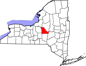 | |
| Towns | ||
| Villages | ||
| CDP | ||
| Other hamlets | ||
| Indian reservations | ||
| Footnotes | ‡This populated place also has portions in another county or counties | |