Nutley, Hampshire

Coordinates: 51°11′34″N 1°07′35″W / 51.1927°N 1.1265°W
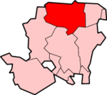
Nutley is a small village and civil parish in the Basingstoke and Deane district of Hampshire, England. It is located approximately 5.6 miles (9.0 km) south-west from Basingstoke, just off the B3046 road. The parish has an acreage of 1,524 acres (617 ha) with 74 acres (30 ha) made up of permanent grass and 386 acres (156 ha) of woodland.[1]
Governance
The village of Nutley is part of the civil parish of Nutley,[2] which is part of the parish council of Preston Candover and Nutley. It is also part of the Upton Grey and the Candovers ward of Basingstoke and Deane borough council.[3] The borough council is a Non-metropolitan district of Hampshire County Council.
References
- ↑ "Nutley acreage". Retrieved 27 October 2010.
- ↑ "Hampshire County Council's legal record of public rights of way in Hampshire" (PDF). 2008. Retrieved 27 October 2010.
- ↑ "Basingstoke and Deane Wards info". 2010. Retrieved 27 October 2010.
This article is issued from Wikipedia - version of the 1/23/2016. The text is available under the Creative Commons Attribution/Share Alike but additional terms may apply for the media files.