Aldermaston Soke

Coordinates: 51°22′N 1°07′W / 51.36°N 01.12°W
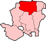
Aldermaston Soke is a hamlet in England that lies on the county boundary between Berkshire and Hampshire, and is administratively part of the civil parish of Mortimer West End, which was transferred from Berkshire to Hampshire in 1879.[1]
Archaeological interest
The settlement lies on marshy ground at the bottom of a valley, very near Silchester (Roman Calleva Atrebatum). The modern road follows the course of a Roman road through the hamlet, diverging either side of it.[2] It has been suggested that the dampness of the ground led to a short section of Roman road remaining in use in Aldermaston Soke as a causeway through the valley bottom.[3]
Botanical interest
The damp ground also makes the location of interest to botanists, as a number of plant species that are rare in Britain have been attested here:[4]
- Hypericum maculatum (a species of St John's wort)
- Viola palustris (Marsh violet)
- Lythrum portula (a species of Loosestrife)
- Hieracium umbellatum and
- Hieracium acuminatum (two species of Hawkweed)
- Dactylorhiza praetermissa (Southern Marsh-orchid)
References
- ↑ M.J. Crawley, "The Botanist in Berkshire: A Plant Hunter's Guide", p. 44. Accessed 10 February 2008.
- ↑ Ivan Donald Margary, Roman Roads in Britain. 3rd edition, London: J. Baker, 1973. p. 131. ISBN 0-212-97001-1
- ↑ George C. Boon, Roman Silchester: The Archaeology of a Romano-British Town (1957), p. 203.
- ↑ Michael J. Crawley, Rare Plant Register Berkshire and South Oxfordshire (2005), pp. 27, 30, 72, 137, 138, 208.
See also
External links
- Ordnance survey map showing Aldermaston Soke and course of the Roman road, at www.streetmap.co.uk. Accessed 10 February 2008.
External links
![]() Media related to Aldermaston Soke at Wikimedia Commons
Media related to Aldermaston Soke at Wikimedia Commons