Newton, Singapore
| Newton | |
|---|---|
| Name transcription(s) | |
| • Chinese | 纽顿 |
| • Pinyin | Niǔdùn |
| • Malay | Newton |
| • Tamil | நியூட்டன் |
| Country |
|
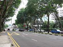

Newton is a planning area located within the Central Area of the Central Region of Singapore. The planning area is bounded by the following planning areas - Orchard and Museum to the south, Tanglin to the west, Novena to the north, Kallang to the northeast and Rochor to the east.
Newton's namesake Newton Road, however, is located within Novena planning area, and starts at Newton Circus in the south and ends at the junction with Thomson Road in the north.
Etymology and history
Originally Syed Ali Road, Newton Road was renamed in 1914 after Howard Newton (died 1897), the Assistant Municipal Engineer in late nineteenth century Singapore, in order to avoid confusion with Syed Alwi Road.
In 1933, Newton Circus, a 40-foot (12 m) wide circular carriage way, was constructed for gyratory traffic according to a Singapore Improvement Trust layout at the focus of a number of converging roads, including Bukit Timah Road, Dunearn Road, Newton Road, Keng Lee Road, Kampong Java Road, Bukit Timah Road, Clemenceau Avenue and Scotts Road. As eight roads converge on the Circus, the Tamils used to call Newton ethumuchandi, or "the eight junction place".
Newton Circus has become the site of a major hawker centre, Newton Food Centre.
See also
References
- Victor R Savage, Brenda S A Yeoh (2003), Toponymics - A Study of Singapore Street Names, Eastern Universities Press, ISBN 981-210-205-1