Marina Bay, Singapore
| Marina Bay | |
|---|---|
| Name transcription(s) | |
| • Chinese | 滨海湾 |
| • Pinyin | bīn hăi wān |
| • Malay | Teluk Marina |
| • Tamil | மரீனா பே |
|
| |
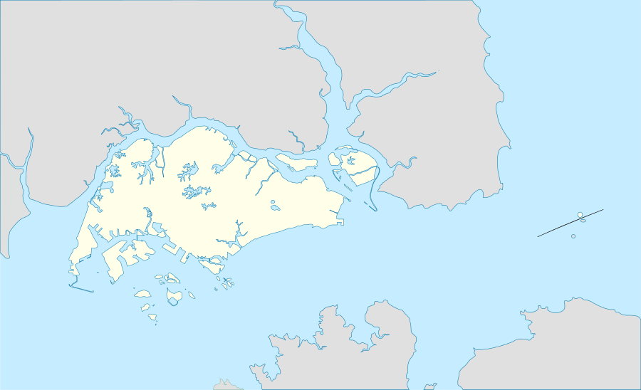 Marina Bay Location of Marina Bay within Singapore | |
| Coordinates: 1°17′04″N 103°51′21″E / 1.28444°N 103.85583°ECoordinates: 1°17′04″N 103°51′21″E / 1.28444°N 103.85583°E | |
| Country |
|
Marina Bay is a bay located in the Central Area of Singapore surrounded by the perimeter of four other planning areas, the Downtown Core, Marina East, Marina South and Straits View. The area surrounding the bay itself, also called Marina Bay, is a 360 hectare extension to the adjacent Central Business District.[1]
Master Plan
The Urban Redevelopment Authority (URA) Master Plan for Marina Bay aims to encourage a mix of uses for this area, including commercial, residential, hotel and entertainment.
The Singapore government also spent $35 million to complete the 3.5 km Waterfront Promenade around Marina Bay.[2] It includes a new eco-friendly visitor centre and The Helix linking Bayfront to Marina Centre where the Youth Olympic Park is located. The Promontory @ Marina Bay (formerly Central Promontory Site) will be used as an interim event space and public space used for activities such as theatres and carnivals.[3]

History
In 1969, land reclamation work to create 360 hectares of prime waterfront site began at Marina Bay. The reclaimed land forms what is today the Marina Centre and Marina South areas, and the reclamation work was completed in 1992.[4][5] [6] In the reclamation process, Telok Ayer Basin and Inner Roads was removed from the map by reclaiming land, while the Singapore River's mouth now flows into the bay instead of directly into the sea. The long term visions for the Marina Bay area was first articulated in the 1983 Master Plan by the URA, with the waterfront areas being deliberately kept open to the public.[4] In 1988, the draft plan for Marina Bay was presented to the public in a two-week exhibition where it set out the objectives for the development, among which are optimising the waterfront location and creating a distinctive image with international landmarks that could become a focal point for the city.[7]
In 2008, Marina Barrage was built, converting the basin into a new downtown freshwater Marina Reservoir, providing water supply, flood control and a new lifestyle attraction.
Events at Marina Bay
The first World Championship Singapore Grand Prix took place on 28 September 2008 on a street circuit through Marina Bay.[8] It was also the first ever Formula One Grand Prix to be staged at night, with the track fully floodlit. Since its inception, The Float@Marina Bay has hosted events such as the National Day Parade, New Year’s Eve Countdown,[9] Singapore Fireworks Celebrations, as well as served as a spectator stand for the inaugural Formula 1 Singapore Grand Prix. The world’s largest floating stadium played host to the Opening and Closing Ceremonies of the inaugural 2010 Summer Youth Olympics.[10]
The area also hosts the annual i Light Marina Bay, the first and only sustainable light art festival in Asia.
Infrastructure
Common Services Tunnel
Singapore is the second Asian country after Japan to implement a comprehensive Common Services Tunnel system to distribute various utility services to all city developments. The Marina Bay network of purpose-built tunnels houses water pipes, electrical and telecommunication cables and other utility services underground. CST not only improves reliability of services supplies and allows easy maintenance and new installations, it also has 100% emergency backup services and the capacity for expansion to meet changing utility needs.[11]
Water management
In 2004, the Public Utilities Board publicly announced plans to construct a new downtown reservoir by damming the Marina Channel. This barrage was completed in 2008. Known as the Marina Barrage, it turned Marina Bay and the Kallang Basin into a confined freshwater reservoir with limited access to marine transportation to regulate the water quality. The new reservoir provides another source of drinking water for Singapore, as well as a stable water level for a variety of water activities and events. The barrage will also prevent flooding in the Chinatown area.
Transportation
There are currently 7 rail stations: City Hall, Raffles Place, Marina Bay, Bayfront, Downtown, Esplanade and Promenade serving Marina Bay. By 2020, the 360 hectares Marina Bay will boast a comprehensive transport network as Singapore's most rail-connected district.[12] The first three new MRT lines will open between 2012 and 2014. By 2018, the Marina Bay district will have more than six MRT stations, all no more than five minutes of each other. A comprehensive pedestrian network including sheltered sidewalks, covered walkways, underground and second-storey links will ensure all-weather protection and seamless connectivity between developments and MRT stations.[13] Within greater Marina Bay, water taxis will even double up as an alternative mode of transportation.
Key developments
In Marina Bay
- ArtScience Museum
- Asia Square
- Bayfront Bridge
- Circle Line
- Clifford Pier
- Common Services Tunnel
- Downtown Line
- Esplanade – Theatres on the Bay
- F1 Pit Building
- Gardens by the Bay
- Marina Bay Street Circuit
- The Fullerton Heritage Precinct: Customs House, The Fullerton Hotel Singapore, Fullerton Waterboat House, One Fullerton, Fullerton Bay Hotel
- The Helix Bridge
- Marina Barrage
- Marina Bay Cruise Centre Singapore
- Marina Bay Financial Centre
- Marina Bay Golf Course
- Marina Bay Link Mall
- Marina Bay Sands
- Marina Bay Suites
- Marina Coastal Expressway
- Marina South Pier
- Marina South Pier MRT Station
- Marina Square
- Millenia Walk
- One Marina Boulevard
- One Raffles Quay
- One Shenton Way
- OUE Bayfront
- Singapore Flyer
- Suntec City
- The Float at Marina Bay
- The Lawn @ Marina Bay
- The Promontory @ Marina Bay (formerly Central Promontory Site)
- The Sail @ Marina Bay
- Thomson-East Coast Line
- Youth Olympic Park
Other places of interest
- The 101-hectare Gardens by the Bay site is made up of Bay South Garden, Bay East Garden, and Bay Central Garden across the mouth of the Singapore River. All three gardens will be interconnected via a series of pedestrian bridges to form a larger loop along the whole waterfront and linked to surrounding developments, open public spaces, transport nodes and attractions.
- A 3.5 km waterfront promenade linking the attractions at the Marina Centre, Collyer Quay and Bayfront areas was completed in 2010.
In popular culture
In the movie Independence Day: Resurgence, it is shown that the Marina Bay was destroyed by an alien spacecraft.
Gallery
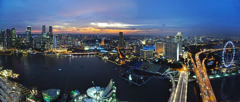
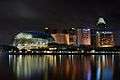 Marina Bay and Marina Centre at night.
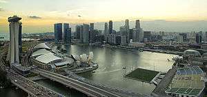
 Marina Bay with the skyline of Raffles Place on 31 December 2006.
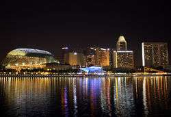
 Marina Bay with the Esplanade Theatres behind on 30 November 2007
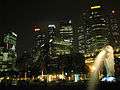 Singapore Downtown Core near Marina Bay on 30 November 2007
 Performing Arts Centre, Marina Bay
See also
References
- ↑ "Vision". Marina Bay Singapore. 2014. http://www.marina-bay.sg/vision.html. Retrieved 2014-03-19.
- ↑ “$35m for Marina Bay waterfront promenade”. Asiaone. 2008-09-19. http://www.asiaone.com/Travel/News/Story/A1Story20080918-88574.html Retrieved 2010-06-03.
- ↑ "Downtown @ Marina Bay". URA. http://www.ura.gov.sg/cudd/cawebsite/downtown-map.htm Retrieved 2010-07-08.
- 1 2 June Gwee, ed. (2013). Case Studies in Public Governance: Building Institutions in Singapore. Taylor & Francis Ebooks. ISBN 9781136447075.
- ↑ Ching Tuan Yee and Benjamin Ng. "Marina Bay: The Shape of Things to Come". Civil Service College.
- ↑ Collin Anderson (2016). DP Architects on Marina Bay: Designing for Reclaimed Lands. Oro Editions. ISBN 9781941806975.
- ↑ Tan Chung Hong (1991). "Planning for the Development of Singapore's Urban Waterfront". In Lin Sien Chia, L. M. Chou. Urban Coastal Area Management: The Experience of Singapore (PDF). International Specialized Book Services. pp. 54–56. ISBN 9789711022877.
- ↑ "Singapore to host F1 Grand Prix next year". Channel NewsAsia. 2006-05-11. http://www.channelnewsasia.com/stories/singaporelocalnews/view/275566/1/.html Retrieved 2007-05-11.
- ↑ Marina Bay Singapore Countdown 2010/11
- ↑ "Singapore YOG 2010 Fan Site". http://www.singaporeyoutholympicgames.com/yog-venues/marina-bay-floating-stadium/ Retrieved 2010-07-08.
- ↑ "State-of-the-art infrastructure in place at Marina Bay". Urban Redevelopment Authority. 2006-06-16. 14 http://www.ura.gov.sg/pr/text/pr06-40.html. Retrieved 2010-06-03.
- ↑ "5 MRT lines to Marina Bay". The Straits Times. 2010-05-24 http://www.straitstimes.com/BreakingNews/Singapore/Story/STIStory_530577.html Retrieved 2010-06-03.
- ↑ "Seamless Connectivity". Marina Bay Singapore. 2008. http://www.marina-bay.sg/connectivity.html. Retrieved 2010-06-03.
External links
| Wikimedia Commons has media related to: |
-
 Marina Bay, Singapore travel guide from Wikivoyage
 - Official website
- Marina Bay Facebook Page
- Urban Redevelopment Authority Official Website
- Marina Bay Photo Gallery