Newborough, Staffordshire
| Newborough | |
 Newborough Church |
|
 Newborough |
|
| Population | 476 (2011)[1] |
|---|---|
| OS grid reference | SK1443124560 |
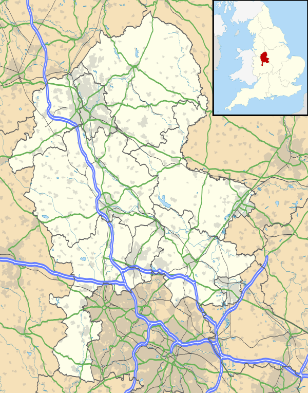
| Civil parish | Newborough |
| District | East Staffordshire |
| Shire county | Staffordshire |
| Region | West Midlands |
| Country | England |
| Sovereign state | United Kingdom |
| Post town | Burton-on-Trent |
| Postcode district | DE13 0 |
| Police | Staffordshire |
| Fire | Staffordshire |
| Ambulance | West Midlands |
| EU Parliament | West Midlands |
| UK Parliament | Staffordshire |
|
|
Coordinates: 52°49′28″N 1°48′19″W / 52.82455°N 1.805291°W
Newborough is a village and civil parish in the county of Staffordshire, in the country of England and is located 3 miles (5 km) south west of Hanbury and 8 miles (13 km) west of Burton-upon-Trent. Newborough has a pub, a school and a church. At the 2011 UK census, the population stood at 476, comprising 240 males and 236 females.
The Village
The local church is dedicated to All Saints. The current building was consecrated in 1901, after being built by the architect John Oldrid Scott.[2] Originally built on the site of a pub, it was built using stone from Hollington, Pateley Bridge and Harrogate.[3] The Church is a Grade 2 Listed Building, after being listed on 12 January 1966, and given its English Heritage Building ID of 273885.[4]
The village originally had three public houses in the village: The White Hart, The Buffalo and The Red Lion, although it had many more alehouses. The Red Lion continues its trade to this day, but the present day All Saints church stands on the site of the White Hart. The Buffalo is now a residential home of the same name, and houses now stand on the old car park.[5]
There is also The Bakehouse B&B, which has recently come under new ownership. A coffee shop now lies within the old lounge of the living quarters, and the B&B continues to run successfully. Two holiday cottages, known as "The Poplars" and "The Piano Barn" are also in the village at the site of the Piano Workshop, at Poplars Farm.
Each year, the village holds a Well dressing event on the May Bank Holiday. The tradition in the village only dates back to 1978, but the ancient tradition is thought to have originated in Pagan times. The wells in the village are decorated, and as described on the villages's website, each year the residents use "wooden boards [which] are filled with soft, wet clay on which a design is picked out and then coloured using petals and other natural materials such as leaves, cones and bark".[6]
History
Agardsely was the original name for Newborough. In the Domesday Book, it is recorded as Edgareslege, meaning 'Eadger's leah' or 'Eadger's clearing in the woodland'. It was not until 1263 that the village was renamed to Newborough, after the 6th Earl of Derby, Robert de Ferrers, created a new borough.[7]
The civil parish of Newborough was established in 1866, after previously being part of the Hanbury parish district.[8] According to William White, who wrote about Hanbury as part of the History, Gazetteer and Directory of Staffordshire in 1851, the parish extended to "upwards of five miles square, and including the north end of Needwood Forest, and ten villages and hamlets, divided into five townships, viz, Hanbury, Newborough, Marchington, Marchington-Woodlands, and Draycott-in-the-Clay", while it also included "2483 inhabitants, and about 13,600 acres of land".[9]
Population
| Year of census | Total Population[10] |
|---|---|
| 1881 | 651 |
| 1891 | 574 |
| 1901 | 566 |
| 1911 | 521 |
| 1921 | 496 |
| 1931 | 493 |
| 1951 | 512 |
| 1961 | 459 |
The UK national census revealed that in 1881, the total population for the parish was 651, and since then, the population has steadily declined. Only in the period between the 1931 and 1951 censuses did the population increase (from 493 to 512), however there was then a large drop in population for the 1961 census, where it decreased to 459.[11]
Occupation
The 1881 Census gives an insight into what sort of occupations the villagers had at the time of the census. Most are employed in the agricultural sector, with 111 men in this occupational area. For women, the picture is less clear with the majority being listed as either 'Persons without Specified Occupations' or 'Unknown Occupation'. [12]
| Occupation Group | Male | Female |
|---|---|---|
| General/Local Government | 11 | – |
| Defence of the Country | 3 | – |
| Professionals | 1 | 2 |
| Domestic Service or Offices | 10 | 25 |
| Commercial Occupations | 1 | – |
| Transport & Communications | 4 | – |
| Agriculture | 111 | 6 |
| Animals | 1 | – |
| Workers in House, Furniture & Decorations | 2 | – |
| Workers in Carriages & Harnesses | 2 | – |
| Workers in Food & Lodging | 4 | 1 |
| Workers in Dress | 3 | 8 |
| Workers in Various Mineral Substances | 5 | – |
| Persons without Specified Occupations | 1 | 56 |
| Unknown Occupation | 2 | 63 |
Housing
Over time, the total number of houses in Newborough has fluctuated. Between 1881 and 1921, the total number of houses has slowly decreased (from 150 to 113), and then it has slowly risen again. The most recent data from the 2001 UK Census showed that there were 173 households. Of these 173 houses, 50 of them were categorised as "couple households with dependent children" and 43 of them were labelled "couple households with no children". [14]
| Year of census | Total Houses[15] |
|---|---|
| 1881 | 150 |
| 1891 | 146 |
| 1901 | 137 |
| 1911 | 121 |
| 1921 | 113 |
| 1931 | 122 |
| 1951 | 138 |
| 1961 | 140 |
References
- ↑ "Statistics by Area – Neighbourhood Summary 2011 UK Census". Office for National Statistics. Retrieved 8 February 2015.
- ↑ "John Oldrid Scott, 1841–1913". Glasgow Sculpture. Retrieved 20 March 2012.
- ↑ "BBC Domesday Project". BBC. Retrieved 2 May 2012.
- ↑ "Listed Buildings". British Listed Buildings. Retrieved 2 May 2012.
- ↑ "Burton Upon Trent Visitor Information". Visitor UK. Retrieved 2 May 2012.
- ↑ Newborough Village "Newborough Village Well Dressing" Check
|url=value (help). Newborough Village. Retrieved 2 May 2012. - ↑ "Staffordshire Places – Newborough". Staffordshire Places. Retrieved 20 March 2012.
- ↑ "Staffordshire Place Guide – Newborough". Staffordshire County Council. Retrieved 20 March 2012.
- ↑ "History, Gazetteer and Directory of Staffordshire, William White, Sheffield, 1851 – Newborough". GENUKI. Retrieved 20 March 2012.
- ↑ "Population Data – A Vision of Britain Through Time". A Vision of Britain Through Time. Retrieved 20 March 2012.
- ↑ "Population Data – A Vision of Britain Through Time". A Vision of Britain Through Time. Retrieved 20 March 2012.
- ↑ "Occupation Data – A Vision of Britain Through Time". A Vision of Britain Through Time. Retrieved 2 May 2012.
- ↑ "Occupation Data – A Vision of Britain Through Time". A Vision of Britain Through Time. Retrieved 2 May 2012.
- ↑ "Households – 2001 UK Census". Office for National Statistics. Retrieved 2 May 2012.
- ↑ "Household Data – A Vision of Britain Through Time". A Vision of Britain Through Time. Retrieved 2 May 2012.
External links
| Wikimedia Commons has media related to Newborough, Staffordshire. |