Wychnor
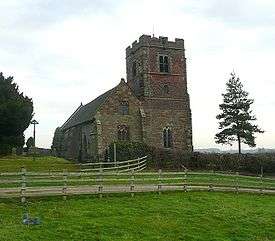
Wychnor (or Wichnor) is a civil parish in Staffordshire, England, situated in the East Staffordshire local government district adjoining Alrewas and Barton-under-Needwood. It is situated on the A38, formerly the Roman road Ryknild Street, and contains the hamlet of Wychnor Bridges where the A38 crosses the River Trent. The Trent and Mersey Canal passes through the parish. There is a railway junction nearby; Wychnor Junction where the South Staffordshire Line joins the Cross Country Route.
It's earliest spelling was H.wiccenofre. Ofre was the Anglo-Saxon word for "edge or bank". Hwicce was a provence comprising Gloucestershire, Worcestershire and a part of Warwickshire and the people were called Hwiccas or Hwicii. It is thought that some of these people came to settle in Wychnor and so gave their name to the place they settled in. In the Doomsday Book, it is referred to as "Wicenore".[1]
The parish also contains Wychnor Park, an 18th-century country house.[2] In the 2001 census the parish had a population of 70.[3]
References
- ↑ Harrison, Edith (1934). The Story of Wychnor ... Written for the school children of Wychnor.
- ↑ "MAGIC: Multi Agency Geographic Information for the Countryside". DEFRA. Retrieved 2009-03-15.
- ↑ "Parish headcounts: East Staffordshire (Non-Metropolitan District)". Neighbourhood Statistics. Office for National Statistics. Retrieved 2009-03-15.
Coordinates: 52°44′35″N 1°44′20″W / 52.743°N 1.739°W