Mayfield, Staffordshire
| Mayfield | |
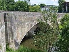 Hanging Mill Bridge, Mayfield |
|
 Mayfield |
|
| Population | 2,000 |
|---|---|
| OS grid reference | SK154448 |
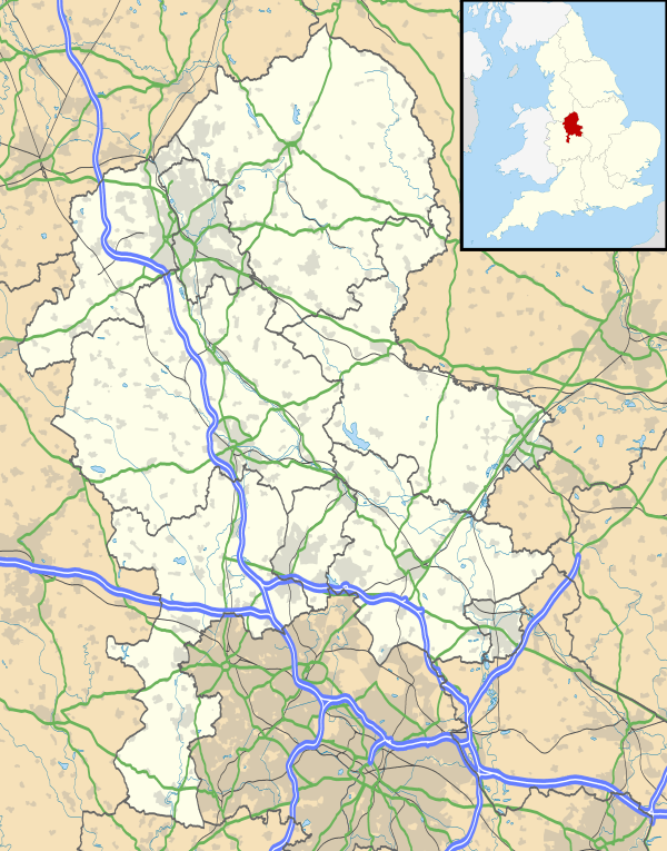
| Shire county | Staffordshire |
| Region | West Midlands |
| Country | England |
| Sovereign state | United Kingdom |
| Post town | ASHBOURNE |
| Postcode district | DE6 3 |
| Police | Staffordshire |
| Fire | Staffordshire |
| Ambulance | West Midlands |
| EU Parliament | West Midlands |
|
|
Coordinates: 53°00′23″N 1°46′07″W / 53.0065°N 1.7685°W
Location and History
Mayfield is a village on the outskirts of Ashbourne in Derbyshire, about 9 miles from Uttoxeter, situated in East Staffordshire.
The village is divided into Mayfield, Church Mayfield, Wallash, Upper Mayfield and Middle Mayfield. It has a population of approximately 2000. It lies on the banks of the River Dove. The Dove is the boundary between the Derbyshire and Staffordshire. Mayfield is on the Staffordshire side of the border but it has an Ashbourne postal address because its nearest postal town, Ashbourne, is in Derbyshire. Derbyshire is not used by Royal Mail.
Mayfield was mentioned in the Domesday Book, in which it was called 'Mavreveldt'. The name is possibly derived from the Old English for 'open land growing with madder' or perhaps, 'assembly open land'.[1]
It was the scene of a siege during the retreat of Bonnie Prince Charlie, whose followers terrorised the local villagers forcing them to take refuge in St John the Baptist's church. Several musket ball holes, reputedly from weapons fired during the siege, can still be seen in one of the doors of the church.[2]

There has been a church in Mayfield for over a thousand years. The Domesday Survey of 1086 recorded a priest in Mayfield, one of only twenty-five priests recorded for the county of Staffordshire. There is now no trace of the original Church, which would have been a Saxon wooden building standing on or near to the site of the present church. The Saxon church was replaced during the reign of Henry I by a Norman stone building in about 1125. The church was extended in the 15 and 16th Centuries, with the tower being built in 1515. The final extension was in 1854.[3]
Economy
Mayfield's mill, in one form or another, has been standing on the banks of the Dove since the 12th Century.[4] Today Mayfield Yarns produces warped and twisted yarns. The parish is also home to several farms.
School
The village has a Church of England school called Henry Prince First School, which takes children up to the age of nine. It opened in the 1860s; in 2005 a nursery was added.
Local Customs
Every summer Mayfield continues the well dressing tradition where wells and springs are decorated with tableaux created by pressing flower petals into clay. The first Well Dressing festival in Mayfield was held in 1896.[5]
The preparation of the boards takes several days. Clay is spread over the wet boards then the outline of the design pricked out with coffee beans. "Petalling" follows and finally the boards are erected by the wells. The wells are blessed by local clergy (Church of England, Catholic and Methodist) and remain for a week for people to view.
Notable residents
Thomas Moore (28 May 1779 – 25 February 1852), the Irish poet, singer, songwriter, and entertainer lived in Mayfield for a time.[2]
References
- ↑ "Mayfield". Key To English Place Names. English Place Name Society. Retrieved 9 May 2012.
- 1 2 Mayfield, East Staffordshire Borough Council website
- ↑ "History of Mayfield Parish Church". Mayfield Parish Church. Retrieved 17 March 2015.
- ↑ Mayfield Heritage Group (2002). Mayfield 2000 (1 ed.). Mayfied Books. pp. 80–82.
- ↑ "The Origins of Mayfield Well Dressing". Mayfield Heritage Group. Retrieved 17 March 2015.