New Hampshire Route 135
| ||||
|---|---|---|---|---|
|
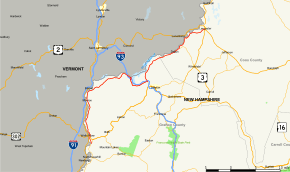
Map of northern New Hampshire with NH 135 highlighted in red | ||||
| Route information | ||||
| Maintained by NHDOT | ||||
| Length: | 46.677 mi[1] (75.119 km) | |||
| Major junctions | ||||
| South end: |
| |||
| North end: |
| |||
| Location | ||||
| Counties: | Grafton, Coos | |||
| Highway system | ||||
| ||||

New Hampshire Route 135 (abbreviated NH 135) is a 46.677-mile-long (75.119 km) north–south state highway in New Hampshire. The highway runs along the Connecticut River from Woodsville in the town of Haverhill to Lancaster.
The southern terminus of NH 135 is at New Hampshire Route 10 in Woodsville. The northern terminus is at U.S. Route 2 and U.S. Route 3 in Lancaster.
Major intersections
| County | Location[1][2] | mi[1][2] | km | Destinations | Notes |
|---|---|---|---|---|---|
| Grafton | Haverhill | 0.000 | 0.000 | Southern terminus | |
| 1.638 | 2.636 | Village of Woodsville | |||
| Monroe | 11.530 | 18.556 | Barnet Road to | ||
| Littleton | 21.779 | 35.050 | Southern end of wrong-way concurrency with NH 18 | ||
| 22.568– 22.888 | 36.320– 36.835 | Exit 44 on I-93 | |||
| 27.593 | 44.407 | Northern end of wrong-way concurrency with NH 18 | |||
| 27.658– 27.861 | 44.511– 44.838 | Exit 43 on I-93 | |||
| Coos | Dalton | 38.871 | 62.557 | Northern terminus of NH 142 | |
| Lancaster | 46.677 | 75.119 | Northern terminus | ||
1.000 mi = 1.609 km; 1.000 km = 0.621 mi
| |||||
References
- 1 2 3 Bureau of Planning & Community Assistance (February 20, 2015). "NH Public Roads". Concord, New Hampshire: New Hampshire Department of Transportation. Retrieved April 7, 2015.
- 1 2 Bureau of Planning & Community Assistance (April 3, 2015). "Nodal Reference 2015, State of New Hampshire". New Hampshire Department of Transportation. Retrieved April 7, 2015.
External links
This article is issued from Wikipedia - version of the 4/19/2015. The text is available under the Creative Commons Attribution/Share Alike but additional terms may apply for the media files.