New Hampshire Route 18
| ||||
|---|---|---|---|---|
|
Map of Grafton County in northwestern New Hampshire with NH 18 highlighted in red | ||||
| Route information | ||||
| Maintained by NHDOT | ||||
| Length: | 20.116 mi[1] (32.374 km) | |||
| Major junctions | ||||
| South end: |
| |||
| North end: |
| |||
| Location | ||||
| Counties: | Grafton | |||
| Highway system | ||||
| ||||

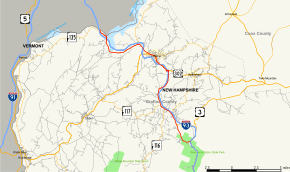
New Hampshire Route 18 is a 20.116-mile-long (32.374 km) state highway in northwestern New Hampshire. It is a local road serving Franconia, Bethlehem, and Littleton, New Hampshire, which I-93 bypasses. Its northern extension, Vermont Route 18, continues northward from the Connecticut River to St. Johnsbury, Vermont. NH 18 closely parallels I-93 for its entire length and has several interchanges with the Interstate highway.
Route description
NH 18 begins as a spur of I-93 (the Franconia Notch Parkway) at the height of land in Franconia Notch. (U.S. Route 3 is overlapped with I-93 on the Parkway.) NH 18 proceeds to the northwest, intersecting NH 141 and NH 142, near its interchange with I-93. In downtown Franconia, NH 18 joins with NH 116 and meets the eastern end of NH 117 before leaving town and crossing into Bethlehem. NH 18 has two interchanges with I-93 in Bethlehem, joining U.S. Route 302 westbound at the second one (US 302 east provides access to downtown). The highway crosses into Littleton, splitting with NH 116 in the center of town. Just west of downtown, US 302 splits from NH 18 as well. (This intersection is signed as the northern terminus of NH 10, although this designation officially ends much further south.) Northwest of town, NH 18 joins NH 135 near another interchange with I-93. The two routes have a direct interchange with I-93 near the Connecticut River at exit 44 (I-93's last exit in New Hampshire). NH 135 splits off NH 18 before it crosses the river into Vermont (along with I-93 to its west) and becomes VT 18.
Junction list
The entire route is in Grafton County. [1][2]
| Location[1][2] | mi[1][2] | km | Destinations | Notes | |
|---|---|---|---|---|---|
| Franconia | 0.000– 0.053 | 0.000– 0.085 | Southern terminus; Exit 34C on I-93 | ||
| 2.804 | 4.513 | Western terminus of NH 141 | |||
| 4.070 | 6.550 | Southern terminus of NH 142 | |||
| 4.825 | 7.765 | Wallace Hill Road to | Southern end of concurrency with NH 116; Exit 38 on I-93 | ||
| 5.300 | 8.530 | Eastern terminus of NH 117 | |||
| Bethlehem | 7.533– 7.719 | 12.123– 12.423 | Exit 39 on I-93 | ||
| 9.525 | 15.329 | Southern end of concurrency with US 302; Exit 40 on I-93 | |||
| Littleton | 11.826 | 19.032 | Northern end of concurrency with NH 116 | ||
| 12.382 | 19.927 | Also signed as | Northern end of concurrency with US 302 | ||
| 14.016 | 22.557 | Southern end of wrong-way concurrency with NH 135 | |||
| 18.722– 19.042 | 30.130– 30.645 | Exit 44 on I-93 | |||
| 19.831 | 31.915 | Northern end of wrong-way concurrency with NH 135 | |||
| 20.116 | 32.374 | Continuation into Vermont | |||
1.000 mi = 1.609 km; 1.000 km = 0.621 mi
| |||||
Road names along route
NH Route 18 uses the following local road names:
- Franconia
- Profile Road
- Main Street
- Bethlehem
- Profile Road/Old Franconia Road
- Main Street/Dartmouth College Road
- Littleton
- Bethlehem Road
- Cottage Street
- Main Street
- St. Johnsbury Road
References
- 1 2 3 4 Bureau of Planning & Community Assistance (February 20, 2015). "NH Public Roads". Concord, New Hampshire: New Hampshire Department of Transportation. Retrieved April 7, 2015.
- 1 2 3 Bureau of Planning & Community Assistance (April 3, 2015). "Nodal Reference 2015, State of New Hampshire". New Hampshire Department of Transportation. Retrieved April 7, 2015.