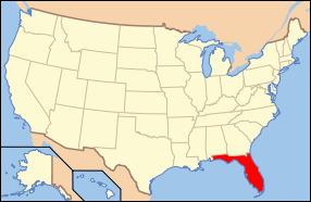
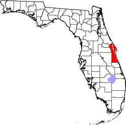
| [3] |
Name on the Register[4] |
Image |
Date listed[5] |
Location |
City or town |
Description |
|---|
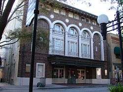
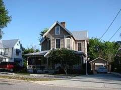
| 1 |
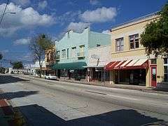
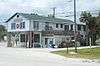
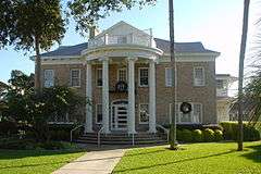
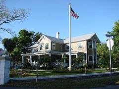
Aladdin Theater |
|
000000001991-10-17-0000October 17, 1991
(#91001541) |
300 Brevard Avenue
28°21′19″N 80°43′35″W / 28.355278°N 80.726389°W / 28.355278; -80.726389 (Aladdin Theater) |
Cocoa |
|
| 2 |
Barton Avenue Residential District |
|
000000001992-08-21-0000August 21, 1992
(#92001046) |
11-59 Barton Avenue
28°19′48″N 80°43′12″W / 28.330000°N 80.720000°W / 28.330000; -80.720000 (Barton Avenue Residential District) |
Rockledge |
|
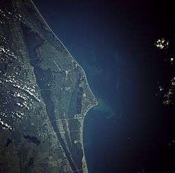
| 3 |
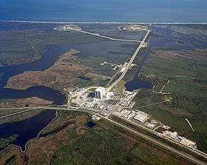
Cape Canaveral Air Force Station |
|
000000001984-04-16-0000April 16, 1984
(#84003872) |
Launch Pads 5, 6, 13, 14, 19, 26, 34, and Mission Control Center
28°28′26″N 80°34′28″W / 28.473889°N 80.574444°W / 28.473889; -80.574444 (Cape Canaveral Air Force Station) |
Cocoa |
|
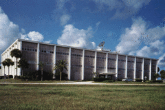
| 4 |
Central Instrumentation Facility |
|
000000002000-01-21-0000January 21, 2000
(#99001635) |
Kennedy Space Center
28°31′27″N 80°39′22″W / 28.524167°N 80.656111°W / 28.524167; -80.656111 (Central Instrumentation Facility) |
Merritt Island |
|
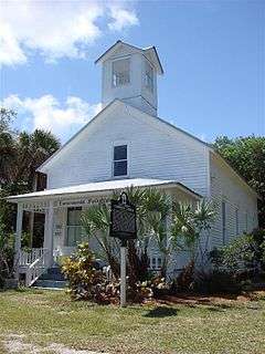
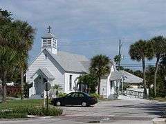
| 5 |
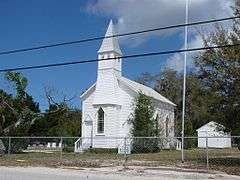
City Point Community Church |
|
000000001995-06-20-0000June 20, 1995
(#95000731) |
3783 North Indian River Drive
28°25′23″N 80°45′11″W / 28.423056°N 80.753056°W / 28.423056; -80.753056 (City Point Community Church) |
Cocoa |
|
| 6 |
Community Chapel of Melbourne Beach |
|
000000001992-05-14-0000May 14, 1992
(#92000505) |
501 Ocean Avenue
28°04′06″N 80°33′49″W / 28.068333°N 80.563611°W / 28.068333; -80.563611 (Community Chapel of Melbourne Beach) |
Melbourne Beach |
|
| 7 |
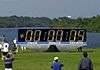
Crawlerway |
|
000000002000-01-21-0000January 21, 2000
(#99001641) |
Kennedy Space Center
28°36′13″N 80°37′39″W / 28.603611°N 80.6275°W / 28.603611; -80.6275 (Crawlerway) |
Merritt Island |
|
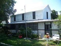
| 8 |
J. R. Field Homestead |
|
000000001997-09-11-0000September 11, 1997
(#97001121) |
750 Field Manor Drive
28°23′53″N 80°43′00″W / 28.398056°N 80.716667°W / 28.398056; -80.716667 (J. R. Field Homestead) |
Indianola |
|
| 9 |
Florida Power and Light Company Ice Plant |
|
000000001982-11-17-0000November 17, 1982
(#82001033) |
1604 South Harbor City Boulevard
28°34′13″N 80°36′15″W / 28.570278°N 80.604167°W / 28.570278; -80.604167 (Florida Power and Light Company Ice Plant) |
Melbourne |
|
| 10 |
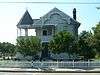
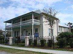
William H. Gleason House |
|
000000001997-01-25-0000January 25, 1997
(#96001608) |
1736 Pineapple Avenue
28°08′06″N 80°37′45″W / 28.135°N 80.629167°W / 28.135; -80.629167 (William H. Gleason House) |
Melbourne |
|
| 11 |
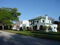
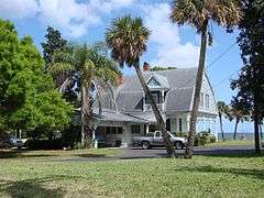
Green Gables |
|
000000002016-05-18-0000May 18, 2016
(#16000269) |
1501 South Harbor City
28°05′06″N 80°36′22″W / 28.085014°N 80.606010°W / 28.085014; -80.606010 (Green Gables) |
Melbourne |
|
| 12 |
Headquarters Building |
|
000000002000-12-01-0000December 1, 2000
(#99001644) |
Kennedy Space Center
28°31′27″N 80°39′04″W / 28.524167°N 80.651111°W / 28.524167; -80.651111 (Headquarters Building) |
Merritt Island |
|
| 13 |
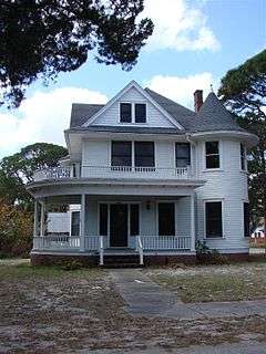
Dr. George E. Hill House |
|
000000001994-03-03-0000March 3, 1994
(#93000819) |
870 Indianola Drive
28°23′45″N 80°43′09″W / 28.395833°N 80.719167°W / 28.395833; -80.719167 (Dr. George E. Hill House) |
Merritt Island |
|
| 14 |
Hotel Mims |
|
000000001995-07-28-0000July 28, 1995
(#95000913) |
3202 State Road 46
28°39′54″N 80°50′46″W / 28.665°N 80.846111°W / 28.665; -80.846111 (Hotel Mims) |
Mims |
|
| 15 |
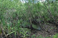
Indian Fields |
|
000000001994-04-14-0000April 14, 1994
(#94000358) |
Address Restricted
|
Titusville |
|
| 16 |
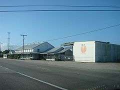
Jorgensen's General Store |
|
000000001999-06-25-0000June 25, 1999
(#99000711) |
5390 U.S. Route 1
27°55′44″N 80°31′38″W / 27.928889°N 80.527222°W / 27.928889; -80.527222 (Jorgensen's General Store) |
Grant-Valkaria |
|
| 17 |
La Grange Church and Cemetery |
|
000000001995-12-07-0000December 7, 1995
(#95001413) |
1575 Old Dixie Highway
28°38′23″N 80°49′39″W / 28.639722°N 80.8275°W / 28.639722; -80.8275 (La Grange Church and Cemetery) |
Titusville |
|
| 18 |
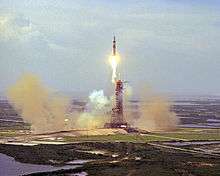
Launch Complex 39 |
|
000000001973-05-24-0000May 24, 1973
(#73000568) |
Kennedy Space Center
28°36′08″N 80°37′43″W / 28.602222°N 80.628611°W / 28.602222; -80.628611 (Launch Complex 39) |
Titusville |
|
| 19 |
Launch Complex 39-Pad A |
|
000000002000-01-21-0000January 21, 2000
(#99001638) |
Kennedy Space Center
28°36′29″N 80°36′16″W / 28.608056°N 80.604444°W / 28.608056; -80.604444 (Launch Complex 39-Pad A) |
Merritt Island |
|
| 20 |
Launch Complex 39-Pad B |
|
000000002000-01-21-0000January 21, 2000
(#99001639) |
Kennedy Space Center
28°37′37″N 80°37′16″W / 28.626944°N 80.621111°W / 28.626944; -80.621111 (Launch Complex 39-Pad B) |
Merritt Island |
|
| 21 |
Launch Control Center |
|
000000002000-01-21-0000January 21, 2000
(#99001645) |
Kennedy Space Center
28°35′07″N 80°38′59″W / 28.585278°N 80.649722°W / 28.585278; -80.649722 (Launch Control Center) |
Merritt Island |
|
| 22 |
Melbourne Beach Pier |
|
000000001984-04-12-0000April 12, 1984
(#84000829) |
Ocean Avenue and Riverside Drive
28°04′05″N 80°34′05″W / 28.068056°N 80.568056°W / 28.068056; -80.568056 (Melbourne Beach Pier) |
Melbourne Beach |
|
| 23 |
Missile Crawler Transporter Facilities |
|
000000002000-01-21-0000January 21, 2000
(#99001643) |
Kennedy Space Center
28°35′11″N 80°38′57″W / 28.5864°N 80.6492°W / 28.5864; -80.6492 (Missile Crawler Transporter Facilities) |
Merritt Island |
|
| 24 |
Old Haulover Canal |
|
000000001978-12-19-0000December 19, 1978
(#78000262) |
Address Restricted
28°44′11″N 80°45′17″W / 28.736389°N 80.754722°W / 28.736389; -80.754722 (Old Haulover Canal) |
Merritt Island |
|
| 25 |
Old St. Luke's Episcopal Church and Cemetery |
|
000000001990-06-15-0000June 15, 1990
(#90000848) |
5555 North Tropical Trail
28°27′26″N 80°43′03″W / 28.457222°N 80.7175°W / 28.457222; -80.7175 (Old St. Luke's Episcopal Church and Cemetery) |
Courtenay |
|
| 26 |
Operations and Checkout Building |
|
000000002000-01-21-0000January 21, 2000
(#99001636) |
Kennedy Space Center
28°31′25″N 80°38′47″W / 28.523611°N 80.646389°W / 28.523611; -80.646389 (Operations and Checkout Building) |
Merritt Island |
|
| 27 |
Porcher House |
|
000000001986-01-06-0000January 6, 1986
(#86000023) |
434 Delannoy Avenue
28°21′45″N 80°43′32″W / 28.3625°N 80.725556°W / 28.3625; -80.725556 (Porcher House) |
Cocoa |
|
| 28 |
Press Site–Clock and Flag Pole |
|
000000002000-01-21-0000January 21, 2000
(#99001637) |
Kennedy Space Center
28°34′56″N 80°38′44″W / 28.582222°N 80.645556°W / 28.582222; -80.645556 (Press Site–Clock and Flag Pole) |
Merritt Island |
|
| 29 |
Pritchard House |
|
000000001990-01-12-0000January 12, 1990
(#89002167) |
424 South Washington Avenue
28°36′37″N 80°48′28″W / 28.610278°N 80.807778°W / 28.610278; -80.807778 (Pritchard House) |
Titusville |
|
| 30 |
Judge George Robbins House |
|
000000001990-01-12-0000January 12, 1990
(#89002168) |
703 Indian River Avenue
28°36′27″N 80°48′23″W / 28.6075°N 80.806389°W / 28.6075; -80.806389 (Judge George Robbins House) |
Titusville |
|
| 31 |
Rockledge Drive Residential District |
|
000000001992-08-21-0000August 21, 1992
(#92001045) |
15-23 Rockledge Avenue, 219-1361 Rockledge Drive, and 1-11 Orange Avenue
28°20′14″N 80°43′13″W / 28.337222°N 80.720278°W / 28.337222; -80.720278 (Rockledge Drive Residential District) |
Rockledge |
|
| 32 |
James Wadsworth Rossetter House |
|
000000002005-07-27-0000July 27, 2005
(#05000734) |
1328 Houston Street
28°07′42″N 80°37′34″W / 28.128333°N 80.626111°W / 28.128333; -80.626111 (James Wadsworth Rossetter House) |
Melbourne |
|
| 33 |
Spell House |
|
000000001990-01-12-0000January 12, 1990
(#89002166) |
1200 Riverside Drive
28°36′07″N 80°48′22″W / 28.601944°N 80.806111°W / 28.601944; -80.806111 (Spell House) |
Titusville |
|
| 34 |
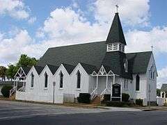
St. Gabriel's Episcopal Church |
|
000000001972-12-05-0000December 5, 1972
(#72000302) |
414 Palm Avenue
28°36′28″N 80°48′39″W / 28.607778°N 80.810833°W / 28.607778; -80.810833 (St. Gabriel's Episcopal Church) |
Titusville |
|
| 35 |
St. Joseph's Catholic Church |
|
000000001987-12-03-0000December 3, 1987
(#87000816) |
Miller Street, Northeast
28°02′00″N 80°35′12″W / 28.033333°N 80.586667°W / 28.033333; -80.586667 (St. Joseph's Catholic Church) |
Palm Bay |
|
| 36 |
Titusville Commercial District |
|
000000001990-01-10-0000January 10, 1990
(#89002164) |
Roughly bounded by Julia Street, Hopkins Avenue, Main Street, and Indian River Avenue
28°36′43″N 80°48′26″W / 28.611944°N 80.807222°W / 28.611944; -80.807222 (Titusville Commercial District) |
Titusville |
|
| 37 |
Valencia Subdivision Residential District |
|
000000001992-08-21-0000August 21, 1992
(#92001047) |
14-140 Valencia Road, 825-827 Osceola Drive, and 24-28 Orange Avenue
28°20′11″N 80°43′18″W / 28.336389°N 80.721667°W / 28.336389; -80.721667 (Valencia Subdivision Residential District) |
Rockledge |
|
| 38 |
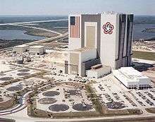
Vehicle Assembly Building-High Bay and Low Bay |
|
000000002000-01-21-0000January 21, 2000
(#99001642) |
Kennedy Space Center
28°35′08″N 80°39′05″W / 28.585556°N 80.651389°W / 28.585556; -80.651389 (Vehicle Assembly Building-High Bay and Low Bay) |
Merritt Island |
|
| 39 |
Wager House |
|
000000001990-01-10-0000January 10, 1990
(#89002165) |
621 Indian River Avenue
28°36′29″N 80°48′23″W / 28.608056°N 80.806389°W / 28.608056; -80.806389 (Wager House) |
Titusville |
|
| 40 |
Marion S. Whaley Citrus Packing House |
|
000000001993-04-08-0000April 8, 1993
(#93000286) |
2275 U.S. Route 1
28°18′46″N 80°42′37″W / 28.312778°N 80.710278°W / 28.312778; -80.710278 (Marion S. Whaley Citrus Packing House) |
Rockledge |
|
| 41 |
Windover Archeological Site (8BR246) |
|
000000001987-04-20-0000April 20, 1987
(#87000810) |
Address Restricted
|
Titusville |
|


_003.jpg)

.jpg)

_001.jpg)