Viera East, Florida
| Viera East, Florida | |
|---|---|
| CDP | |
| Coordinates: 28°15′55″N 80°43′5″W / 28.26528°N 80.71806°WCoordinates: 28°15′55″N 80°43′5″W / 28.26528°N 80.71806°W | |
| Country |
|
| State |
|
| County | Brevard |
| Area | |
| • Total | 5.1 sq mi (13.2 km2) |
| • Land | 5.1 sq mi (13.1 km2) |
| • Water | 0.02 sq mi (0.04 km2) |
| Elevation | 25 ft (8 m) |
| Population (2010) | |
| • Total | 10,757 |
| • Density | 2,100/sq mi (810/km2) |
| Time zone | Eastern (EST) (UTC-5) |
| • Summer (DST) | EDT (UTC-4) |
| GNIS feature ID | 1989257[1] |
Viera East is a census-designated place (CDP) in Brevard County, Florida, United States. The population was 10,757 at the 2010 census.[2] It forms a part of the larger unincorporated community of Viera and is part of the Palm Bay–Melbourne–Titusville Metropolitan Statistical Area.
Geography
Viera East is located at 28°15′55″N 80°43′5″W / 28.26528°N 80.71806°W (28.2655, -80.7182),[3] to the east of Interstate 95.
According to the United States Census Bureau, the CDP has a total area of 5.1 square miles (13.2 km2), of which 5.1 square miles (13.1 km2) is land and 0.02 square miles (0.04 km2), or 0.31%, is water.[4]
See also
References
- ↑ "US Board on Geographic Names". United States Geological Survey. 2007-10-25. Retrieved 2008-01-31.
- ↑ "Profile of General Population and Housing Characteristics: 2010 Demographic Profile Data (DP-1): Viera East CDP, Florida". U.S. Census Bureau, American Factfinder. Retrieved January 31, 2012.
- ↑ "US Gazetteer files: 2010, 2000, and 1990". United States Census Bureau. 2011-02-12. Retrieved 2011-04-23.
- ↑ "Geographic Identifiers: 2010 Demographic Profile Data (G001): Viera East CDP, Florida". U.S. Census Bureau, American Factfinder. Retrieved January 31, 2012.
Municipalities and communities of Brevard County, Florida, United States | ||
|---|---|---|
| Cities | 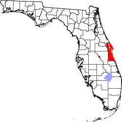 | |
| Towns | ||
| CDPs | ||
| Unincorporated communities | ||
This article is issued from Wikipedia - version of the 7/31/2014. The text is available under the Creative Commons Attribution/Share Alike but additional terms may apply for the media files.