Murphysboro Township, Jackson County, Illinois
| Murphysboro Township | |
|---|---|
| Township | |
 Location in Jackson County | |
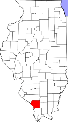 Jackson County's location in Illinois | |
| Coordinates: 37°44′14″N 89°19′34″W / 37.73722°N 89.32611°WCoordinates: 37°44′14″N 89°19′34″W / 37.73722°N 89.32611°W | |
| Country | United States |
| State | Illinois |
| County | Jackson |
| Established | November 4, 1884 |
| Area | |
| • Total | 37.04 sq mi (95.9 km2) |
| • Land | 36.28 sq mi (94.0 km2) |
| • Water | 0.76 sq mi (2.0 km2) 2.05% |
| Elevation | 509 ft (155 m) |
| Population (2010) | |
| • Total | 10,563 |
| • Density | 291.2/sq mi (112.4/km2) |
| Time zone | CST (UTC-6) |
| • Summer (DST) | CDT (UTC-5) |
| ZIP codes | 62901, 62966 |
| GNIS feature ID | 0429415 |
Murphysboro Township is one of sixteen townships in Jackson County, Illinois, USA. As of the 2010 census, its population was 10,563 and it contained 5,174 housing units.[1]
Geography
According to the 2010 census, the township has a total area of 37.04 square miles (95.9 km2), of which 36.28 square miles (94.0 km2) (or 97.95%) is land and 0.76 square miles (2.0 km2) (or 2.05%) is water.[1]
Cities, towns, villages
- Carbondale (west edge)
- Murphysboro (south three-quarters)
Unincorporated towns
- Mount Carbon at 37°45′07″N 89°19′16″W / 37.751995°N 89.321199°W
- Poplar Ridge at 37°42′01″N 89°22′14″W / 37.700328°N 89.370646°W
- Texas Junction at 37°45′35″N 89°19′24″W / 37.759773°N 89.323422°W
(This list is based on USGS data and may include former settlements.)
Adjacent townships
- Somerset Township (north)
- DeSoto Township (northeast)
- Carbondale Township (east)
- Makanda Township (southeast)
- Pomona Township (south)
- Sand Ridge Township (west)
- Levan Township (northwest)
Cemeteries
The township contains these twelve cemeteries: Bostick, Hall, Hiller-Crab Orchard, Mount Carbon, Mount Pleasant, Murdale Gardens of Memory, Murphysboro City, Pleasant Grove Memorial, Poplar Ridge, Saint Andrews, Tower Grove and Worthen.
Major highways
Airports and landing strips
- Saint Joseph Memorial Hospital Heliport
Lakes
- Browns Lake
- Carbon Lake
- Country Club Lake
Landmarks
- Lake Murphysboro State Park (southeast edge)
- Riverside Park
School districts
- Murphysboro Community Unit School District 186
Political districts
- Illinois' 12th congressional district
- State House District 115
- State Senate District 58
References
- "Murphysboro Township, Jackson County, Illinois". Geographic Names Information System. United States Geological Survey. Retrieved 2010-01-17.
- United States Census Bureau 2007 TIGER/Line Shapefiles
- United States National Atlas
- 1 2 "Population, Housing Units, Area, and Density: 2010 - County -- County Subdivision and Place -- 2010 Census Summary File 1". United States Census. Retrieved 2013-05-28.
External links
Municipalities and communities of Jackson County, Illinois, United States | ||
|---|---|---|
| Cities | ||
| Villages | ||
| Townships | ||
| CDP | ||
| Other unincorporated communities | ||
| Ghost town | ||
| Footnotes | ‡This populated place also has portions in an adjacent county or counties | |
This article is issued from Wikipedia - version of the 6/27/2016. The text is available under the Creative Commons Attribution/Share Alike but additional terms may apply for the media files.