Degognia Township, Jackson County, Illinois
| Degognia Township | |
|---|---|
| Township | |
 Location in Jackson County | |
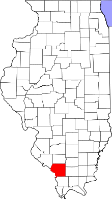 Jackson County's location in Illinois | |
| Coordinates: 37°49′N 89°38′W / 37.817°N 89.633°WCoordinates: 37°49′N 89°38′W / 37.817°N 89.633°W | |
| Country | United States |
| State | Illinois |
| County | Jackson |
| Established | November 4, 1884 |
| Area | |
| • Total | 30.64 sq mi (79.4 km2) |
| • Land | 29.53 sq mi (76.5 km2) |
| • Water | 1.11 sq mi (2.9 km2) 3.62% |
| Elevation | 361 ft (110 m) |
| Population (2010) | |
| • Total | 153 |
| • Density | 5.2/sq mi (2.0/km2) |
| Time zone | CST (UTC-6) |
| • Summer (DST) | CDT (UTC-5) |
| ZIP codes | 62280, 62907, 62950 |
| GNIS feature ID | 0428883 |
Degognia Township is one of 16 townships in Jackson County, in the U.S. state of Illinois. As of the 2010 census, its population was 153 and it contained 73 housing units.[1] The township derives its name from Degognia Creek.[2]
Geography
According to the 2010 census, the township has a total area of 30.64 square miles (79.4 km2), of which 29.53 square miles (76.5 km2) (or 96.38%) is land and 1.11 square miles (2.9 km2) (or 3.62%) is water.[1]
Unincorporated towns
- Cora at 37°49′26″N 89°40′13″W / 37.823941°N 89.67038°W
- Degognia at 37°51′40″N 89°37′49″W / 37.861163°N 89.630378°W
- Jones Ridge at 37°48′01″N 89°37′31″W / 37.800329°N 89.625379°W
(This list is based on USGS data and may include former settlements.)
Adjacent townships
- Bradley Township (northeast)
- Kinkaid Township (east)
- Fountain Bluff Township (southeast)
Cemeteries
The township contains these three cemeteries: Buchanan, Houge and Isom.
Major highways
Airports and landing strips
- Reeds Creek Landing Airport
Rivers
School districts
- Trico Community Unit School District 176
Political districts
- Illinois' 12th congressional district
- State House District 115
- State Senate District 58
References
- "Degognia Township, Jackson County, Illinois". Geographic Names Information System. United States Geological Survey. Retrieved 2010-01-17.
- United States Census Bureau 2007 TIGER/Line Shapefiles
- United States National Atlas
- 1 2 "Population, Housing Units, Area, and Density: 2010 - County -- County Subdivision and Place -- 2010 Census Summary File 1". United States Census. Retrieved 2013-05-28.
- ↑ Callary, Edward (29 September 2008). Place Names of Illinois. University of Illinois Press. p. 90. ISBN 978-0-252-09070-7.
External links
Municipalities and communities of Jackson County, Illinois, United States | ||
|---|---|---|
| Cities | ||
| Villages | ||
| Townships | ||
| CDP | ||
| Other unincorporated communities | ||
| Ghost town | ||
| Footnotes | ‡This populated place also has portions in an adjacent county or counties | |
This article is issued from Wikipedia - version of the 10/27/2016. The text is available under the Creative Commons Attribution/Share Alike but additional terms may apply for the media files.