Kinkaid Township, Jackson County, Illinois
| Kinkaid Township | |
|---|---|
| Township | |
|
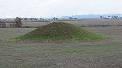
The Cleiman Mound, a Middle Woodland period Indian mound along Illinois Route 3 | |
 Location in Jackson County | |
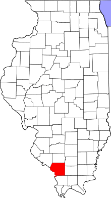 Jackson County's location in Illinois | |
| Coordinates: 37°49′26″N 89°32′49″W / 37.82389°N 89.54694°WCoordinates: 37°49′26″N 89°32′49″W / 37.82389°N 89.54694°W | |
| Country | United States |
| State | Illinois |
| County | Jackson |
| Established | November 4, 1884 |
| Area | |
| • Total | 36.33 sq mi (94.1 km2) |
| • Land | 35.58 sq mi (92.2 km2) |
| • Water | 0.75 sq mi (1.9 km2) 2.06% |
| Elevation | 594 ft (181 m) |
| Population (2010) | |
| • Total | 486 |
| • Density | 13.7/sq mi (5.3/km2) |
| Time zone | CST (UTC-6) |
| • Summer (DST) | CDT (UTC-5) |
| ZIP codes | 62280, 62907, 62950 |
| GNIS feature ID | 0429211 |
Kinkaid Township is one of sixteen townships in Jackson County, Illinois, USA. As of the 2010 census, its population was 486 and it contained 227 housing units.[1]
Geography
According to the 2010 census, the township has a total area of 36.33 square miles (94.1 km2), of which 35.58 square miles (92.2 km2) (or 97.94%) is land and 0.75 square miles (1.9 km2) (or 2.06%) is water.[1]
Unincorporated towns
- Crain at 37°46′48″N 89°30′28″W / 37.780051°N 89.507874°W
- Dry Hill at 37°49′02″N 89°33′12″W / 37.817274°N 89.553431°W
- Glenn at 37°48′13″N 89°34′50″W / 37.803663°N 89.580655°W
(This list is based on USGS data and may include former settlements.)
Adjacent townships
- Bradley Township (north)
- Ora Township (northeast)
- Levan Township (east)
- Sand Ridge Township (southeast)
- Fountain Bluff Township (south)
- Degognia Township (west)
Cemeteries
The township contains these Eight cemeteries: Bower, Glenn, Jones, Lee, McBride, McCormick, Talbott and Wilson.
Major highways
School districts
- Trico Community Unit School District 176
Political districts
- Illinois' 12th congressional district
- State House District 115
- State Senate District 58
References
- "Kinkaid Township, Jackson County, Illinois". Geographic Names Information System. United States Geological Survey. Retrieved 2010-01-17.
- United States Census Bureau 2007 TIGER/Line Shapefiles
- United States National Atlas
- 1 2 "Population, Housing Units, Area, and Density: 2010 - County -- County Subdivision and Place -- 2010 Census Summary File 1". United States Census. Retrieved 2013-05-28.
External links
Municipalities and communities of Jackson County, Illinois, United States | ||
|---|---|---|
| Cities | ||
| Villages | ||
| Townships | ||
| CDP | ||
| Other unincorporated communities | ||
| Ghost town | ||
| Footnotes | ‡This populated place also has portions in an adjacent county or counties | |
This article is issued from Wikipedia - version of the 1/28/2014. The text is available under the Creative Commons Attribution/Share Alike but additional terms may apply for the media files.