Montrose, Minnesota
| Montrose, Minnesota | |
|---|---|
| City | |
| Motto: "It's Good to be Home" | |
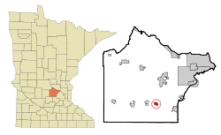 Location of the city of Montrose within Wright County, Minnesota | |
| Coordinates: 45°4′2″N 93°54′45″W / 45.06722°N 93.91250°W | |
| Country | United States |
| State | Minnesota |
| County | Wright |
| Area[1] | |
| • Total | 3.21 sq mi (8.31 km2) |
| • Land | 3.20 sq mi (8.29 km2) |
| • Water | 0.01 sq mi (0.03 km2) |
| Elevation | 994 ft (303 m) |
| Population (2010)[2] | |
| • Total | 2,847 |
| • Estimate (2016[3]) | 3,121 |
| • Density | 889.7/sq mi (343.5/km2) |
| Time zone | Central (CST) (UTC-6) |
| • Summer (DST) | CDT (UTC-5) |
| ZIP code | 55363 |
| Area code(s) | 763 |
| FIPS code | 27-43810[4] |
| GNIS feature ID | 0648049[5] |
| Website | www.montrose-mn.com |
Montrose is a city in Wright County, Minnesota, United States. The population was 2,847 at the 2010 census.[6]
History
Montrose was platted in 1878, and named after Montrose, in Scotland.[7] Montrose was incorporated in 1881.[7] The Dr. E.P. Hawkins Clinic, Hospital, and House, an early-20th-century medical complex, is listed on the National Register of Historic Places.[8]
Geography
According to the United States Census Bureau, the city has a total area of 3.21 square miles (8.31 km2); 3.20 square miles (8.29 km2) is land and 0.01 square miles (0.03 km2) is water.[1] U.S. Highway 12 and Minnesota State Highway 25 are two of the main routes in the community.
Nearby places include Delano, Buffalo, Hanover, Rockford, Waverly, and Watertown.
Demographics
| Historical population | |||
|---|---|---|---|
| Census | Pop. | %± | |
| 1880 | 141 | — | |
| 1890 | 214 | 51.8% | |
| 1900 | 305 | 42.5% | |
| 1910 | 284 | −6.9% | |
| 1920 | 268 | −5.6% | |
| 1930 | 233 | −13.1% | |
| 1940 | 275 | 18.0% | |
| 1950 | 300 | 9.1% | |
| 1960 | 360 | 20.0% | |
| 1970 | 379 | 5.3% | |
| 1980 | 762 | 101.1% | |
| 1990 | 1,008 | 32.3% | |
| 2000 | 1,143 | 13.4% | |
| 2010 | 2,847 | 149.1% | |
| Est. 2016 | 3,121 | [9] | 9.6% |
2010 census
As of the census[2] of 2010, there were 2,847 people, 1,043 households, and 734 families residing in the city. The population density was 889.7 inhabitants per square mile (343.5/km2). There were 1,116 housing units at an average density of 348.8 per square mile (134.7/km2). The racial makeup of the city was 95.2% White, 0.6% African American, 0.2% Native American, 0.9% Asian, 1.2% from other races, and 1.9% from two or more races. Hispanic or Latino of any race were 3.0% of the population.
There were 1,043 households of which 46.1% had children under the age of 18 living with them, 54.6% were married couples living together, 9.2% had a female householder with no husband present, 6.6% had a male householder with no wife present, and 29.6% were non-families. 22.1% of all households were made up of individuals and 4.8% had someone living alone who was 65 years of age or older. The average household size was 2.73 and the average family size was 3.23.
The median age in the city was 29.5 years. 31.9% of residents were under the age of 18; 7% were between the ages of 18 and 24; 40.2% were from 25 to 44; 15.4% were from 45 to 64; and 5.4% were 65 years of age or older. The gender makeup of the city was 50.2% male and 49.8% female.
2000 census
As of the census[4] of 2000, there were 1,143 people, 454 households, and 281 families residing in the city. The population density was 1,190.4 people per square mile (459.7/km²). There were 467 housing units at an average density of 486.3 per square mile (187.8/km²). The racial makeup of the city was 97.20% White, 0.70% African American, 0.17% Asian, 1.31% from other races, and 0.61% from two or more races. Hispanic or Latino of any race were 1.31% of the population.
There were 454 households out of which 36.6% had children under the age of 18 living with them, 51.1% were married couples living together, 6.8% had a female householder with no husband present, and 37.9% were non-families. 30.8% of all households were made up of individuals and 7.3% had someone living alone who was 65 years of age or older. The average household size was 2.52 and the average family size was 3.18.
In the city the population was spread out with 28.7% under the age of 18, 11.6% from 18 to 24, 34.1% from 25 to 44, 17.7% from 45 to 64, and 7.9% who were 65 years of age or older. The median age was 30 years. For every 100 females there were 107.4 males. For every 100 females age 18 and over, there were 107.9 males.
The median income for a household in the city was $39,583, and the median income for a family was $52,833. Males had a median income of $31,434 versus $26,481 for females. The per capita income for the city was $19,281. About 4.6% of families and 6.4% of the population were below the poverty line, including 6.1% of those under age 18 and 4.0% of those age 65 or over.
References
- 1 2 "US Gazetteer files 2010". United States Census Bureau. Retrieved 2012-11-13.
- 1 2 "American FactFinder". United States Census Bureau. Retrieved 2012-11-13.
- ↑ "Population Estimates". United States Census Bureau. Retrieved 2013-05-28.
- 1 2 "American FactFinder". United States Census Bureau. Retrieved 2008-01-31.
- ↑ "US Board on Geographic Names". United States Geological Survey. 2007-10-25. Retrieved 2008-01-31.
- ↑ "2010 Census Redistricting Data (Public Law 94-171) Summary File". American FactFinder. U.S. Census Bureau, 2010 Census. Retrieved 23 April 2011.
- 1 2 Upham, Warren (1920). Minnesota Geographic Names: Their Origin and Historic Significance. Minnesota Historical Society. p. 589.
- ↑ National Park Service (2010-07-09). "National Register Information System". National Register of Historic Places. National Park Service.
- ↑ "Annual Estimates of the Resident Population for Incorporated Places: April 1, 2010 to July 1, 2015". Retrieved July 2, 2016.
- ↑ "Census of Population and Housing". Census.gov. Retrieved June 4, 2015.
External links
Municipalities and communities of Wright County, Minnesota, United States | ||
|---|---|---|
| Cities | 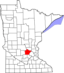 | |
| Townships | ||
| CDP | ||
| Unincorporated communities | ||
| Ghost town | ||
| Footnotes | ‡This populated place also has portions in an adjacent county or counties | |
Coordinates: 45°03′54″N 93°54′40″W / 45.06500°N 93.91111°W