Howard Lake, Minnesota
| Howard Lake, Minnesota | |
|---|---|
| City | |
|
Downtown Howard Lake | |
| Motto: "Home Of The Good Neighbor"[1] | |
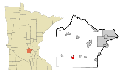 Location of Howard Lake within Wright County, Minnesota | |
| Coordinates: 45°4′N 94°4′W / 45.067°N 94.067°W | |
| Country | United States |
| State | Minnesota |
| County | Wright |
| Area[2] | |
| • Total | 2.05 sq mi (5.31 km2) |
| • Land | 1.77 sq mi (4.58 km2) |
| • Water | 0.28 sq mi (0.73 km2) |
| Elevation | 1,014 ft (309 m) |
| Population (2010)[3] | |
| • Total | 1,962 |
| • Estimate (2012[4]) | 1,993 |
| • Density | 1,108.5/sq mi (428.0/km2) |
| Time zone | Central (CST) (UTC-6) |
| • Summer (DST) | CDT (UTC-5) |
| ZIP codes | 55349, 55575 |
| Area code(s) | 320 |
| FIPS code | 27-30284[5] |
| GNIS feature ID | 0645261[6] |
| Website | www.howard-lake.mn.us |

Howard Lake is a city in Wright County, Minnesota, United States. The population was 1,962 at the 2010 census.[7]
Geography
According to the United States Census Bureau, the city has a total area of 2.05 square miles (5.31 km2); 1.77 square miles (4.58 km2) is land and 0.28 square miles (0.73 km2) is water.[2]
The town of Howard Lake sits on the south shore of Howard Lake. Other area lakes include Mallard Pass Lake, Lake Ann, Dutch Lake, and Smith Lake.
Infrastructure
Transportation
U.S. Highway 12 serves as a main route in Howard Lake.
History
The area was first settled in 1855 by Morgan V. Cochran, who later sold his land to Charles Goodsell in 1863. Howard Lake developed as a railroad station.[1]
Howard Lake was platted in 1869, and named after nearby Howard Lake.[8] A post office was established under the name Howard in 1870; the post office was renamed Howard Lake in 1892 and remains in operation.[9] One property in Howard Lake, the 1904 Howard Lake City Hall, is listed on the National Register of Historic Places.[10]
Demographics
| Historical population | |||
|---|---|---|---|
| Census | Pop. | %± | |
| 1880 | 477 | — | |
| 1890 | 610 | 27.9% | |
| 1900 | 737 | 20.8% | |
| 1910 | 626 | −15.1% | |
| 1920 | 744 | 18.8% | |
| 1930 | 768 | 3.2% | |
| 1940 | 847 | 10.3% | |
| 1950 | 931 | 9.9% | |
| 1960 | 1,007 | 8.2% | |
| 1970 | 1,162 | 15.4% | |
| 1980 | 1,240 | 6.7% | |
| 1990 | 1,343 | 8.3% | |
| 2000 | 1,853 | 38.0% | |
| 2010 | 1,962 | 5.9% | |
| Est. 2015 | 2,039 | [11] | 3.9% |
2010 census
As of the census[3] of 2010, there were 1,962 people, 786 households, and 518 families residing in the city. The population density was 1,108.5 inhabitants per square mile (428.0/km2). There were 865 housing units at an average density of 488.7 per square mile (188.7/km2). The racial makeup of the city was 96.5% White, 0.6% African American, 0.3% Native American, 0.2% Asian, 0.1% Pacific Islander, 1.5% from other races, and 0.8% from two or more races. Hispanic or Latino of any race were 4.7% of the population.
There were 786 households of which 35.9% had children under the age of 18 living with them, 50.5% were married couples living together, 10.1% had a female householder with no husband present, 5.3% had a male householder with no wife present, and 34.1% were non-families. 30.2% of all households were made up of individuals and 10.2% had someone living alone who was 65 years of age or older. The average household size was 2.42 and the average family size was 2.98.
The median age in the city was 36.5 years. 27.1% of residents were under the age of 18; 6.6% were between the ages of 18 and 24; 29.5% were from 25 to 44; 22.2% were from 45 to 64; and 14.7% were 65 years of age or older. The gender makeup of the city was 48.0% male and 52.0% female.
2000 census
As of the census[5] of 2000, there were 1,853 people, 735 households, and 490 families residing in the city. The population density was 1,405.2 people per square mile (542.0/km²). There were 759 housing units at an average density of 575.6 per square mile (222.0/km²). The racial makeup of the city was 98.27% White, 0.27% African American, 0.16% Native American, 0.38% Asian, 0.49% from other races, and 0.43% from two or more races. Hispanic or Latino of any race were 1.03% of the population. 52.1% were of German, 8.9% Norwegian, 7.3% Swedish and 5.8% American ancestry according to Census 2000.
There were 735 households out of which 34.1% had children under the age of 18 living with them, 51.7% were married couples living together, 10.6% had a female householder with no husband present, and 33.2% were non-families. 27.9% of all households were made up of individuals and 12.4% had someone living alone who was 65 years of age or older. The average household size was 2.52 and the average family size was 3.10.
In the city the population was spread out with 28.4% under the age of 18, 9.0% from 18 to 24, 30.1% from 25 to 44, 18.6% from 45 to 64, and 13.9% who were 65 years of age or older. The median age was 33 years. For every 100 females there were 91.0 males. For every 100 females age 18 and over, there were 89.6 males.
The median income for a household in the city was $38,015, and the median income for a family was $49,327. Males had a median income of $32,500 versus $25,040 for females. The per capita income for the city was $17,900. About 5.8% of families and 9.4% of the population were below the poverty line, including 13.0% of those under age 18 and 7.3% of those age 65 or over.
References
- 1 2 "City of Howard Lake Minnesota". City of Howard Lake Minnesota. Retrieved October 8, 2012.
- 1 2 "US Gazetteer files 2010". United States Census Bureau. Retrieved 2012-11-13.
- 1 2 "American FactFinder". United States Census Bureau. Retrieved 2012-11-13.
- ↑ "Population Estimates". United States Census Bureau. Retrieved 2013-05-28.
- 1 2 "American FactFinder". United States Census Bureau. Retrieved 2008-01-31.
- ↑ "US Board on Geographic Names". United States Geological Survey. 2007-10-25. Retrieved 2008-01-31.
- ↑ "2010 Census Redistricting Data (Public Law 94-171) Summary File". American FactFinder. U.S. Census Bureau, 2010 Census. Retrieved 23 April 2011.
- ↑ Upham, Warren (1920). Minnesota Geographic Names: Their Origin and Historic Significance. Minnesota Historical Society. p. 588.
- ↑ "Wright County". Jim Forte Postal History. Retrieved 1 August 2015.
- ↑ National Park Service (2010-07-09). "National Register Information System". National Register of Historic Places. National Park Service.
- ↑ "Annual Estimates of the Resident Population for Incorporated Places: April 1, 2010 to July 1, 2015". Retrieved July 2, 2016.
- ↑ "Census of Population and Housing". Census.gov. Retrieved June 4, 2015.
External links
| Wikimedia Commons has media related to Howard Lake, Minnesota. |
- City of Howard Lake, MN – Official Website
- Howard Lake Community Guide
- Herald Journal newspaper site
- City-Data.com
- ePodunk: Profile for Howard Lake, Minnesota
Municipalities and communities of Wright County, Minnesota, United States | ||
|---|---|---|
| Cities | 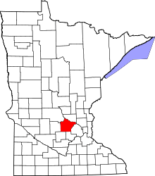 | |
| Townships | ||
| CDP | ||
| Unincorporated communities | ||
| Ghost town | ||
| Footnotes | ‡This populated place also has portions in an adjacent county or counties | |
Coordinates: 45°4′N 94°4′W / 45.067°N 94.067°W