Cokato, Minnesota
| Cokato, Minnesota | |
|---|---|
| City | |
|
Downtown Cokato | |
| Motto: "In The Midst Of Opportunity"[1] | |
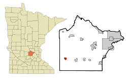 Location of the city of Cokato within Wright County, Minnesota | |
| Coordinates: 45°4′32″N 94°11′21″W / 45.07556°N 94.18917°W | |
| Country | United States |
| State | Minnesota |
| County | Wright |
| Government | |
| • Mayor | Gordon Erickson [2] |
| Area[3] | |
| • Total | 1.56 sq mi (4.04 km2) |
| • Land | 1.56 sq mi (4.04 km2) |
| • Water | 0 sq mi (0 km2) |
| Elevation | 1,056 ft (322 m) |
| Population (2010)[4] | |
| • Total | 2,694 |
| • Estimate (2012[5]) | 2,726 |
| • Density | 1,726.9/sq mi (666.8/km2) |
| Time zone | Central (CST) (UTC-6) |
| • Summer (DST) | CDT (UTC-5) |
| ZIP code | 55321 |
| Area code(s) | 320 |
| FIPS code | 27-12430[6] |
| GNIS feature ID | 0641381[7] |
| Website | www.cokato.mn.us |

Cokato is a city in Wright County, Minnesota, United States. The population was 2,694 at the 2010 census.[8]
Geography
According to the United States Census Bureau, the city has a total area of 1.56 square miles (4.04 km2), all of it land.[3]
Infrastructure
Transportation
U.S. Highway 12 serves as a main route in the city.
History
Cokato was founded in 1869 when the railroad was extended to that point.[9] The city was named after the Siouan word meaning "at the middle."[10] Cokato was incorporated in 1878.[11]
Demographics
| Historical population | |||
|---|---|---|---|
| Census | Pop. | %± | |
| 1880 | 274 | — | |
| 1890 | 363 | 32.5% | |
| 1900 | 684 | 88.4% | |
| 1910 | 718 | 5.0% | |
| 1920 | 1,014 | 41.2% | |
| 1930 | 1,125 | 10.9% | |
| 1940 | 1,175 | 4.4% | |
| 1950 | 1,403 | 19.4% | |
| 1960 | 1,356 | −3.3% | |
| 1970 | 1,735 | 27.9% | |
| 1980 | 2,056 | 18.5% | |
| 1990 | 2,180 | 6.0% | |
| 2000 | 2,727 | 25.1% | |
| 2010 | 2,694 | −1.2% | |
| Est. 2015 | 2,727 | [12] | 1.2% |
2010 census
As of the census[4] of 2010, there were 2,694 people, 1,000 households, and 652 families residing in the city. The population density was 1,726.9 inhabitants per square mile (666.8/km2). There were 1,103 housing units at an average density of 707.1 per square mile (273.0/km2). The racial makeup of the city was 95.0% White, 0.3% African American, 0.5% Native American, 0.5% Asian, 2.3% from other races, and 1.4% from two or more races. Hispanic or Latino of any race were 4.3% of the population.
There were 1,000 households of which 36.9% had children under the age of 18 living with them, 50.4% were married couples living together, 10.7% had a female householder with no husband present, 4.1% had a male householder with no wife present, and 34.8% were non-families. 30.1% of all households were made up of individuals and 15.5% had someone living alone who was 65 years of age or older. The average household size was 2.61 and the average family size was 3.29.
The median age in the city was 32.5 years. 31.8% of residents were under the age of 18; 6.9% were between the ages of 18 and 24; 25.6% were from 25 to 44; 20.6% were from 45 to 64; and 15.2% were 65 years of age or older. The gender makeup of the city was 48.4% male and 51.6% female.
2000 census
As of the census[6] of 2000, there were 2,727 people, 990 households, and 663 families residing in the city. The population density was 2,125.8 people per square mile (822.6/km²). There were 1,035 housing units at an average density of 806.8 per square mile (312.2/km²). The racial makeup of the city was 96.81% White, 0.15% African American, 0.26% Native American, 0.44% Asian, 0.04% Pacific Islander, 1.25% from other races, and 1.06% from two or more races. Hispanic or Latino of any race were 2.68% of the population. 29.5% were of German, 24.2% Finnish, 15.3% Swedish and 9.8% Norwegian ancestry according to Census 2000.
There were 990 households out of which 36.6% had children under the age of 18 living with them, 51.1% were married couples living together, 11.2% had a female householder with no husband present, and 33.0% were non-families. 29.7% of all households were made up of individuals and 17.0% had someone living alone who was 65 years of age or older. The average household size was 2.66 and the average family size was 3.33.
In the city the population was spread out with 31.8% under the age of 18, 8.4% from 18 to 24, 25.4% from 25 to 44, 16.9% from 45 to 64, and 17.5% who were 65 years of age or older. The median age was 33 years. For every 100 females there were 91.5 males. For every 100 females age 18 and over, there were 90.3 males.
The median income for a household in the city was $39,613, and the median income for a family was $51,645. Males had a median income of $35,362 versus $21,484 for females. The per capita income for the city was $17,149. About 7.1% of families and 7.7% of the population were below the poverty line, including 7.5% of those under age 18 and 14.9% of those age 65 or over.
Culture
The city of Cokato is home to the Cokato Museum & Gust Akerlund Studio. The museum is a local history museum dedicated to chronicling the story of the people of the city of Cokato, and the surrounding townships, in southwest Wright County. The Akerlund Studio is a restored photography studio, and home of Gust Akerlund, who operated the studio during the early 20th century.[14]
Cokato hosts the Cokato Corn Carnival annually during the second week of August in Peterson Park, near Cokato Elementary School. The highlight of the festival is the serving of free corn-on-the-cob, along with a parade, midway and carnival rides, musical entertainment, the Miss Cokato coronation, and other events.[15]
The Aho family of Cokato was featured by journalist Steve Hartman on CBS News Sunday Morning on December 9, 2012, for having twelve sons who all played football at the local high school over a period of more than two decades.
Notable people
- David Bromstad – interior designer and television personality. In 2006, he became the winner of the debut season of the HGTV series Design Star. He is the host of his own television show, Color Splash with David Bromstad, which debuted in 2007 on HGTV. Born in Cokato.[16]
References
- ↑ "City of Cokato Minnesota". City of Cokato Minnesota. Retrieved October 4, 2012.
- ↑ http://www.cokato.mn.us/?page_id=91
- 1 2 "US Gazetteer files 2010". United States Census Bureau. Archived from the original on 2012-06-26. Retrieved 2012-11-13.
- 1 2 "American FactFinder". United States Census Bureau. Retrieved 2012-11-13.
- ↑ "Population Estimates". United States Census Bureau. Archived from the original on 2013-06-17. Retrieved 2013-05-28.
- 1 2 "American FactFinder". United States Census Bureau. Archived from the original on 2013-09-11. Retrieved 2008-01-31.
- ↑ "US Board on Geographic Names". United States Geological Survey. 2007-10-25. Retrieved 2008-01-31.
- ↑ "2010 Census Redistricting Data (Public Law 94-171) Summary File". American FactFinder. U.S. Census Bureau, 2010 Census. Archived from the original on 21 July 2011. Retrieved 23 April 2011.
- ↑ Upham, Warren (1920). Minnesota Geographic Names: Their Origin and Historic Significance. Minnesota Historical Society. p. 587.
- ↑ "Profile for Cokato, Minnesota, MN". ePodunk. Retrieved October 4, 2012.
- ↑ City of Cokato. "History". Retrieved 2010-11-02
- ↑ "Annual Estimates of the Resident Population for Incorporated Places: April 1, 2010 to July 1, 2015". Retrieved July 2, 2016.
- ↑ "Census of Population and Housing". Census.gov. Archived from the original on May 11, 2015. Retrieved June 4, 2015.
- ↑ City of Cokato. "Cokato Museum & Akerlund Studio". Retrieved 2010-11-02.
- ↑ City of Cokato. "Corn Carnival". Retrieved 2010-11-02
- ↑ "David Bromstad". IMDb. Retrieved October 14, 2012.
External links
| Wikimedia Commons has media related to Cokato, Minnesota. |
Municipalities and communities of Wright County, Minnesota, United States | ||
|---|---|---|
| Cities | 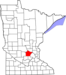 | |
| Townships | ||
| CDP | ||
| Unincorporated communities | ||
| Ghost town | ||
| Footnotes | ‡This populated place also has portions in an adjacent county or counties | |
Coordinates: 45°04′33″N 94°11′24″W / 45.07583°N 94.19000°W