Albertville, Minnesota
| Albertville, Minnesota | |
|---|---|
| City | |
|
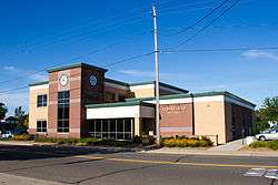
Albertville City Hall | |
| Motto: "Small Town Living. Big City Life."[1] | |
 Location of the city of Albertville within Wright County, Minnesota | |
| Coordinates: 45°14′17″N 93°39′35″W / 45.23806°N 93.65972°W | |
| Country | United States |
| State | Minnesota |
| County | Wright |
| Area[2] | |
| • Total | 4.64 sq mi (12.02 km2) |
| • Land | 4.37 sq mi (11.32 km2) |
| • Water | 0.27 sq mi (0.70 km2) |
| Elevation | 961 ft (293 m) |
| Population (2010)[3] | |
| • Total | 7,044 |
| • Estimate (2015[4]) | 7,745 |
| • Density | 1,611.9/sq mi (622.4/km2) |
| Time zone | Central (CST) (UTC-6) |
| • Summer (DST) | CDT (UTC-5) |
| ZIP code | 55301 |
| Area code(s) | 763 |
| FIPS code | 27-00730[5] |
| GNIS feature ID | 0639253[6] |
| Website | www.ci.albertville.mn.us |
Albertville is a city in Wright County, Minnesota, United States. The population was 7,044 at the 2010 census.[7]
Geography
According to the United States Census Bureau, the city has a total area of 4.64 square miles (12.02 km2); 4.37 square miles (11.32 km2) is land and 0.27 square miles (0.70 km2) is water.[2] Albertville is generally considered the half way point between Minneapolis and Saint Cloud.
The city contains the Church of St Albert, constructed in 1906.
Infrastructure
Transportation
Interstate 94 serves as a main route in the city.
Economy
Albertville is the home of Albertville Premium Outlets, an outlet mall which houses 100 stores.
Education
Albertville is part of St. Michael–Albertville Independent School District #885. The St. Michael–Albertville school colors are royal blue and gold, with the mascot as the Knight. The school district consists of seven schools and two alternative academies. The schools are St. Michael-Albertville High School (Grades 9–12), which is a new building and is about 410,000 square feet (38,000 m2); St. Michael–Albertville Middle School East and West (Grades 5–8); St. Michael Elementary School (Grades 1–4); Fieldstone Elementary School (Grades 1–4); Big Woods Elementary School (Grades 1–4); and Albertville Primary School (Kindergarten). The two ALP academies are Page Academy (Middle School alternative) and the Knights Academy (High School alternative). There is also a private Catholic School for grades K–7 (with 8th grade to be added in 2012) in St. Michael.
The district's new high school cost about $77 million to construct, and has currently the largest Performing Arts Center in the state of Minnesota, which can hold 1,450.
Demographics
| Historical population | |||
|---|---|---|---|
| Census | Pop. | %± | |
| 1910 | 222 | — | |
| 1920 | 268 | 20.7% | |
| 1930 | 217 | −19.0% | |
| 1940 | 243 | 12.0% | |
| 1950 | 238 | −2.1% | |
| 1960 | 279 | 17.2% | |
| 1970 | 451 | 61.6% | |
| 1980 | 564 | 25.1% | |
| 1990 | 1,251 | 121.8% | |
| 2000 | 3,621 | 189.4% | |
| 2010 | 7,044 | 94.5% | |
| Est. 2015 | 7,345 | [8] | 4.3% |
| U.S. Decennial Census | |||
2010 census
As of the census[3] of 2010, there were 7,044 people, 2,377 households, and 1,799 families residing in the city. The population density was 1,611.9 inhabitants per square mile (622.4/km2). There were 2,488 housing units at an average density of 569.3 per square mile (219.8/km2). The racial makeup of the city was 91.6% White, 2.5% African American, 0.3% Native American, 3.0% Asian, 0.6% from other races, and 2.0% from two or more races. Hispanic or Latino of any race were 2.8% of the population.
There were 2,377 households of which 50.9% had children under the age of 18 living with them, 62.2% were married couples living together, 8.7% had a female householder with no husband present, 4.8% had a male householder with no wife present, and 24.3% were non-families. 18.1% of all households were made up of individuals and 3.9% had someone living alone who was 65 years of age or older. The average household size was 2.96 and the average family size was 3.41.
The median age in the city was 30.9 years. 34.4% of residents were under the age of 18; 6.4% were between the ages of 18 and 24; 36.6% were from 25 to 44; 17.3% were from 45 to 64; and 5.3% were 65 years of age or older. The gender makeup of the city was 49.6% male and 50.4% female.
2000 census
As of the census[5] of 2000, there were 3,621 people, 1,287 households, and 984 families residing in the city. The population density was 826.3 people per square mile (319.2/km²). There were 1,318 housing units at an average density of 300.8 per square mile (116.2/km²). The racial makeup of the city was 98.51% White, 0.30% African American, 0.22% Native American, 0.25% Asian, 0.08% from other races, and 0.64% from two or more races. Hispanic or Latino of any race were 0.66% of the population. 44.9% were of German, 11.8% Norwegian, 8.1% Swedish and 5.1% Irish ancestry according to Census 2000.
There were 1,287 households out of which 49.1% had children under the age of 18 living with them, 61.4% were married couples living together, 10.7% had a female householder with no husband present, and 23.5% were non-families. 16.9% of all households were made up of individuals and 2.8% had someone living alone who was 65 years of age or older. The average household size was 2.81 and the average family size was 3.21.
In the city the population was spread out with 34.1% under the age of 18, 8.5% from 18 to 24, 41.5% from 25 to 44, 10.8% from 45 to 64, and 5.1% who were 65 years of age or older. The median age was 29 years. For every 100 females there were 101.4 males. For every 100 females age 18 and over, there were 102.1 males.
The median income for a household in the city was $58,260, and the median income for a family was $63,578. Males had a median income of $41,783 versus $30,244 for females. The per capita income for the city was $21,424. About 6.7% of families and 6.9% of the population were below the poverty line, including 9.9% of those under age 18 and none of those age 65 or over.
Notable people
- Chas Betts – professional wrestler and amateur wrestler, won the 2012 U.S. Olympic Trials at 84 kg GR and competed at the 2012 Olympics. St. Michael–Albertville High School alumni.
LISA ERICKSON - Amateur Ballroom Dance Competitor, won the United States Amateur Titles 9-Dance in American Smooth and Rhythm 1992-1994. (Resident, Licensed Insurance Advisor)
References
- ↑ "City of Albertville Minnesota". City of Albertville Minnesota. Retrieved October 16, 2012.
- 1 2 "US Gazetteer files 2010". United States Census Bureau. Archived from the original on 2012-01-24. Retrieved 2012-11-13.
- 1 2 "American FactFinder". United States Census Bureau. Retrieved 2012-11-13.
- ↑ "Population Estimates". United States Census Bureau. Archived from the original on 2013-06-17. Retrieved 2013-05-28.
- 1 2 "American FactFinder". United States Census Bureau. Archived from the original on 2013-09-11. Retrieved 2008-01-31.
- ↑ "US Board on Geographic Names". United States Geological Survey. 2007-10-25. Retrieved 2008-01-31.
- ↑ "2010 Census Redistricting Data (Public Law 94-171) Summary File". American FactFinder. U.S. Census Bureau, 2010 Census. Archived from the original on 21 July 2011. Retrieved 23 April 2011.
- ↑ "Annual Estimates of the Resident Population for Incorporated Places: April 1, 2010 to July 1, 2015". Retrieved July 2, 2016.
External links
| Wikimedia Commons has media related to Albertville, Minnesota. |
- Albertville official website
- St. Michael–Albertville Independent School District #885
- Cit-Data.com
- ePodunk: Profile for Albertville, Minnesota
Municipalities and communities of Wright County, Minnesota, United States | ||
|---|---|---|
| Cities | 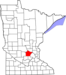 | |
| Townships | ||
| CDP | ||
| Unincorporated communities | ||
| Ghost town | ||
| Footnotes | ‡This populated place also has portions in an adjacent county or counties | |
Coordinates: 45°14′16″N 93°39′16″W / 45.23778°N 93.65444°W