Minamiuonuma
| Minamiuonuma 南魚沼市 | |||
|---|---|---|---|
| City | |||
|
Minamiuonuma City Hall | |||
| |||
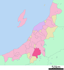 Location of Minamiuonuma in Niigata | |||
 Minamiuonuma
| |||
| Coordinates: 37°3′55.9″N 138°52′33.9″E / 37.065528°N 138.876083°ECoordinates: 37°3′55.9″N 138°52′33.9″E / 37.065528°N 138.876083°E | |||
| Country | Japan | ||
| Region | Chūbu (Kōshin'etsu) (Hokuriku) | ||
| Prefecture | NIigata | ||
| Area | |||
| • Total | 584.55 km2 (225.70 sq mi) | ||
| Population (June 2016) | |||
| • Total | 58,051 | ||
| • Density | 99.3/km2 (257/sq mi) | ||
| Time zone | Japan Standard Time (UTC+9) | ||
| Symbols | |||
| • Tree | Kobushi magnolia | ||
| • Flower | Erythronium japonicum | ||
| Phone number | 0250-62-2510 | ||
| Address | 180-1 Muika-machi, Minamiuonuma-shi, Niigata-ken 949-6696 | ||
| Website |
www | ||


Minamiuonuma (南魚沼市 Minamiuonuma-shi) is a city located in north-central Niigata Prefecture, in the Hokuriku region of Japan. As of 1 June 2016, the city had an estimated population of 42,993 and a population density of 223 persons per km². Its total area was 192.74 square kilometres (74.42 sq mi).
Geography

Minamiuonuma is situated in a valley in a mountainous region of Niigata Prefecture known as “Snow Country” because of the heavy snowfall in winter. The city is bounded by Uonuma and the Echigo-Sanzan mountains in the north, and Yuzawa, a popular ski resort town, in the south. The Uono River flows through most of the city. The city and its surrounding areas are dotted with many onsen (Japanese hot springs) and ski resorts, making it a popular destination in winter. There are also a large number of paddy fields, and popular seasonal fruit like watermelon, as this is a major Koshihikari rice-growing region in Japan. Parts of the city are within the borders of the Jōshin'etsu-kōgen National Park.
Surrounding municipalities
History
The area of present-day Minamiuonuma was part of ancient Echigo Province. The modern city of Minamiuonuma was established on November 1, 2004, from the merger of the towns Muikamachi and Yamato (both from Minamiuonuma District). On October 1, 2005, the town of Shiozawa (from Minamiuonuma District) was also merged into Minamiuonuma.
Economy
The economy of Minamiuonuma is based primarily on agriculture and seasonal tourism.
Education
Minamiuonuma has 19 public elementary schools and six public middle schools. There are four public high schools, and also one special education school. The International University of Japan is also based at Minamiuonuma.
Transportation
Railway
Highway
- Kan-etsu Expressway – Shiozawa-Ishiuchi IC, Muikamachi IC
- Japan National Route 17
- Japan National Route 253
- Japan National Route 291
- Japan National Route 353
Sister city relations
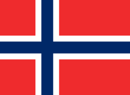 - Lillehammer, Norway,[1] since 1992
 - Sölden, Austria,[1] since 1982
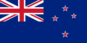 - Ashburton, New Zealand,[1] since 1987

References
- 1 2 3 Prefecture "International Exchange" Check
|url=value (help). List of Affiliation Partners within Prefectures. Council of Local Authorities for International Relations (CLAIR). Retrieved 1 July 2016.
External links
 Media related to Minamiuonuma at Wikimedia Commons
- Minami-Uonuma City official website (Japanese)
- Official website of Minami-Uonuma city (Translated English)
- Local Association which plays active role in International University of Japan