Tagami, Niigata
| Tagami 田上町 | |||
|---|---|---|---|
| Town | |||
|
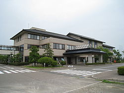
Tagami town hall | |||
| |||
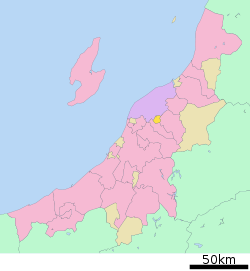 Location of Tagami in Niigata | |||
 Tagami
| |||
| Coordinates: 37°41′55.6″N 139°3′28.7″E / 37.698778°N 139.057972°ECoordinates: 37°41′55.6″N 139°3′28.7″E / 37.698778°N 139.057972°E | |||
| Country | Japan | ||
| Region | Chūbu (Kōshin'etsu) (Hokuriku) | ||
| Prefecture | NIigata | ||
| District | Minamikanbara | ||
| Area | |||
| • Total | 31.71 km2 (12.24 sq mi) | ||
| Population (June 2016) | |||
| • Total | 12,041 | ||
| • Density | 380/km2 (1,000/sq mi) | ||
| Time zone | Japan Standard Time (UTC+9) | ||
| Symbols | |||
| • Tree | Sakura | ||
| • Flower | Hydrangea macrophylla | ||
| Phone number | 0256-57-6222 | ||
| Address | 3070 Haranosaki Shinden, Tagami-cho, Minamikambara-gun, Niigata-ken 959-1503 | ||
| Website |
www | ||


Tagami (田上町 Tagami-machi) is a town located in Minamikanbara District, Niigata Prefecture, in the Hokuriku region of Japan. As of 1 June 2016, the town had an estimated population of 12,041 and a population density of 380 persons per km². Its total area was 31.71 square kilometres (12.24 sq mi).
Geography
Tagami is located in central Niigata Prefecture, bordered by the city of Niigata to the north. The Shinano River flows through the town.
Surrounding municipalities
History
The area of present-day Tagami was part of ancient Echigo Province. The village of Tagami was established on April 1, 1889 with the creation of the municipalities system. Its as raised to town status on August 1, 1973.
Economy
The local economy is dominated by agriculture, notably rice production. However, the town is increasingly becoming a bedroom community for neighbouring Niigata city.
Education
Tagami has two public elementary schools and one public middle school. There is no high school within town limits; however, the Niigata Chuoh Junior College is located in Tagami.
Transportation
Railway
Highway
External links
 Media related to Tagami, Niigata at Wikimedia Commons
- Tagami official website (Japanese)