Kita-ku, Niigata
| Kita-ku 北区 | |
|---|---|
| Ward | |
| Kita Ward | |
|
Fukushimagata Lagoon Park | |
 Location of Kita-ku in Niigata city | |
 Kita-ku
| |
| Coordinates: 37°54′58.5″N 139°13′6.9″E / 37.916250°N 139.218583°E | |
| Country | Japan |
| Region | Kōshin'etsu, Hokuriku (Chūbu) |
| Prefecture | Niigata |
| City | Niigata |
| Area | |
| • Total | 107.72 km2 (41.59 sq mi) |
| Population (June 1, 2016) | |
| • Total | 75,990 |
| • Density | 705/km2 (1,830/sq mi) |
| Time zone | Japan Standard Time (UTC+9) |
| Address | 3197 Kuzutsuka, Kita-ku, Niigata-shi, Niigata 950-3393 |
| Phone number | 025-387-1000 |
| Website |
www |

Kita-ku (北区 Kita-ku) is one of the eight wards of Niigata City, Niigata Prefecture, in the Hokuriku region of Japan. As of 1 June 2016, the ward had an estimated population of 75,990 and a population density of 705 persons per km². Its total area was 107.72 square kilometres (41.59 sq mi).
Geography
Kita-ku is located in north-east Niigata city, and is bordered by the Sea of Japan to the north.
Surrounding municipalities
History
The area of present-day Kita-ku was part of ancient Echigo Province. The village of Kuzudzuka was established on April 1, 1889 within Kitakanbara District, Niigata with the establishment of the municipalities system, and was raised to town status on November 1, 1901. It was renamed Toyosaka on March 31, 1955 and was elevated to city status on November 1, 1970. The city of Niigata annexed Toyosaka on March 21, 2005. Niigata became a government-designated city on April 1, 2007 and was divided into wards, with former Toyosaka becoming part of the new Kita Ward along with a coastal section of the former Niigata city.
Education
University
Primary and secondary education
Kita-ku has 13 public elementary schools and eight public middle schools. The ward has one public high school operated by the Niigata Prefectural Board of Education and one private high school.
Transportation
.JPG)
Railway
Transit bus
- Transit bus operated by Niigata Kotsu
- E2 / E4[1][2]
- Toyosaka Sta. - JRA Racecourse
- Toyosaka Sta. - Tsukioka Onsen
Highways
Points of interest
Places
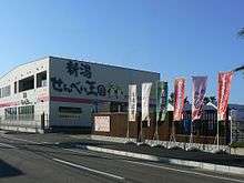
- Fukushimagata Lagoon Water Park
- Niigata Racecourse, one of the racecourses of JRA
- Niigata Senbei Okoku
References
- ↑ 運行便別時刻表 [Bus Lines and Timetables (2016.3- )] (in Japanese). Niigata Kotsu. Retrieved 9 October 2016.
- ↑ 路線図(東方面) [Bus Map for East Niigata (2016.3- )] (PDF) (in Japanese). Niigata Kotsu. Retrieved 9 October 2016.
External links
![]() Media related to Kita-ku, Niigata at Wikimedia Commons
Media related to Kita-ku, Niigata at Wikimedia Commons
- Niigata City official website (Japanese)
- Niigata Kita-ku website (Japanese)
- Niigata City Official Tourist Information (multilingual)
- Niigata Pref. Official Travel Guide (multilingual)