Millis Center Historic District
|
Millis Center Historic District | |
 | |
  | |
| Location | Millis, Massachusetts |
|---|---|
| Coordinates | 42°10′3″N 71°21′36″W / 42.16750°N 71.36000°WCoordinates: 42°10′3″N 71°21′36″W / 42.16750°N 71.36000°W |
| Area | 110 acres (45 ha) |
| Architect | Weston, Frank; McDonough, T.M.; Smith, George L. |
| Architectural style | Late Victorian, Late 19th And 20th Century Revivals |
| NRHP Reference # | [1] |
| Added to NRHP | September 14, 2007 |
The Millis Center Historic District is a historic district on Curve, Daniels, Exchange, Irving, Lavender, Main, Union Streets in Millis, Massachusetts. The district encompasses the historic mid-to-late-19th century village center of the town, including the residential area north of Main Street, and two 19th-century industrial complexes, along with civic and institutional buildings.[2] The district was added to the National Register of Historic Places in 2007.[1]
Description and history
The area that is now Millis was first settled by English settlers in the 1640s, and was for many years part of Medway before being separately incorporated in 1885. Its town center developed around a north-south route (now Massachusetts Route 115, partly Exchange Street and partly Plain Street) and an east-west route now designated in sections Exchange Street, Curve Street, and Union Street. The much straighter Main Street, now Massachusetts Route 109, was built in 1809 as the Hartford and Dedham Turnpike, and the railroad was built through the area in between the east-west routes in the 1850s. The town was predominantly agrarian until the 1880s, when reliable rail service was introduced. Lansing Millis, for whom the town is named, was responsible for the growth of the center as an industrial center, owning a shoe factory, steel factory, and bottling plant.[2]
The historic district extends along Main Street from Exchange to Plain Street, and along the curving route of Exchange, Curve, and Union Streets from Main Street in the west to its eastern railroad junction. It also extends northward along Exchange Street from its junction with Curve. The district, 110 acres (45 ha) in size, includes civic, commercial, industrial, and residential properties. Most of its buildings date to after 1850, with only four houses and one church (the First Parish Church at 142 Exchange Street) dating to that early period. The oldest house is that of John Richardson, a typical Georgian colonial at 191 Curve Street, dates to the mid-18th century.[2]
See also
- National Register of Historic Places listings in Norfolk County, Massachusetts
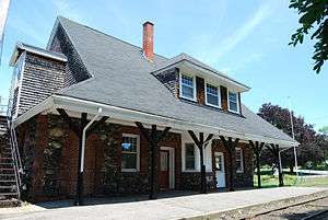
- Millis (MBTA station)
References
- 1 2 National Park Service (2008-04-15). "National Register Information System". National Register of Historic Places. National Park Service.
- 1 2 3 "NRHP nomination for Millis Center Historic District". Commonwealth of Massachusetts. Retrieved 2014-06-01.
| Wikimedia Commons has media related to Millis (MBTA station). |
| Topics |  | ||||||||||||||||||||||||||||||
|---|---|---|---|---|---|---|---|---|---|---|---|---|---|---|---|---|---|---|---|---|---|---|---|---|---|---|---|---|---|---|---|
| Lists by county | |||||||||||||||||||||||||||||||
| Lists by city |
| ||||||||||||||||||||||||||||||
| Other lists | |||||||||||||||||||||||||||||||
| |||||||||||||||||||||||||||||||